Beyond The Forecast: From Plowable Snow To A Meltdown
BOSTON (CBS) – It's beginning to look a lot like Christmas! Following the recent howling frigid weather, today's menu features a calm snow special with rain for dessert over southeastern Massachusetts and up along the coast across Cape Ann to the coastline of Maine.
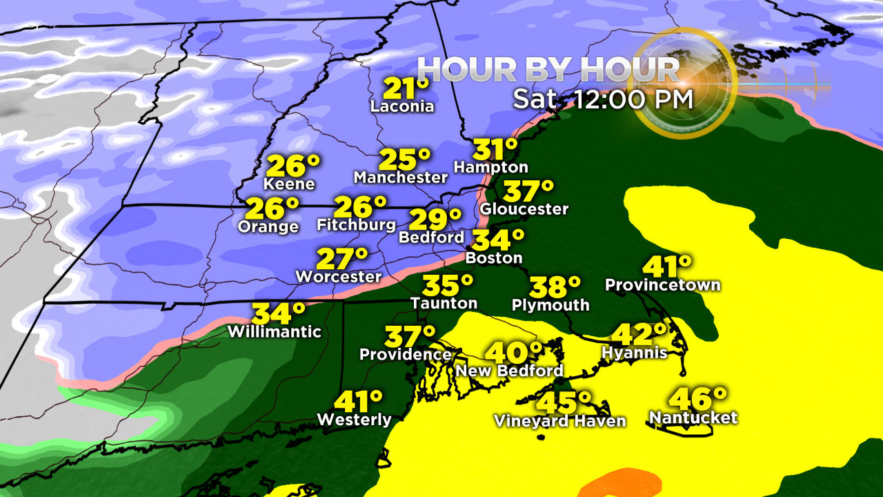
PROJECTED AMOUNTS:
Boston received its first inch snow event this morning and the city should end up with just under 4 inches. Most places across the state will be in the 4-5" range with isolated totals a bit higher. The lower amounts will be seen over extreme southern New England onto Cape Cod.
TIMING
The rain line will gradually pivot north and northwestward to near the Mass Pike then up the I-95 corridor through York, Maine by early this afternoon. With cold dense air trapped at low levels, a spell of sleet and freezing rain is possible across northern MA away from the coastal plain before the precipitation moves out to sea the first part of the afternoon. Before that happens, some bursts of heavier rain falling near and south of Boston will produce puddling in poor drainage areas where storm drains are clogged by the snow.
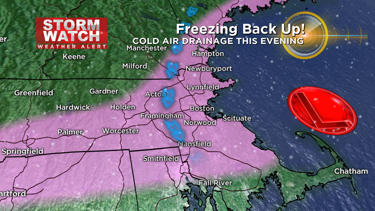
FLASH FREEZE?
The areas that eventually warm up to above freezing namely near and south of the Mass Pike into northern Connecticut, northern Rhode Island and Plymouth County plus over northeastern Massachusetts, especially closer to the coast extending up along the NH Seacoast into the southern Maine coastline - those areas should be alert for potential temperature drops back into the upper 20s from north to south this evening so wet roads could glaze over especially if some patchy mist is still in the air! There will NOT be a serious ice storm- just some thin glazing and icing over. This cold air drain will occur once today's wave of low pressure crosses the lower Cape and heads out over the Gulf Of ME.
THE MELTDOWN:
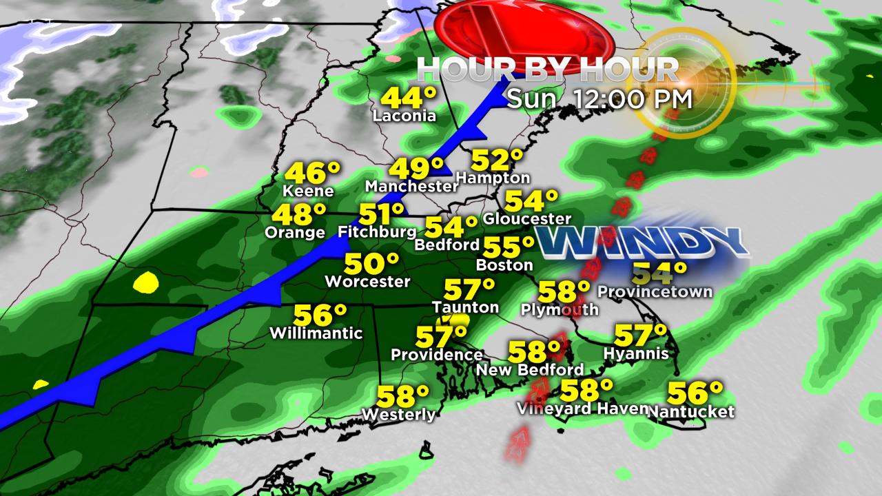
The next wave of low pressure will take an inside route and travel well west of the region across western NY into far northern New England. This inside runner will capture a wedge of warm air and yank it up across the area so late this evening and overnight, the temperatures will start rising to the level of 45-50 by 7 a.m. many areas except over some valley areas of Worcester County where cold air is tougher to scour out.
Thanks to the rain and balmy conditions, the snow cover will definitely shrink and even disappear in places where the depth was lower from today's storm south of the MA Pike. Tomorrow's ribbon of rain will transit east and southeastward and will be safely out of the region before the colder air arrives later in the day and especially overnight Sunday.
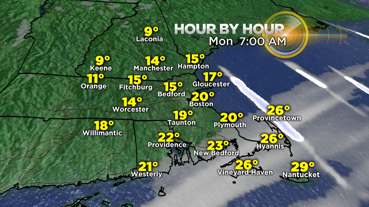
BACK TO THE DEEP FREEZE:
Enjoy the warm air while it lasts! The chill returns by daybreak Monday but it will not be as harsh as yesterday. Nevertheless, the temperatures will be well below the average through Tuesday but the weather looks peaceful through Wednesday and that is the day that winter officially begins at 5:44 a.m.