What You Can Expect During Messy Monday Morning Commute
BOSTON (CBS) -- Some measurable snow will march into Boston, just in time for the Monday morning commute. This isn't a major storm, but as we all know, timing will make the AM drive a headache.
Timing:
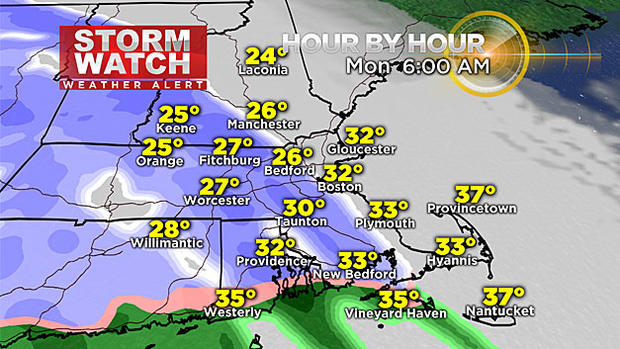
4 a.m. to 10 a.m. for most of the snowfall Monday. Snow spreads west to east across southern New England at 6 a.m.. The freezing line looks to be across the south coast at that time.
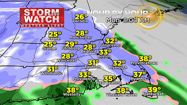
Temps slowly warm from south to north and the freezing line retreats in that direction too. 8 a.m. Monday, the snow still accumulates, though it will be a slushy snow since temps will be around freezing. The wintry mix on Cape Cod, will change to rain.
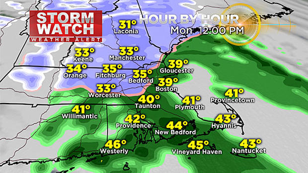
By noon, the snow changes to all rain for Boston and for areas south of the Pike. Still light snow in northern Worcester County and in New Hampshire (away from the coast).
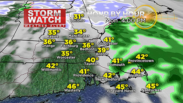
The system moves out around 4 p.m. Anything left over will be in the form of rain.
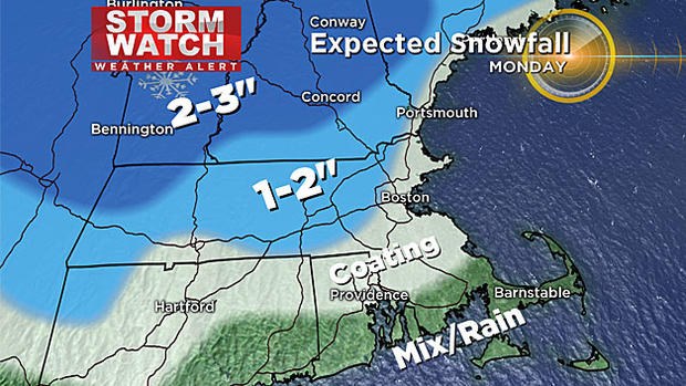
Accumulations:
Boston may see a coating to 1" of brief accumulation (until late morning) before it gets washed away by rain.
Cape Cod will see a wintry mix then mainly rain.
Outside 128 looking at 1-2" of accumulation through Monday afternoon.
Worcester Hills will see 1-2" of snow.
Berkshires/NW of MA more like 2-3" of snow.
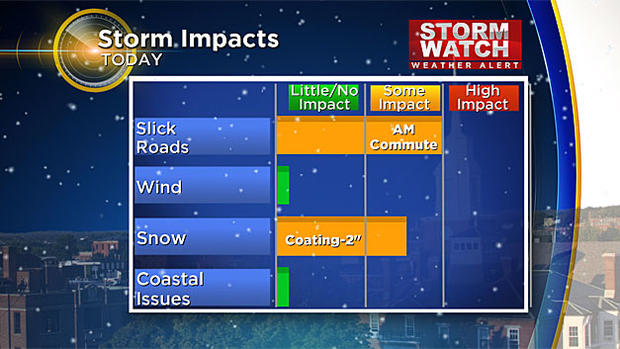
Impacts:
The morning commute will be slick with reduced visibility as light to moderate snow falls. With a coating to 2" across most of southern New England, it will be slow-going. This particular storm will not bring wind-related or coastal issues.
Extended Forecast:
A couple more rounds of a wintry mix will move in mid-week. One on Wednesday, another Thursday night into Friday. For now it will be more of a wintry mix event, but stay tuned. We turn windy & colder for the next weekend. Highs may be in the low 30s with lows in the teens.


