WBZ-TV Weather Alert: King Tide Flooding Through Midweek
BOSTON (CBS) - WBZ-TV's weather team is declaring Tuesday to be a "weather alert day."
What is a weather alert day? Essentially, we're trying to warn you in advance when weather could be disruptive. Not every city or town will be affected by each weather alert day – so our job will be to highlight the areas that will be most impacted and when.
It's the coastal communities that we're concerned about for Tuesday.
Why?
Well the supermoon was certainly a beautiful sight to take in Sunday night and Monday morning, but one result of such a close full moon is that we'll see the highest tide cycles of the year, also known as "King Tides." The added gravitational pull from the moon allows high tides to be higher and low tides to be lower. And typically, the difference is a matter of few inches compared to a typical high tide.

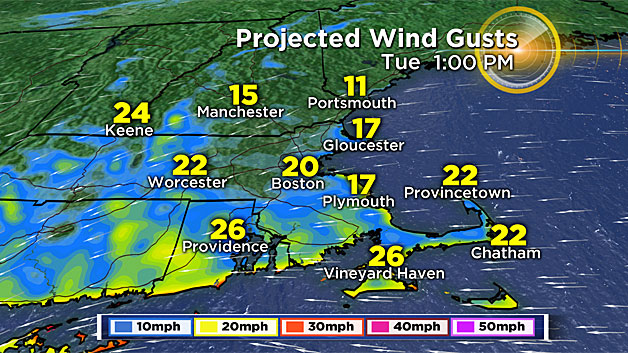
On top of that, a weak coastal storm is going to hit southern New England Tuesday, resulting in an onshore flow. The wind will shift to the east ahead of this area of low pressure, and may gust briefly to 30 miles per hour. This period of strongest wind coincides with high tides in southeast Mass. and Nantucket.
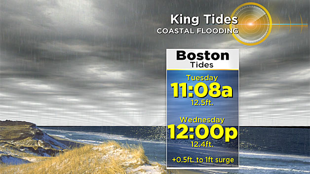
Around Boston, the highest high tide will be Tuesday just after 11 a.m. at 12.5 feet. For reference, this is a couple of inches higher than the tides we saw back in October which inundated some low-lying areas and zones typically prone to flooding.
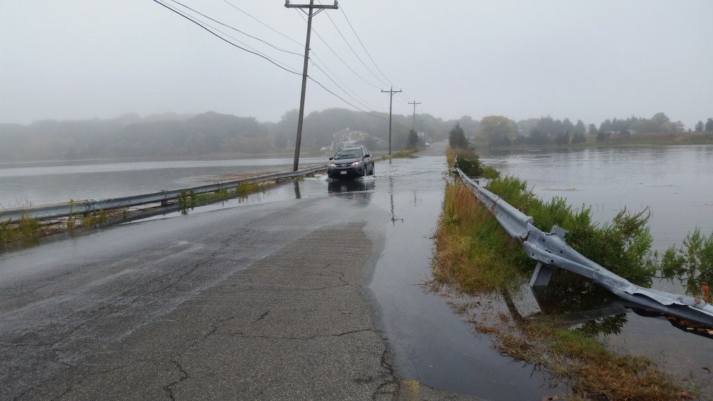
Expect widespread areas of minor coastal flooding within a couple of hours either side of high tide, with a low risk of a few pockets of moderate coastal flooding.
If you live along the coastline in an area that typically floods (especially if it did last month) then you'll see flooding again. I wouldn't be surprised if some partial street closures result from the flooding Tuesday (for example, Morrissey Boulevard).
Thankfully this storm system is progressive, so our wind by Wednesday will no longer be coming in off the ocean.
The high tide is just slightly lower on Wednesday at midday. Areas of minor coastal flooding will still occur.
We'll keep you posted on it all on-air and online here at CBSBoston.com.
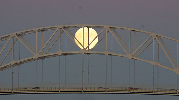
Meanwhile, here are a handful of beautiful Supermoon pictures from Sunday night. Clear skies made for perfect viewing conditions across New England. The moon won't be this close to Earth again for another 18 years. Hope you were able to catch it – it was hard to miss!