Eye On Weather: Lessons Learned From Hurricane Of '38
BOSTON (CBS) - Every corner of the eastern U.S. coast has a hurricane that defines tropical weather.
In New Orleans, it's Katrina.
In New Jersey, it's Sandy.
And in New England, it's '38.
Also known as the Long Island Express or the Great New England Hurricane, there's no storm on record that matches the pure destructive power of the Hurricane of '38.
Read: More 'Eye on Weather' Stories
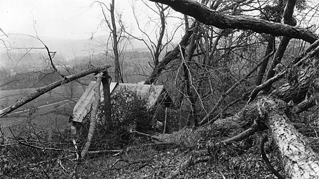
New England had gone through a long period without a damaging tropical system. 1815 was the last time anything near the same strength had blown through. And to add an even stronger element of surprise, the forecast called for a hurricane down by the Carolina coast to head out to sea. Instead a Category 3 storm plowed into Long Island on September 21 (and then Connecticut) with a forward speed of 50-60 mph! This tremendous motion allowed '38 to cover hundreds of miles overnight, and then lay waste to the area over the course of a single afternoon, without anyone knowing it was coming. It's the storm responsible for the strongest wind ever recorded in the area – 186 mph at Blue Hill Observatory in Milton.
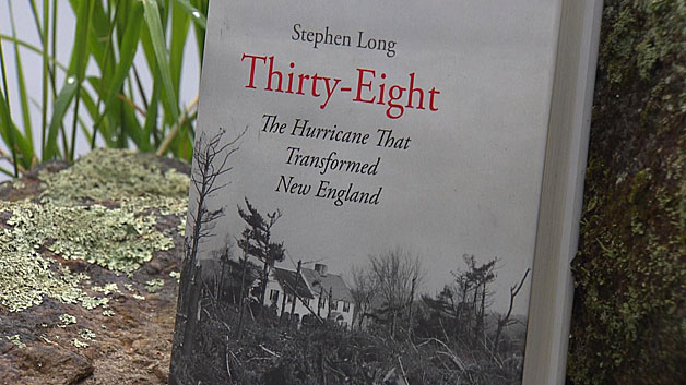
Stephen Long, an author, recently put together a book entitled 'Thirty Eight: The Hurricane That Transformed New England.' Much of his research took him to Harvard Forest in Petersham, Mass. Many think of hurricanes as coastal events, but much of interior New England saw unprecedented tree damage during the storm.
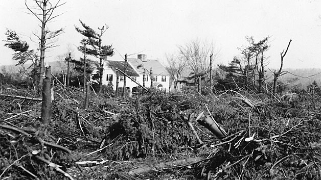
"Natural mortality in a year might be 1%," says Long of typical forest death. "Well this was 5% in one afternoon. 5% of the forest in New England went down in an afternoon."

To put this type of loss into perspective, that's roughly the equivalent of the entire White Mountain National Forest going down over the course of a few hours. Most of the casualties were white pine, a species of tree that took over when farmland was abandoned in the late 1800s.
Most of the forest we have today is a result of '38. When all the towering pines were taken out, hardwoods quickly took off with more sunlight available to them. In fact, the forest we have now is what the original forest looked like before land was cleared by farming and then taken over by the pines.
What would happen with a similar storm today?
Long says that, perhaps counter-intuitively, there are more trees now than there were 78 years ago. And there are also more people living among them because the population has more than doubled.
"It will be even more devastating than '38 was, and '38 was the single most devastating weather event that New England has ever experience. This will be worse," says Long.
To the south, water is the main concern for many coastal residents. Wind is always a headline maker, but storm surge is the most deadly and destructive element of hurricanes. Most vulnerable are inlets and bays; places where water can be forced into before it runs out of room and rushes inland. Buzzard's Bay and Narraganset Bay are two particularly prone areas, with numerous small inlets in between. The Great New England Hurricane brought a surge upwards of 15-to-20 feet, easily inundating coastal communities.
Since '38, one thing has changed in a big way - our natural defenses have weakened. We spoke with Mike Travers of Travers Landscape Construction in Bourne about what he has seen over the years. The company was founded in 1910, before the '38 Hurricane, by Mike's grandfather.
"I've seen 300 feet in the last 30 years from Sankaty Head to the Navy base just disappear into the ocean," says Travers of Nantucket's shore.
The loss is dramatic and undeniable across much of the Cape and Islands. Sea rise, time, hurricanes, nor'easters, and human activity have all conspired to take away beaches and dunes over the last several decades. At the same time, the population has continued to grow. A look at census data shows most coastal Massachusetts towns have seen increases in the 200-to-600% range. Which puts more in the way of a hurricane, both in terms of people and property.
At the same time, building standards continue to become more strict.
"When you want to do something near the water, you better have the money and a very good lawyer," says Travers, who frequently helps people battle the elements.
Now most homes come equipped (or are required to install if doing home improvements) with high velocity shingles, "bulletproof" windows, and hurricane bracing.
Flood zones have become larger and more widespread post-Sandy, when they were redrawn by FEMA. And building near the coast altogether has become extremely difficult. A myriad of laws and zoning requirements have been put in place since the 70s.
So what happens when the next 'big one' hits?
Recent studies suggest total losses would be somewhere in the $40-60 billion range. There is so much more 'in the way' of a storm now than there was nearly eight decades ago. There's more wealth, more insured property, and a higher ceiling for astronomical cost.
We may be building for storms, but there's not much you can do about a gigantic storm surge like the one we'd expect with a Category 3 hurricane. Fox Point and the New Bedford-Fairhaven hurricane barriers would help out, but you can't build walls in front of the entire coast. And you also can't keep trees from falling down in 100 mph+ wind.
The return period for a storm like '38 is once every 100-150 years here in New England. It could strike this year, or 50 years from now. But we know a similar event will come knocking again some day. Knowing what's possible and building and preparing in a responsible way is the only way to mitigate losses, and try to avoid a repeat of this catastrophic event.