Melting Snow Ahead...But Will We Add More?
Find Eric Fisher on Twitter and Facebook
The blizzard of 2016 is behind us, and it's amazing to think a storm talked about for so long actually lived up to the hype. But this storm managed it, producing huge snow totals from Virginia to New York and respectable amounts into far southern New England. Flooding surpassed Sandy in some areas of New Jersey, and winds gusted well over 70mph along the coast from the Mid-Atlantic to Nantucket. A nearly identical storm to the infamous blizzard of '96, although not quite reaching into New England the same way.
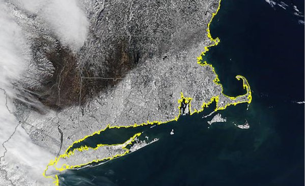
Source: SSEC/MODIS
This satellite image is my favorite of the storm, showing where the march north ended. You can see the exact line where snow stopped falling and people started wondering what all the fuss was about. 6" in Boston, 2" in Arlington, nothing a few miles west. To the north, 5" for the Beverly but nothing at all in Salisbury, Andover, or Lowell. The bare ground of Litchfield County in Connecticut with 16" in the southwest corner and 30" in NYC. All week we talked about the sharp cutoff, and now you can visually see it in action!
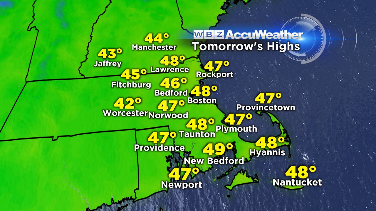
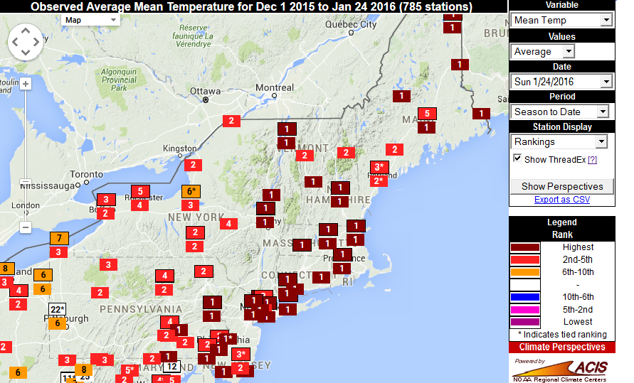
So what lies ahead? How about the warmest temperatures in two weeks. Highs will soar through the 40s and come close to 50 in some parts of SE Mass on Thursday. It may not feel as great as Monday did, with more clouds overhead and a gusty southwest wind at 15-35mph. But it should be an effective way to continue the snow melt. High temps stay near 40 for Wednesday and Thursday, so a gradual melt will continue. Is it a 'January thaw'? Well you could say that...but what exactly are we thawing out from? Last week was quite chilly but January is still running +2F versus average and will finish at least +3F considering the forecast for the final days. In fact, combined with an exceptional December, the first two-thirds of Meteorological Winter are on pace for the warmest ever recorded in New England. It has not been very tough to take.
Will nature make us pay for it? Perhaps...but there isn't *too* much in the pipeline. The main thing to watch over the next 7 days is a coastal low that spins up late Thursday. It's expected to make a close enough pass to the area to make life interesting. The main question is whether or not this system will phase with a polar disturbance diving down out of Canada, or will remain separate and get booted out to sea before having any impact.
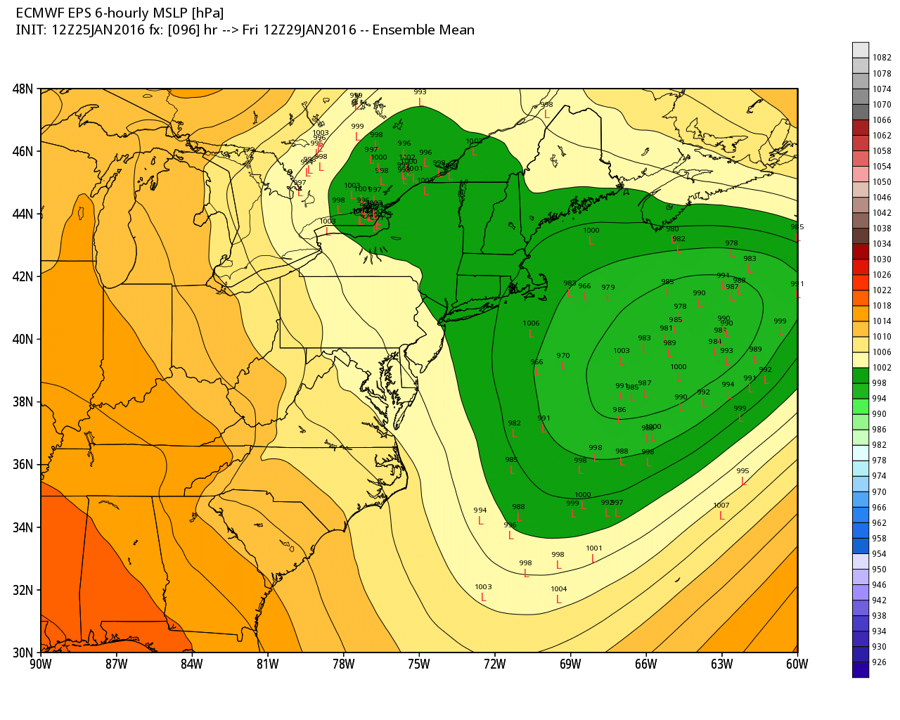
EPS members on Friday morning. The mean position of the storm is out to sea, but there are several members on the western end of the envelope still and there is also a lingering trough back to the clipper in SE Canada. Enough to stay vigilant. Source: Weatherbell
Guidance and history suggests that this will stay far enough west to bring at least *some* snow to the region, with the highest risk being Cape Cod and Nantucket. Unlike the past storm system...the only area potentially in the path of this one is eastern New England. I think that even if it passes well east of us and its shield of snow misses the shore, an inverted trough between it and the polar kicker should produce some areas of snow late Thursday night into Friday. If it still looks far east of the benchmark (40N/70W) Tuesday afternoon then this low-impact scenario will be the likely one. Right now it's just time to monitor the trends and not write it off until we have some more info.
Once that low passes, mild times return. A couple quick disturbances will likely swing through in a fast flow regime...one over the weekend and another early next week....with a few rain/snow showers. But 40s on Sunday and Monday are a good bet...with perhaps even a run at 50F for some towns.
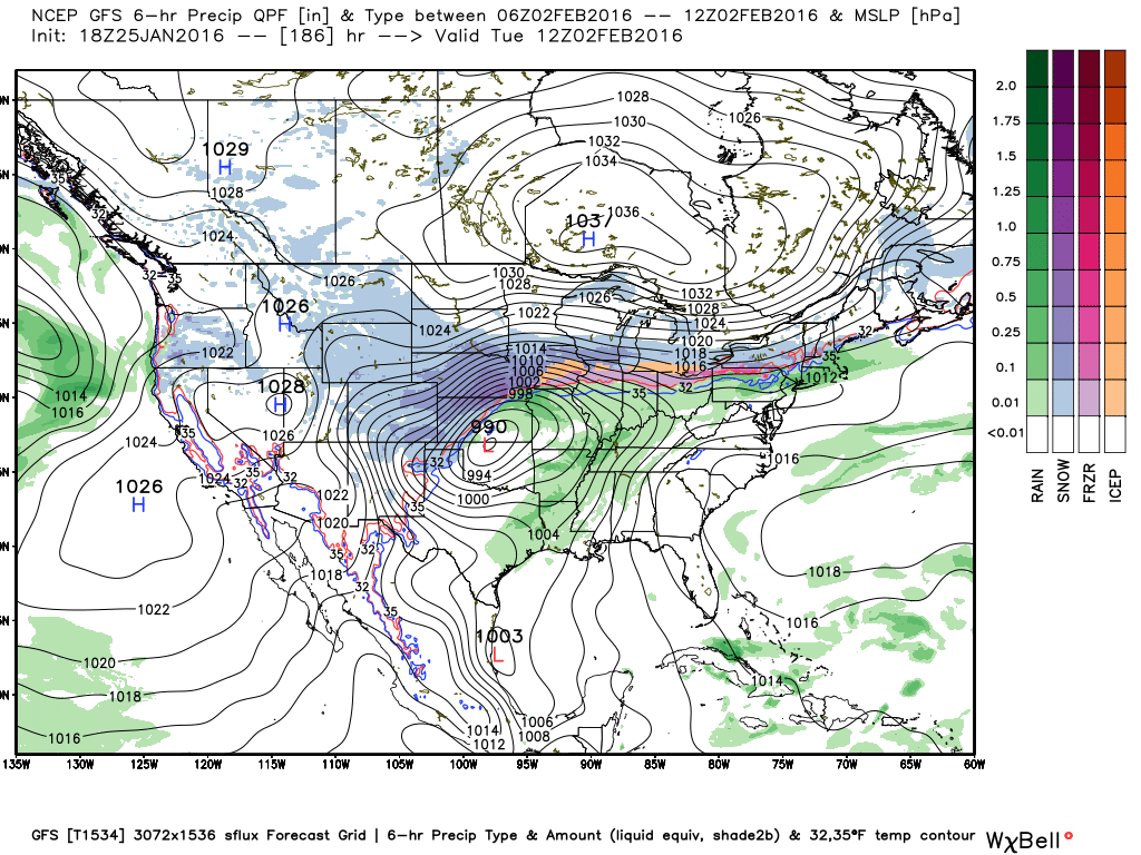
GFS surface map for Groundhog Day looks plenty interesting. If correct, that's a great setup for an ice storm somewhere in the Great Lakes region to New England. The Euro has a strong disturbance rushing up into the Great Lakes, but I think the GFS may actually be on to something here. Would also be a more wintry scenario for New England but there's plenty of time to watch. Source: Weatherbell
The next "big storm" to watch looks to get started around February 1st in the middle of the country. There's a bit of uncertainty on this one's eventual path, but I don't think we'll be in play for significant snow with it. Guidance is strongly pointing to a storm that would track to our west. The problem is, a cold high over Canada could end up putting ice in play. It's too far out for those kinds of details but the general idea is that this will be the time frame to watch for the next widespread storm east of the Rockies. Indications are a burst of arctic air will follow it into the U.S. The outlook for February is for a volatile month that may end up being our coldest of winter...but not nearly as harsh as last year. We'll see how it plays out!