Searching For Snow? Here's What We're Watching
Find Eric Fisher on Twitter and Facebook
Working as an operational meteorologist is a constant battle between giving the forecast and trying to keep people from hating you. Trust me, it's a delicate balance. While the inner geek wouldn't mind getting buried up to his eyeballs (read: last winter) the realist knows that the majority of people could care less if it snows after December 25th, and some even take it as a personal affront whenever ice or snow is verbalized in a forecast. In my experience, the ratio seems to be about 70/30 in favor of as little snow/cold as possible.
That 30%, the ones that most likely are reading this blog post, are in pure agony when winter isn't delivering the goods. The weather fanatics want snow, wind, bitter cold, and whatever other chaos the arctic can unleash. They search the land of numerical weather prediction...reading the signs in weather models like a meteorological Ouija board. A GFS run blows up a storm here, the ECMWF delivers an arctic outbreak there...anything that shows potential. This group is often respectably patient in December, but gets restless by New Year's Eve and downright grouchy by mid-January.
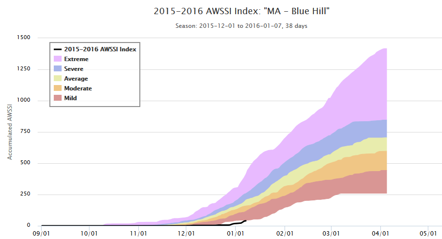
This young winter is at a record low level of 'severity' to date. Source: MRCC http://mrcc.isws.illinois.edu/research/awssi/indexAwssi.jsp#manual
Last year, winter didn't truly show up until late January and then rocked out an epic stretch of snow and cold none will forget. Will the same happen this year? I don't think so, but there's little doubt that cold and snow chances will be on the increase. This was part of the seasonal outlook, and in general the expectation was for the snowiest period to be in late January/February (maybe even into March). Indications are that we may finally start to see some flakes in the week ahead.
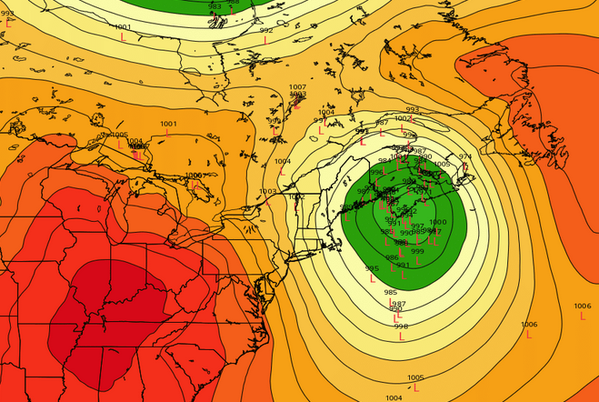
Friday's 12z ECMWF EPS look at low locations for Wednesday. The mean is well to our north and east, not overly favorable for southern New England snow. Source: Weatherbell
First up, we finally get to use the term 'Alberta Clipper'! Much beloved by New England weather watchers, this energy originates around Alberta Province in Canada and zips down to our neck of the woods. If the timing is right, these little babies can explode near the coast and provide solid snowfall.
The one we're watching for Tuesday night into Wednesday doesn't look classic for the Boston area, but there's some promise. Right now models are indicating a vigorous disturbance to cross New England and then rapidly deepen once it hits the coastline. As I see it, the one thing working against us is the trajectory of this energy. It's a little too far north, which in turn leads to explosive development in the Gulf of Maine instead of near Nantucket Sound. There's no doubt that an impressive storm fires up, but as of this writing it appears to be too late/east to bring significant snow to southern New England. Chances for big snow are much higher in Maine, especially northern Maine.
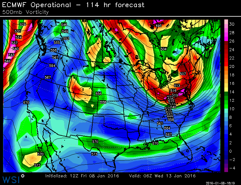
A powerful disturbance digs in late Tuesday night, aiding in rapid development to our east. Will it trend farther south over the next few days? One to watch. Source: WSI Energycast
We're still a few days out, so we'll have to see if the disturbance can dig a little farther south and increase our odds. In any case, I think we'll get some snow out of this system. The storm is forming along the edge of a potent arctic front, which on its own should produce some snow showers or squalls as it passes through the region. The air behind this front could end up being the coldest of the season so far, so there's some nice baroclinicity to work with (temperature gradient between the polar air and warm ocean air).
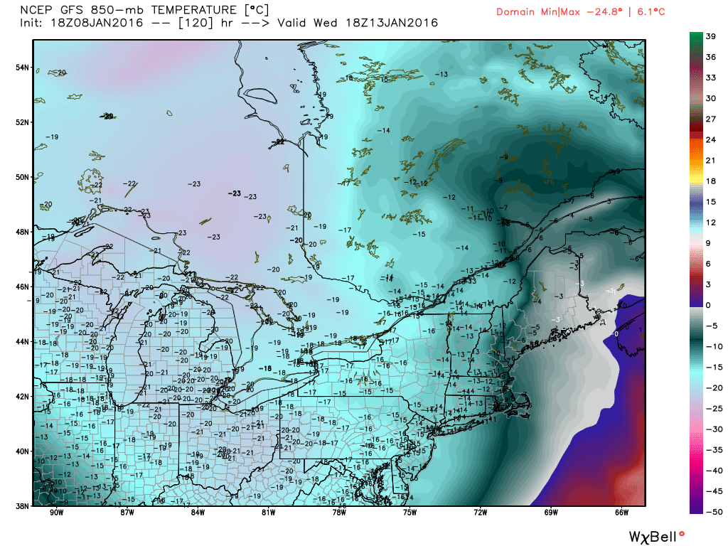
Temps a few thousand feet up, at 850mb, are similar to the readings we saw earlier this week. Source: Weatherbell
There's an after-effect of this storm, regardless of snow amounts. It helps to build strong Greenland blocking - some of the strongest in years. That ridge builds all the way up across the North Pole, and in turn it sets up a strongly negative arctic oscillation. So the end result is blocking in place and colder air across the Lower 48. Then we go back to the beginning, and watch the next wave of energy moving in. That energy will be a take the form of a developing storm system across the south by late week/Saturday.
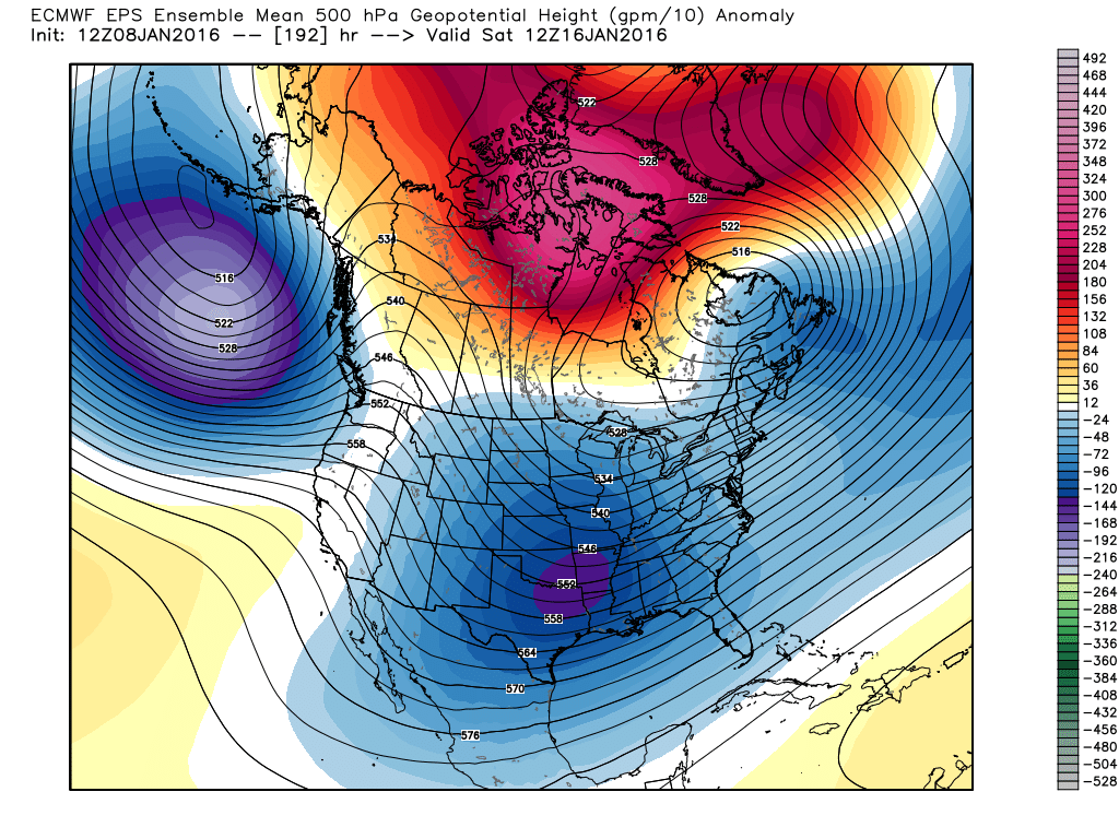
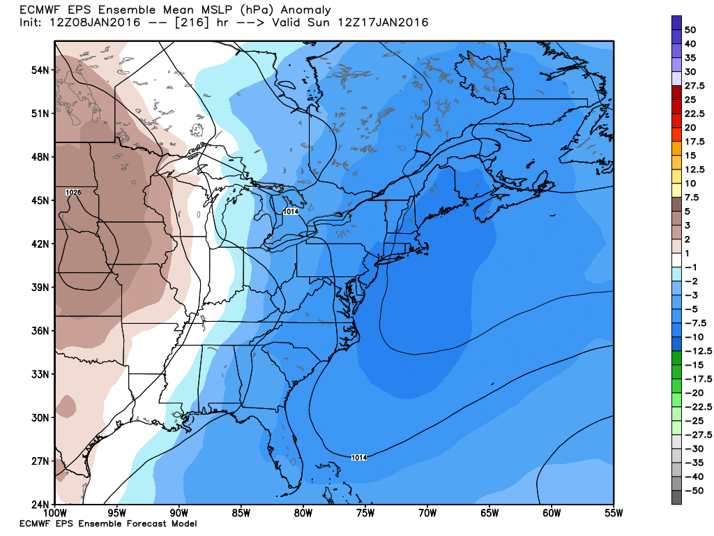
The biggest question mark for MLK Weekend is how suppressed the subtropical jet stream becomes. El Nino is helping to produce a ripping subtropical jet stream, which helps provide energy for storms and pumps in Pacific moisture. There's a delicate balance between the negative arctic oscillation and the STJ. If the AO goes too negative, it may actually push the STJ all the way down along the Gulf Coast and then out to sea. If you're a snow lover, that's not a scenario you want. This will push the weekend storm off to our south and harmlessly out to sea. If the STJ is able to drift a little farther north, then it could link up with polar energy off of the Mid-Atlantic/New England and throw a significant winter storm into the region. And since we have blocking in place, it wouldn't be in a hurry to move.
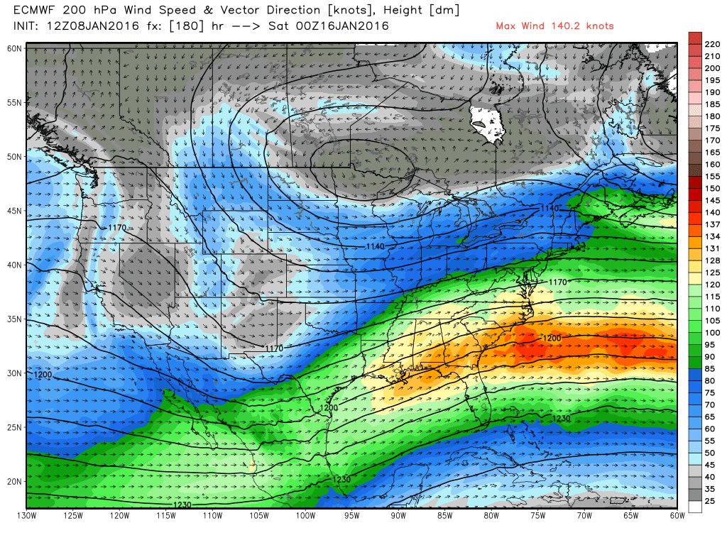
ECMWF shows a suppressed subtropical jet leading into next week, giving way to stormy weather across the south and a very close call for us here in New England. Source: Weatherbell
Operational models have been wavering back and forth on the outcome here, which is typical at this time range. In fact, the ECMWF has completely lost it. That being said, ensembles still show a pattern conducive to a significant storm, and there are many ensemble members that drift up and down the East Coast. Bottom line this far out is that the pattern is one to watch, and the end result will come down to a dance between all the factors above. If you're the type that looks at weather models often...don't read too much into the changes each operational run. They'll likely stay all over the place for at least several more days.
No doubt that the period ahead (end of January into February) will offer our best snow chances yet, and we don't foresee any major warm-ups like we had in December. Winter is settling in for a while.