The Global Jigsaw Puzzle
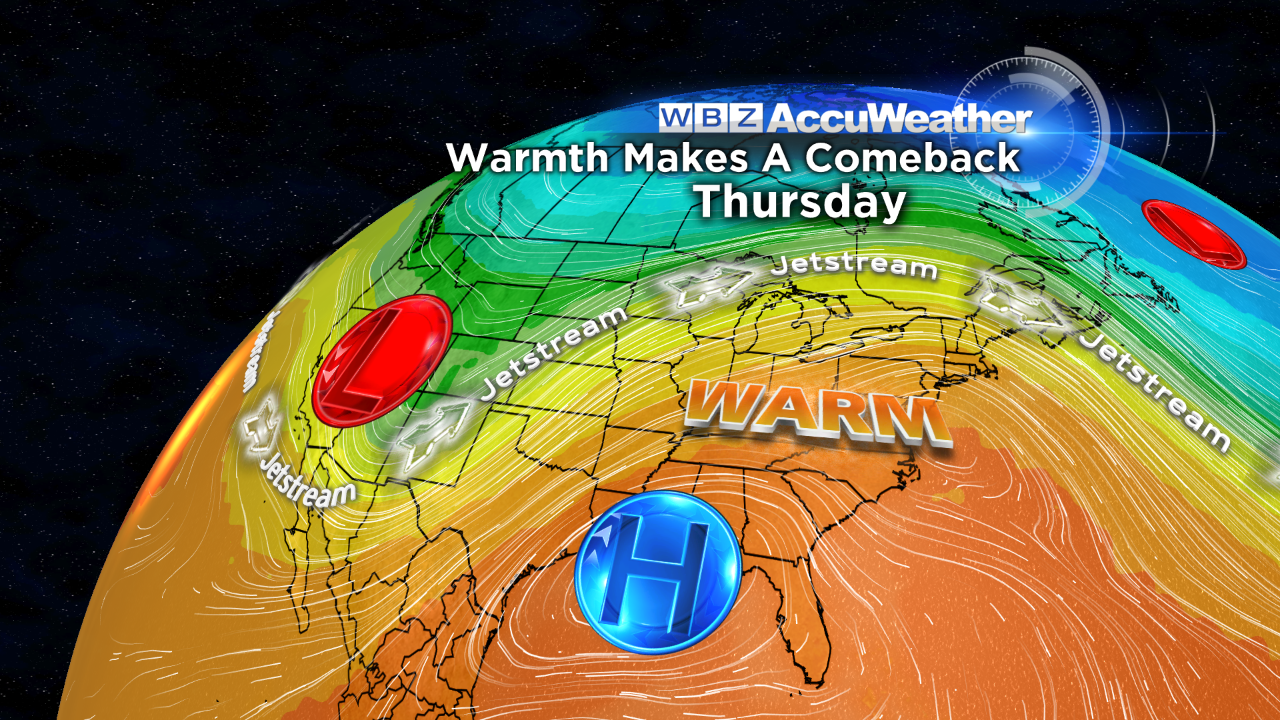
 There is little doubt about the weather in the short-term namely this first week of November. All systems are GO for above to much above average temperatures from now into next Saturday. The jet stream is configured to escort some delightfully warm weather from the Central Plains to New England. The average high temperatures from November 1-7 runs from 57 down to 55 degrees. This week's pattern should deliver high temperatures from 62-72. Starting next Sunday, the temperature will likely go through gyrations down and up for a while but the overall pattern will likely result in an above average mean temperature leading into the last week of the month.
As autumn moves forward, more and more people are asking me about the winter ahead. At this time last year, the myriad of global factors was screaming a very rough winter. On our "Eye On Weather: Winter Special" last November, the WBZ AccuWeather Team was advertising above to much above average snowfall with below to much below average temperatures for the winter. In fact, before that show, we decided that it would be wise not to mention on-air our belief that there was a high risk of a record snowfall season. As a clue, however, I did state on the program that, for the first time, I had placed super giant snow sticks along my driveway and the boundary of my property adjacent to the street!
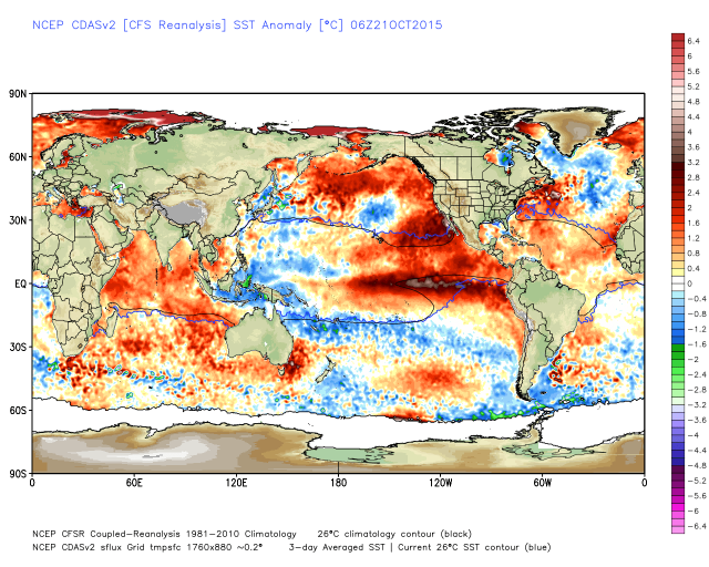
The precise position of the sea-surface temperature anomalies in the Pacific and Atlantic were the main drivers of last winter's wrath. These pockets of warmer and colder than average ocean water are in similar places but there are some slight changes in location and magnitude of warmth. Last winter, an El Nino was in the early stages of developing and it is expected to reach maturity closer to the beginning of this winter. It will be an important player but already its strip of maximum warmth in the equatorial Pacific is shifting westward away from the South America Coast. This triggers a twist in the plot perhaps contributing to a cooler than average El Nino setup here in the Northeast and elsewhere in the eastern and southern portions of the country.
It will be interesting to see how November shakes out because a study of the temperature anomaly for the month seemingly correlates to seasonal snowfall in Boston. This study covers a relatively short period of time going back to 20 years. Check this out:
November Mean Temperature Season Snowfall
=================================================================================
-3.4 degrees 1995-96 107.6"
-5.0 degrees 1996-97 51.9"
-3.6 degrees 1997-98 25.6" *
-0.7 degrees 1998-99 36.4" *
+2.7 degrees 1999-00 24.9"
-1.5 degrees 2000-01 45.9"
+3.0 degrees 2001-02 15.1"
-2.0 degrees 2002-03 70.9"
+1.0 degrees 2003-04 39.4"
-0.5 degrees 2004-05 86.6"
+1.0 degrees 2005-06 39.9"
+4.2 degrees 2006-07 17.1"
-1.9 degrees 2007-08 51.2"
-1.5 degrees 2008-09 65.9"
+4.0 degrees 2009-10 35.7"
-0.1 degrees 2010-11 81.0"
+5.7 degrees 2011-12 9.3"
-2.6 degrees 2012-13 63.4"
-2.0 degrees 2013-14 58.9"
-2.2 degrees 2014-15 110.6"
Conclusion: In 18 of the last 20 years with 1997-98 and 1998-99 as outliers, if the November mean temperature was below average, the corresponding snowfall for that season was above average and, similarly, if the November mean temperature was above average, the corresponding snowfall for that season was below average. In fact, the greater the November temperature above average, the greater the seasonal snowfall is below average as in 2006-07 and 2011-12. The very warm November of 2009 resulted in slightly below average snowfall for the 2009-10 season which was a strong El Nino year but a much different El Nino year than the one of this year.
The WBZ AccuWeather Team will present the winter outlook on WBZ News in a couple of weeks with a detailed discussion about the winter on our half-hour weather special in December.
Make it a great week and enjoy the warm spell.


