Something For Everyone
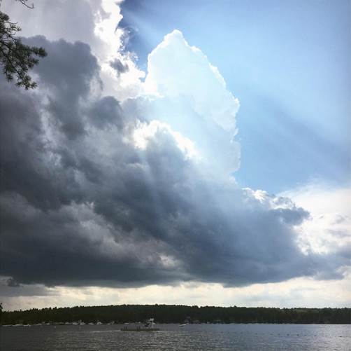
This is where it all began yesterday. Towering clouds over Lake Winnipesaukee blossomed into roaring thunderstorms which tracked east-southeastward into western and southern ME. Training of storm cells along the same track resulted in hours and hours of frequent dangerous lightning, flooding downpours, bursts of wind thankfully with little or no rotation and some large hail in spots. In one 30-minute period, York County ME received close to 3500 lightning bolts with some strikes to structures and trees.
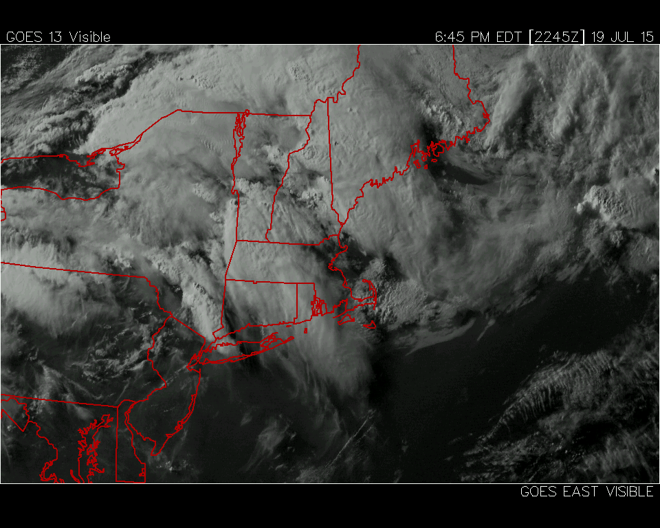 You can see the clusters of storms over eastern NH and western ME plus eastern NY into western MA. Despite the presence of numerous parameters that would dictate severe weather, the atmosphere appeared to be capped meaning development was unfavorable due to too much warmth aloft over eastern MA. Consequently, storms were firing in NY but they would fizzle in a more hostile environment eastward. Meantime, the axis of action was aligned along a thermodynamic focus boundary near the border of NH and ME where there was a disparity between the steamy air and cooler air in ME. Consequently, despite the stifling humidity and 90-degree heat over most of MA, we dodged a bullet. The greatest instability to work with existed to the north.
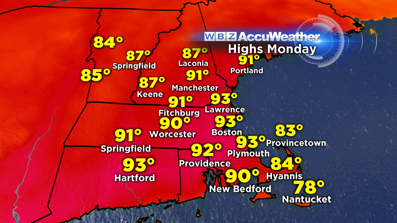
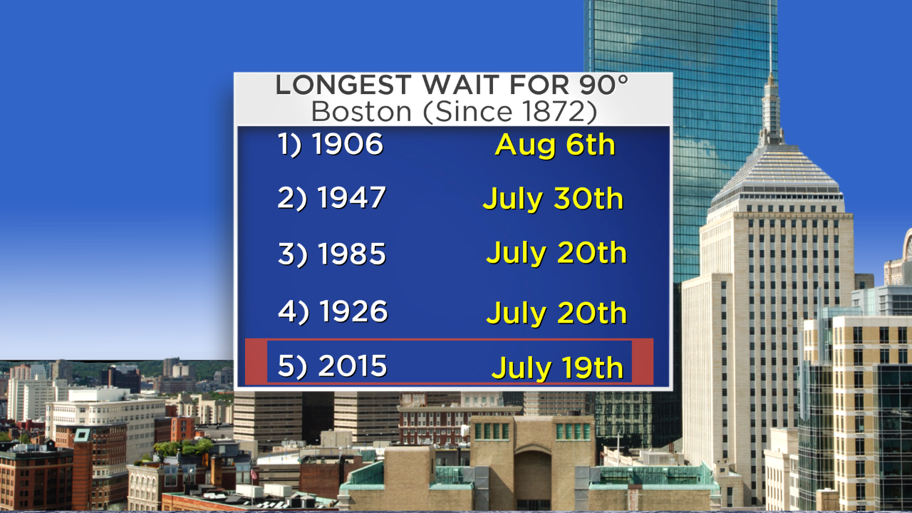 Way overdue, the temperature hit 90 in Boston yesterday. This puts 2015 in 5th place for the longest wait for 90 degrees. The city's high temperature will easily exceed 90 today and probably max out at 93 or 94! The record for today, July 20th, is 99 set in 1991. If it reaches 90 tomorrow, that will make 3 consecutive days which satisfies
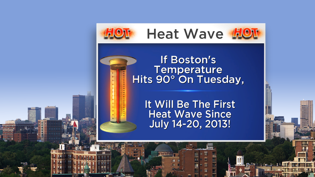 the definition of a heat wave. There were no heat waves last summer so the last heat wave was an ugly one lasting seven days from July 14-20 in 2013. Last summer, there were only 8 days at 90 or higher which was 6 days below average. Three of those days happened in the first week of September. The oppressive humidity will be dropping today.
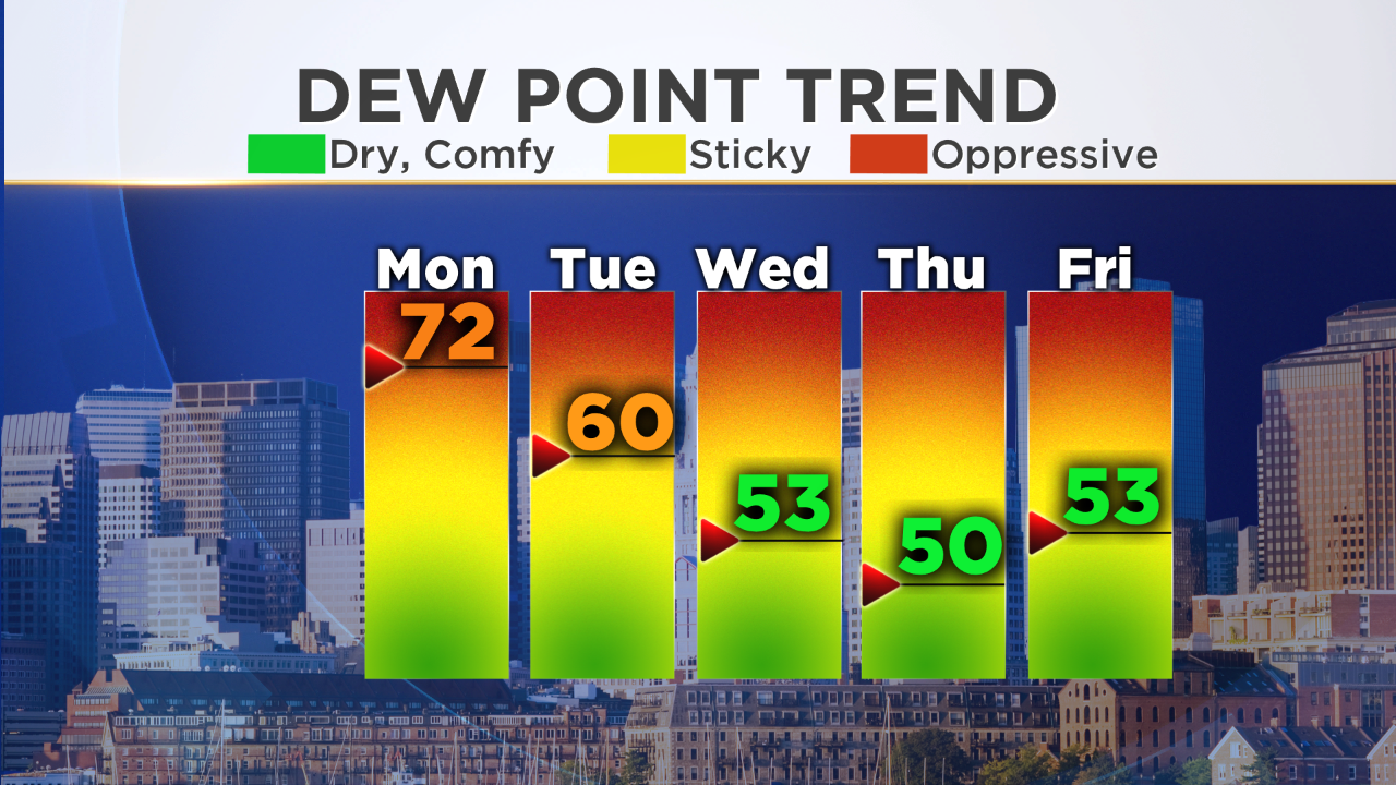 The dew point will descend from over 70 this morning to 60 this afternoon especially north and west of Boston then into super dry territory the rest of the week. That is extraordinary to experience such low humidity during what is, on average, the hottest week of the year.
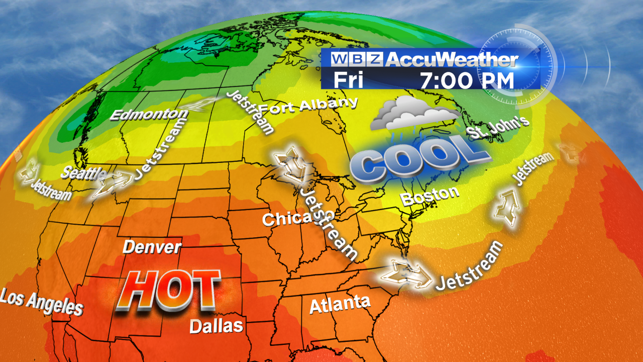 Interestingly, the upper air weather pattern will change significantly to introduce cool unstable air from eastern Canada later in the week. So the week is starting off too hot for some and later in the week it will be too cool for others. There may be a few rain showers with that cool air next Friday and Saturday with highs in the middle 70s!!!
Make it a great week!


