Not A Precursor Of A Hot Summer
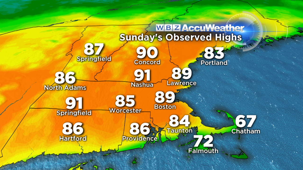
It was just last Monday, May 4, when Boston got its first 70 degrees in 2015 and within 4 hours, the temperature had jumped to 80 with a high of 84 for the day. Then following 5 days over 70, the mercury spiked to 89 yesterday which is 24 degrees above the average high for May 10th! Over the years, there are many record highs in the 80s in April. The hottest stretch so early in the season was March 1998 when the last 5 days of that
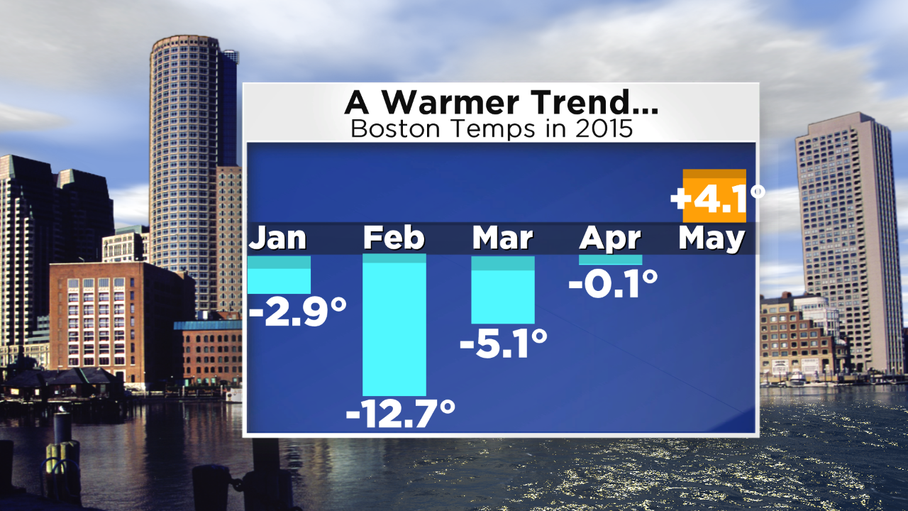 month had highs of 79, 85, 75,78 and 89 degrees! Contrast those highs with the last 5 days of March 2015 at 44, 40, 42, 45 and 50 degrees! Wow! You know how cold this winter was but look at the jump in May following the transitional flat month of April. One could conclude from this trend that June, July and August could feature much above average temperatures. However, with the current set of global factors featuring little change in the location of the pools of warm and cool sea surface temperatures plus an El Nino that is intensifying, it seems plausible that New England mean temperatures for the meteorological summer months will be near or slightly below a degree above average. In fact, I suspect May will end up closer to 1.5 to maybe 2 degrees above average. I am not expecting long lasting spells of excessive heat and stifling humidity this summer. There will be some hot and muggy days for sure and I reiterate that my thinking still goes for 10-12 days of 90 degrees or slightly higher in Boston. Last year, the first day at 90 or higher did not occur until July 2 and there were 6 fewer days at 90+ than the average of 14!
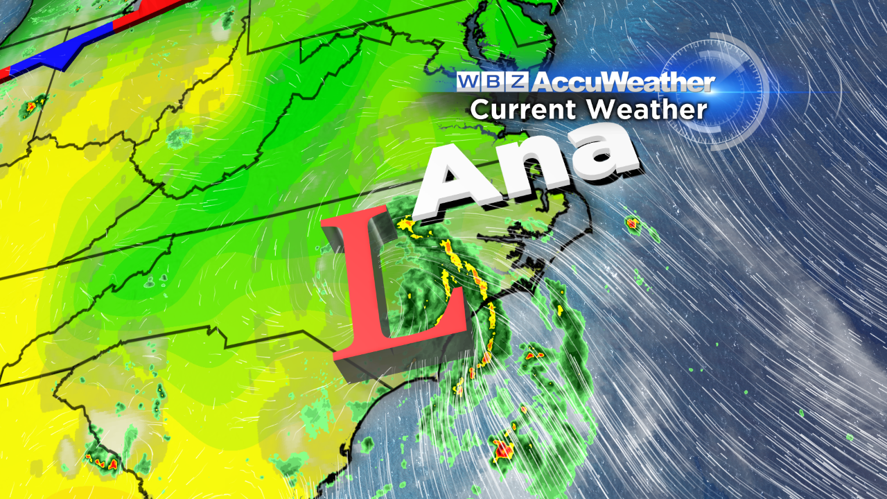 The remnants of Tropical Storm Ana continue to swirl some spiral bands of soaking showers over eastern North Carolina. It was a rather impressive looking storm for so early in the season. In fact, this was the earliest storm since 2003 and that one was also named Ana. This system will move off the coast and track south of New England on Tuesday so no issues here from that one. Will that be the case through the hurricane season which doesn't
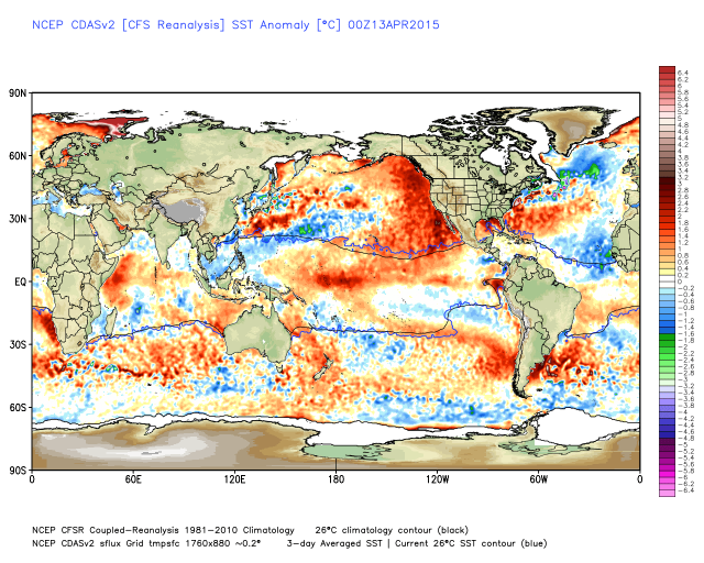 officially begin until June 1? As depicted here, there is a ring of below average temperatures in the Atlantic which extends down to the main southern breeding area. Consequently, with warmer than average water off the southeastern coast and in the Gulf of Mexico, potential storms may generate in these areas as a developing El Nino will provide a hostile upper air environment to any storms which attempt to form in the cooler than average water way out over the Atlantic. Consequently, despite the prediction of a below average number of tropical storms and hurricanes, we will need to keep an eagle CBS eye on possible East Coast trouble. The next name on the hurricane list is Bill.
In the meantime, only a few spotty showers and boomers are possible today and tomorrow with a chance of more widespread showers on Saturday. We need a soaking all-day rain storm to alleviate the dry conditions.
Make it a safe and happy week!