Spring Setback

While warm spring weather has been blossoming across much of the country for several weeks, colder than average conditions have lingered in the Northeast all the way down to the Nation's capital. Consequently, the cherry blossoms are late in blooming again this year. The National Park Service arborists predict a peak bloom April 11-14. Last year's peak bloom was also late on April 10 and the average occurs on March 31. The National Cherry Blossom Festival Parade happens on Saturday April 11.
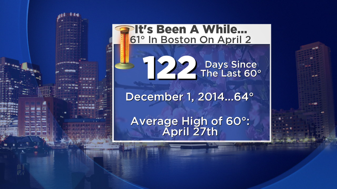 After 122 days, Boston's temperature finally spiked to 60 or greater last Thursday when the official max was 61. That is the average high for April 30. Unfortunately, after the 55-65 on Friday, it was right back to bad habits over the weekend with strong cold winds. There was a record low temperature of 7 below zero at Houlton, ME yesterday morning! On top of that, a few areas had some wet snow mixed with the rain yesterday afternoon so some places had their 11th consecutive weekend containing some snow! And some spots have received some wet snowflakes this morning as a warm front begins to retreat northeastward.
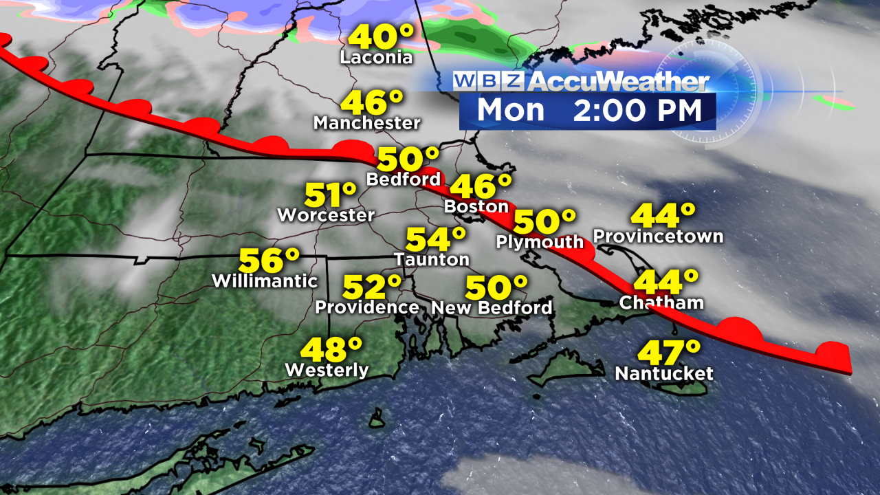 As a warm front shifts northeastward, the broken string of rain and snow showers will move into northern New England this afternoon as the temperatures rise into the 50s across much of southern New England except at some coastal locations. Enjoy it while it lasts because the low-level chill returns Tuesday and lingers for the rest of the week with high temperatures only 40-45 and that is almost a dozen degrees below average. A raw northeasterly wind will freshen to 15-30 mph by later tomorrow and Wednesday.
As high pressure across southern Canada ridges into the Northeast, there could be some drying and possible batches of sunshine either on Wednesday or Thursday before the next upstream system approaches and drives the mist and rain right back into the area late in the week. Don't despair because it could be worse. 33 years ago, I was here at WBZ working the evening shift forecasting up to and through a powder blizzard which dumped 10-20" of unusually fluffy snow for April that was highly blown and drifted by powerful winds. As the blizzard departed early on April 7, there was a record low temperature of 16 degrees in Boston which stands as the lowest temperature ever recorded so late in the season.
 On the flip side, after a lengthy spell of little or no severe weather, the pattern is going to become more favorable for the creation of some nasty storms late Wednesday, Thursday and into Friday as a potent disturbance spins into the Plains, Mississippi Valley and Tennessee Valley. The good news is the steering currents will shift enabling a wetter scenario from time to time across much of the southwestern portion of the country including drought-stricken California not only this week but perhaps over the next few months!
Check out forecast updates from Danielle Niles in the mornings and Eric Fisher in the evenings on WBZ News. Make it a great week!