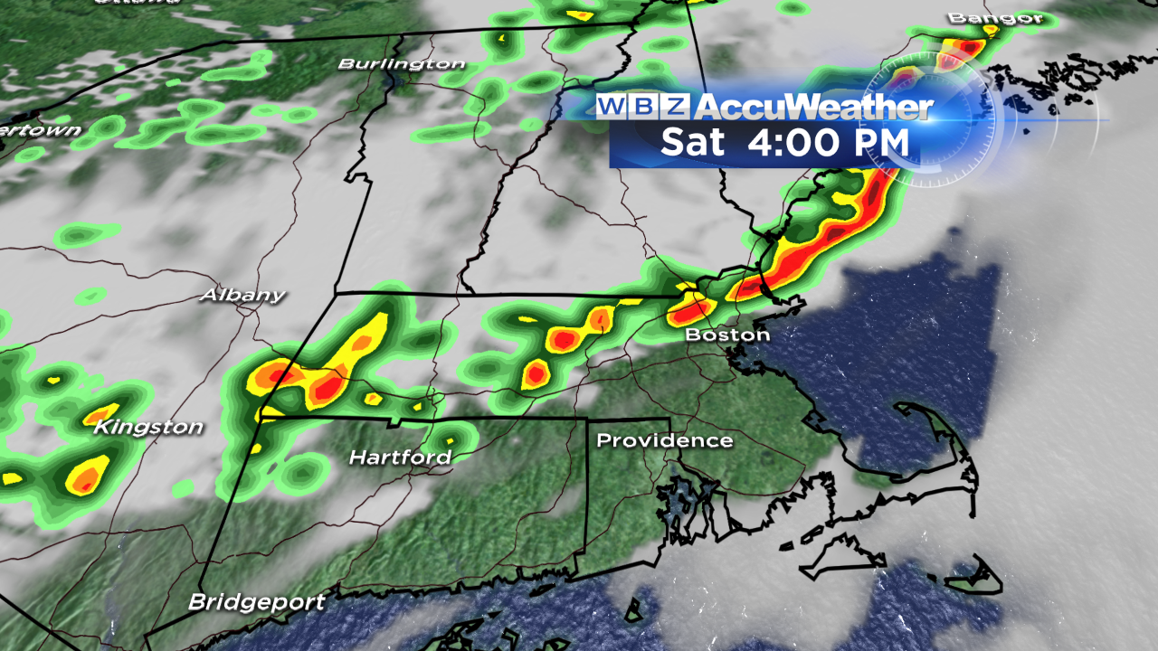
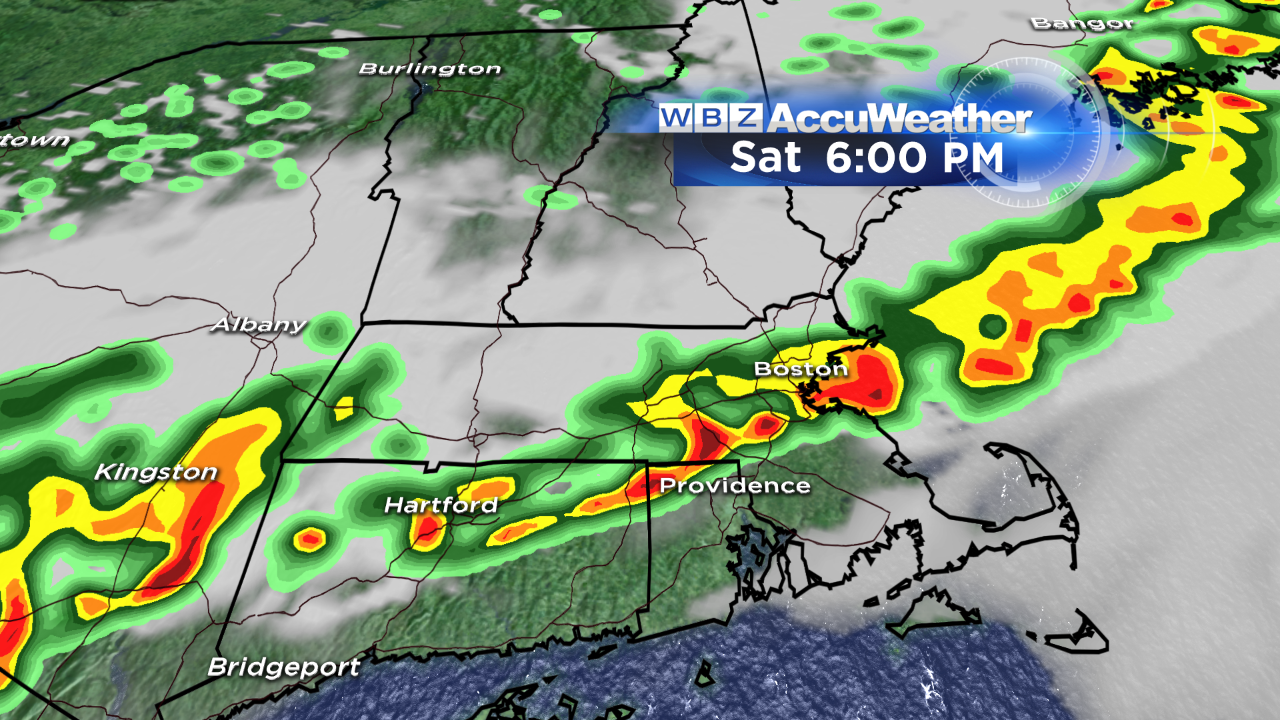
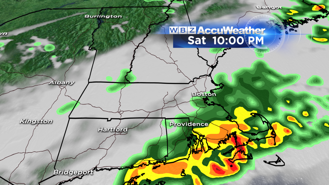
Threat For Severe Storms Saturday
It has been a remarkably hot start to the month of September - we hit 91 in Boston yesterday marking the 7th time we've hit 90+ this year. Our hottest September day on record EVER was September 2, 1953 when the mercury soared to an impressive 100 degrees! We won't be THAT hot today, but highs will approach 90 once again in many communities this afternoon. A tropical airmass is in place too; dewpoints are running in the low 70s…soupy!
Much cooler, drier air will be ushered in by a cold front that will sweep through the region later on today. This front will be the trigger for thunderstorms later on today. With the heat and humidity in place, there will be a lot of instability and energy to fuel these storms. In fact, the Storm Prediction Center has placed much of New England in a slight risk for severe weather today.
Not everyone will see a storm, and not every storm will be severe – but keep in mind, any thunderstorm that develop will contain heavy downpours and lightning, so you'll want to seek shelter indoors. My biggest concern today is for brief, damaging wind gusts and localized flash flooding in the stronger storms that move through. If you have outdoor activities planned for today, there is no question you need to have a backup plan in case a storm heads your way.
Here's a general overview of the timing of thunderstorms. Don't focus on exact placement, but the overall theme:
We'll be monitoring the radar closely today and will be live on WBZ with updates as warranted. And if you don't have the CBS Boston Weather App – download it! It's free and is a great tool to track storms and get alerts for your area.
Be safe!
Danielle