Summer Returns - Just In Time For School
Find Eric Fisher on Twitter and Facebook

Disclaimer: I'm a pumpkin-flavored anything junkie. If they made pumpkin flavored wallpaper I'd have a hard time resisting. So when the commercials for Pumpkin Spice Lattes (PSL's to the hardcore users) or anything of that nature start airing, I get a little riled up. Last Friday, that would have been A+. But on Monday, with the release of the PSL (and some random Dunks throwing out their pumpkin offerings too), it just didn't feel right. Bummer.
On the plus side, summer is back! While August has been comfortable, it's definitely been lacking that definitive summer feel. I saw my breath while on family vacation on the Cape a couple weeks ago. Not my idea of fun. We're not in terribly odd territory, but this August will likely be the coolest since 2008. The average temp for the month (which is all days/nights combined) was 70.0º that August. Right now, we're sitting at 70.2º. The warm temps Monday through Wednesday, combined with seasonable temps Thursday through Sunday, should keep us above that 2008 mark. We haven't had an August with an average temp in the 60s since 1964! But that looks safe for now.
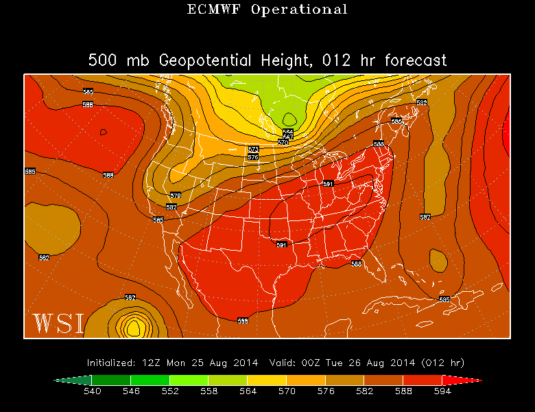
A ridge!! Rare sighting across the Northeast this summer (and its stay will be brief). Also note the weakness between the eastern U.S. ridge and the large sub-tropical Atlantic ridge. That's the path for Cristobal to take northward. Source: WSI Energycast
The reason for this (welcome, I think?) warm-up is that the jet stream has finally developed some ridging over the Northeast. Most of this summer the jet has taken a dip and formed a 'trough' over the Midwest/Northeast, keeping us on the cooler side. But now with high pressure sitting over us and sliding to the south, we'll turn up the heat for at least a couple more days this month.
At the bus stop this morning, temps will generally be in the upper 50s to low 60s. A comfortable one for first day of school photos! The rest of the day will feature southwesterly winds, helping our temps jump well into the 80s during the afternoon. That wind trajectory means it'll be relatively cooler for the S. Coast/Cape/Islands, with mainly 70s expected (still a great beach day!). One thing you may notice is slightly stickier air. Dew points will head up into the 60s - muggier but definitely not oppressive. Just a good old fashioned summer day.
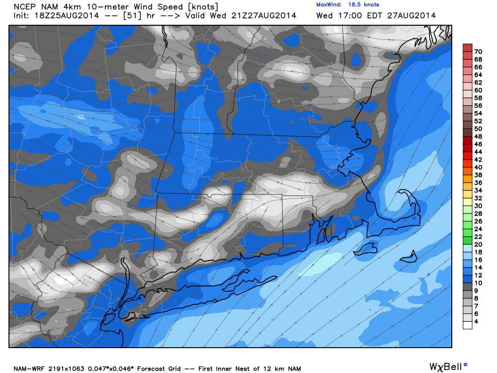
WRF forecast winds for Wednesday afternoon. Mainly westerly, great for giving us some heat! Source: Weatherbell
Wednesday we'll squeeze the most out of this warm spell. Winds will turn more WSW, which is great for getting heat all the way to the coast. You can even get a little downsloping effect as the wind comes down from the Greens/Berkshires/Worcester Hills. Humidity will also be on the increase, with dew points in the upper 60s. A steamy day, and if we're going to hit 90, this is our best shot. We've only had (4) 90+ days all year...which is WELL below average (an average year has about 14 of them in Boston). Late heat *can* happen, but late heat waves are very rare in the Hub. There have only been (3) September heat waves since records began in Boston. When the record books are closed on this summer, they won't show much of anything interesting to the casual reader. My estimate is that when all the numbers are run, it'll end up a barely below average summer in terms of temperature (Meteorological summer is Jun/Jul/Aug). We're talking less than a degree below the average. It's just been the lack of big heat and consistent humidity that has made it a standout!
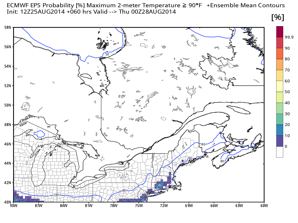
Chance of 90? ECMWF isn't bullish for the Boston area, but I still think we have a shot. The ECMWF EPS only gives us about a 10% chance of topping 90º on Wednesday afternoon. Source: Weatherbell
A cold front will quickly put an end to our summer fling. Winds turn NW Wednesday night, and Thursday looks much cooler with a dry air mass in place. Everyone should stay put in the 70s, perhaps a couple towns near 80 in SE Mass. The front won't just deliver a pleasant air mass - it'll knock Cristobal out to sea. The only issues for us will be in the water. If you're heading to the beach Wednesday/Thursday - watch out for an increasing rip current risk and some higher surf.
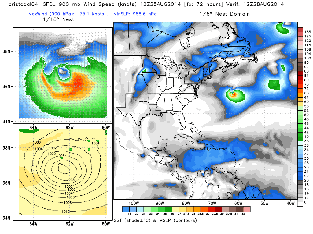
GFDL forecast is similar to many others, with Cristobal getting pushed hundreds of miles out to sea to our east late Wednesday into Thursday. Source: Weatherbell
Looks like the 70s will stick around through Saturday, and then the convo will turn more from just the temperatures to the holiday weekend. Right now it's looking shaky, because of course it is. It wouldn't be New England if some storm system wasn't threatening a holiday. Right now it looks like Saturday is our best bet for dry and brighter weather, although a warm front will be in the vicinity and we'll have to see how much cloud cover it may bring/maybe some showers too. Sunday into Monday looks to feature the higher rain potential, but I wouldn't go canceling any plans just yet. Timing details and more will be figured out as we get a little bit closer.