Bob and Cristobal - Tropics Past & Present
Find Eric Fisher on Twitter and Facebook
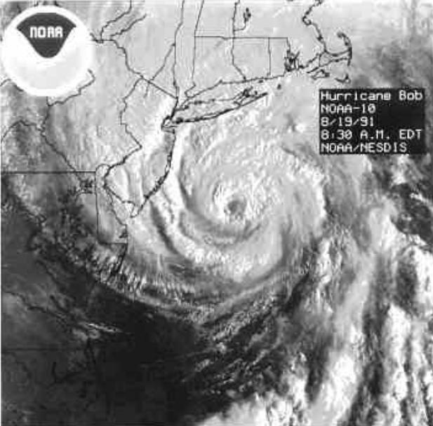
Bob right before landfall on August 19th, 1991. Source: NOAA
It was this time 23 years ago that we were picking up the pieces from a hurricane, and it's something we haven't done since. Bob was the last to make landfall and cross a portion of Massachusetts, first coming ashore at Block Island, RI on August 19th, 1993. For sure, we've seen impacts from the tropics since - but always indirectly. Sandy brought a host of problems, even though it made landfall hundreds of miles away in New Jersey. Irene brought hundreds of thousands of power outages, downed trees, and flooding for much of New England, most significantly impacting Vermont with catastrophic flooding. And even this year - a rare early July hurricane came very close to crossing Nantucket! Arthur was an odd storm, and came within a few dozen miles of ending the 'drought.' But when you boil it all down, we've been fortunate in recent years.
Bob was a deadly storm, killing 6 in New England (all of them in Connecticut). Storm surge up to 15' inundated the coastline, particularly along Buzzard's Bay (an area that's most at risk for storm surge in our local area). Winds gusted over 100mph, and dozens of homes were destroyed. We really haven't seen anything of such magnitude since, which in fact can be unsettling for a meteorologist. It's faded in many a memory - anyone graduating college now and perhaps buying their first home would have no recollection of it. In times like this, complacency can be the biggest enemy.
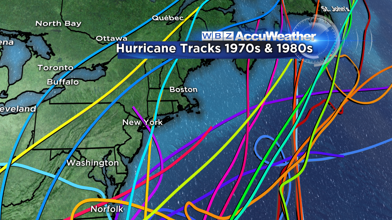
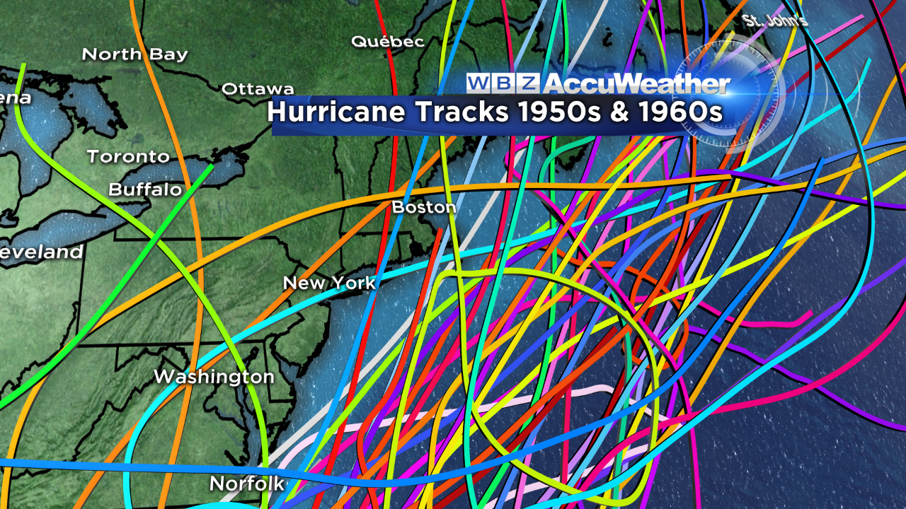
All the tracks of hurricanes, separated by 20 year increments. You can see how many more there were in the neighborhood, and making landfall, in the 50s & 60s!
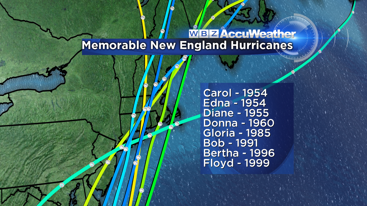
East Coast hurricanes tend to come in cycles...moving with oceanic patterns (like the AMO - Atlantic Multi-decadal oscillation) and other environmental factors. We've saw relative peace during the 70s and 80s (Gloria an exception). But in the 50s and 60s, several infamous storms pounded the east (notably Carol & Edna here in southern New England, both in 1954, and Donna in 1960). The 90s brought a few storms our way, including the aforementioned Bob. Bertha and Floyd also brought significant impact. Silence was the rule in the 2000s as many of the major storms tended to focus on the Gulf Coast and Southeast.
The 2010s (feels weird to say the teens?) have started to trend back to an East Coast focus - with storms like Sandy, Irene, Earl and Arthur. And this year continues to showcase the East Coast as the most 'at risk' area on the U.S. coastline. Will this continue into the next few years? Well there's no such thing as 'being due' when it comes to hurricanes, but I know one thing for certain. The Boston area will get hit by a strong hurricane again. That's an inevitability. The point of this isn't to scare, it's to prepare. We should never assume we're safe from these types of hazards, just because we haven't seen one in a while. The Revere tornado is a good reminder of that principal. It's always important to know your risk, your flood zone, the worst case scenarios, and to have a preparedness plan. That way when the next big one comes knocking, you'll be ahead of the game.
 Atlantic Water Vapor Loop
That brings us up to current times. We are keeping an eye on a couple waves east of the Windward Islands. The leading wave has the best shot at development, and has been designated Invest 96L. Both of these are battling dueling forces - a ton of dry, dusty air that's in place across the Atlantic - and the fact that climatologically, this is the time of year when everything starts spinning and we quickly ramp up to the peak of hurricane season. In the immediate future, the former is probably going to beat out the latter.
96L has a lot to overcome in the days ahead, and there's very low forecast confidence for those days. It's a disorganized system, but a couple of models have latched onto it and are developing it in the Gulf of Mexico next week. The Canadian and GFS are the most bullish (not surprising, the GFS LOVES to spin up phantom storms). As of this writing, the ECMWF is just tossing a lazy yawn in 96L's direction. It barely does anything with the wave, with little impact to anyone.
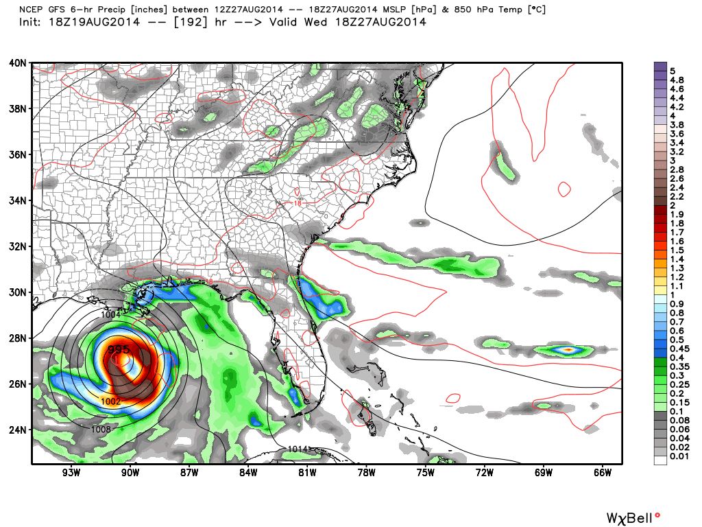
GFS going big in the Gulf, many other models are not. Source: Weatherbell
I don't believe it's a good idea to write off the GFS completely, and don't subscribe to the idea that you shouldn't put out information early in the game. Information with *context* is a-okay, and really it's irresponsible NOT to mention a possibility if you can get people's attention with advance notice. Nothing wrong with saying 'hey, there's something possibly brewing - not set in stone but we're watching it so stay tuned.' I think that's the best way to go with this one for now.
If the ECMWF were to latch on and start developing this, certainly folks around the Gulf Coast should monitor with greater interest. Environmental conditions should be favorable if the wave can hold together and make it into the GOM, so we'll be watching carefully. Way down the line this could even bring some needed rain to the Northeast, but of course that too is up in the air. IF it can get itself together and reach Tropical Storm status, it would be named 'Cristobal' (pronounced krees-TOH-bahl). And it would actually be early - on average the 3rd named storm of the season doesn't form until early September.
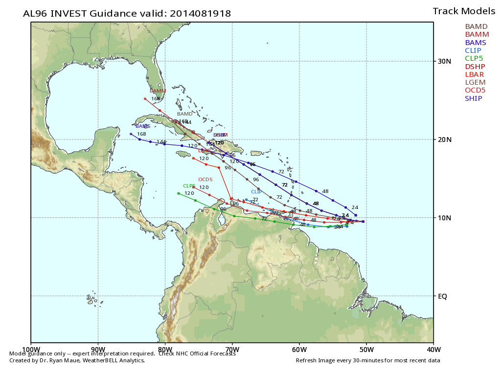
Spaghetti plot for several models forecasting the possible path of Invest 96L. Source: Weatherbell