Eastern Pacific Off To A Record Start
Find Eric Fisher on Twitter and Facebook
Even though we've had damaging and memorable (if not infamous) storms like Irene, Sandy, and Issac in the past few years - the truth of the matter is that the Atlantic Basin has not been showing us its worst. The fact that the U.S. is in a record-shattering long streak between 'Major' Hurricane landfalls has been widely reported. Last year was a dud of a season from even just a heat transfer standpoint. All the storms which developed were pitiful, and no hurricanes struck land (good thing!). This year is off to a slow start as well, although that's not very surprising here in the very early stages. But switch basins, and it's a different story.
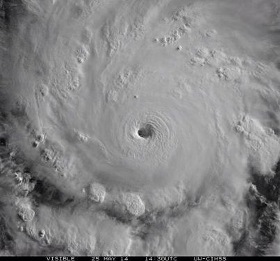
Hurricane Amanda as seen on May 25th, 2014
The first storm of the Eastern Pacific Hurricane Season was Amanda, and it wow-ed its audience. Amanda continued to intensify until it was the strongest May hurricane ever recorded in the East-Pac. It topped out with max sustained winds of 155mph (just a little short of Category 5 status - the strongest of the strong) on May 25th before dissipating over cooler waters. Its power was startling for the time of year, when hurricanes even close to this magnitude are quite rare. Fortunately, this beast of a storm never made landfall.
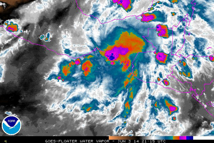
Tropical Storm Boris on June 3rd - a disorganized area of downpours that produced localized flooding.
Up next was Boris - a weak and short-lived system that brought heavy rainfall to southern Mexico. Boris did not live very long before being downgraded. Some of the models, namely the GFS which loves a good 'boguscane,' tried to bring Boris back to life over the Gulf of Mexico. But it was not meant to be and never panned out.

That brings us up to current time and another strong storm, named Cristina. Cristina came up to Category 4 status on Thursday, and that was good for yet another record. Reaching that milestone on June 12th made it the earliest we've ever recorded 2 hurricanes of Cat 4 or greater strength in the East Pac. Not only did Cristina break the record, it crushed the record. The National Hurricane Center reported that there have never even been two Category 4 storms before the end of June in the satellite era, which dates back to 1966. Prior to Cristina, the earliest we've recorded the second Category 4 of the season was on July 1st, 1984 (Elida).
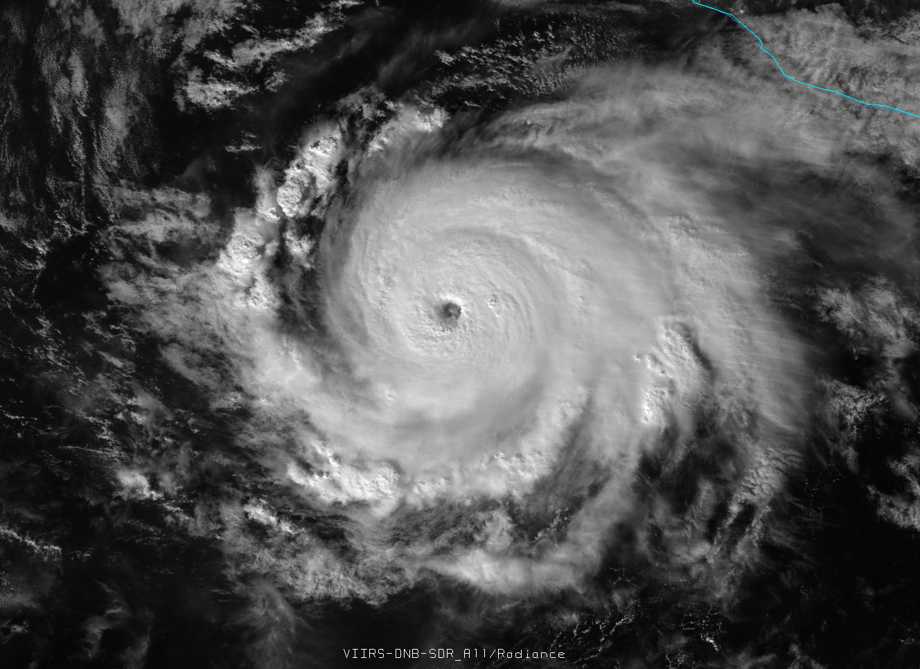
Image of Hurricane Cristina on Wednesday night. Source: Colorado State
Both Amanda and Cristina underwent what we call 'Rapid Intensification' - which can be extremely dangerous if a storm is about to strike land (think Andrew in 1992). Amanda saw its winds increase 70 knots in just 24 hours, but Cristina wasn't to be outdone. On Wednesday night/Thursday morning, over just 12 hours, its max sustained winds climbed an astonishing 65 knots. It's very fortunate both of these were sea monsters, not land strikers.
Many of you have asked about El Nino in recent weeks, and indeed the East Pac tends to be much busier in El Nino years (while the Atlantic basin sees suppressed tropical activity). So perhaps these two strong early season storms are a harbinger of things to come. It's certainly something to monitor as we head deeper into summer.
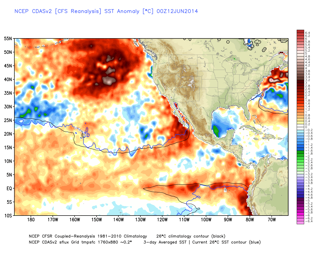
Current Sea Surface Temperature (SST) anomalies. Source: WeatherBell


