Cold Air Is On The Move
With the weekend storm passed, the story now turns to the plummeting temperatures. A flash freeze is ongoing across parts of the state. As the wind shifts around to the northwest on the backside of the storm, cold air snaps back in. This means anything untreated will become slippery in minutes…it's a sheet of ice in spots out there, so watch your step and take it slow on the roads.
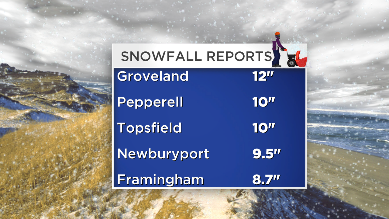
Snowfall totals and pictures have continued to stream into the weather center this morning. Here's a list of some additional snow totals courtesy of the NWS and Skywarn Spotter Network.
No melting is expected tomorrow as highs will only top out in the 20s for most communities. Add a gusty WNW wind to that, and our feels like temperatures will be running in the single digits and teens at the warmest time of the day Monday afternoon. Bundle up!
Tuesday our next disturbance approaches, spreading light snow into the region as early as mid-morning, picking up in intensity during the afternoon and evening especially. Just an early head's up that school dismissal time may be a real mess on Tuesday along with your commute home.
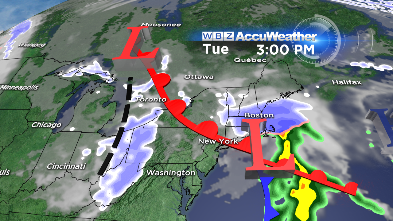
An early estimate shows the potential for 2"-4" of snow, with higher amounts possible. Depending on the track of the storm, the Cape and Islands may see a changeover to rain for this event. We'll keep you posted.
Stay warm & safe out there!
-Danielle