Relatively Quiet Holiday Weekend
Find Eric Fisher on Twitter and Facebook
Columbus Day Weekend may be *the* weekend of fall. Between the festivals, the leaves, the parent's weekends at area colleges and universities, the weddings, the Sox in the playoffs at home, the Pats at home...and of course the hours in the car trying to slowly wind your way down the Pike. A lot of major outdoor activities, so there's some pressure on the Meteorologists to deliver! Fortunately, I think the weather will for the most part behave over the next few days.
First off, a couple of items from Friday. A lot more sunshine made it through than expected, as dry air ended up ruling the day and keeping clouds off to our south. That made for some interesting observations. The one that caught my attention the most was the dew point spread across the Northeast. While many towns had dew points in the upper 40s to mid 50s, a few spots here and there plummeted down into the teens! That's extremely dry air, and it was due to atmospheric mixing. Check out the 12z sounding from Albany, NY this morning. A HUGE slice of very dry air just above the surface (green line is the dew point, red line is the temperature). When the atmosphere got mixing, it dragged this air with it down to the surface. At one point, Saranac Lake, NY was 71º with a dew point of 18º, for a relative humidity of just 13%! And a few other locales saw the same thing happen around New England.
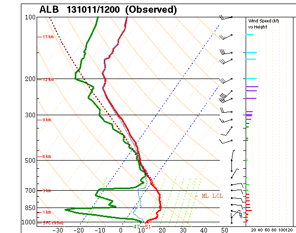
Courtesy: NOAA
The other notable thing from Friday was the most excellent mix of mid and upper-level clouds that were flying across the sky, thanks to that persistent cut-off low in the Mid-Atlantic. Made for an epic sunset with great texture! Check out this photo from Ken Davis in New Lebanon, NH. Outstanding.

KenDavisPhotos.com
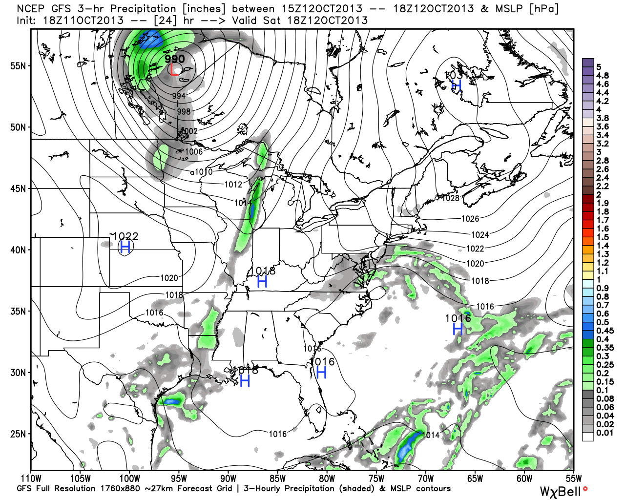
Alright, so now let's dig into the forecast. The issue at hand for Saturday is not the storm to our south, but a very strong area of high pressure to our north. This will slide a little to the southeast, and push a backdoor cold front into New England. Behind that front is moist ocean air at the low levels, and more likely than not a deck of low stratus clouds. So as we see it, the early morning hours may be bright, but this batch of low clouds should invade by mid-morning and move inland. The highest chance of cloudiness will be across southwest Maine, southern New Hampshire, central/eastern MA, and RI. If your travels take you down toward NYC, or up into VT, I think you'll end up with a decent amount of sunshine.
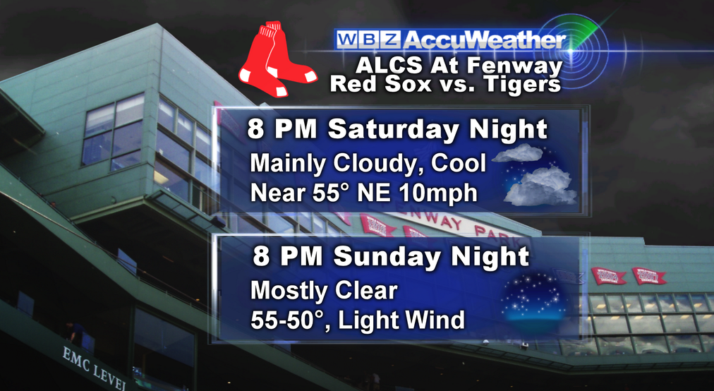
There could also be some areas of drizzle within the areas under a cloud deck. Most data point to these clouds sticking around until the evening, but breaking up during Saturday night. There will also be a stiff NE wind, especially at the coast, which will be in the 10-25mph range. A couple gusts could top 30mph right at the shore, particularly Nantucket and the Vineyard. So not perfect, but at least no rain!
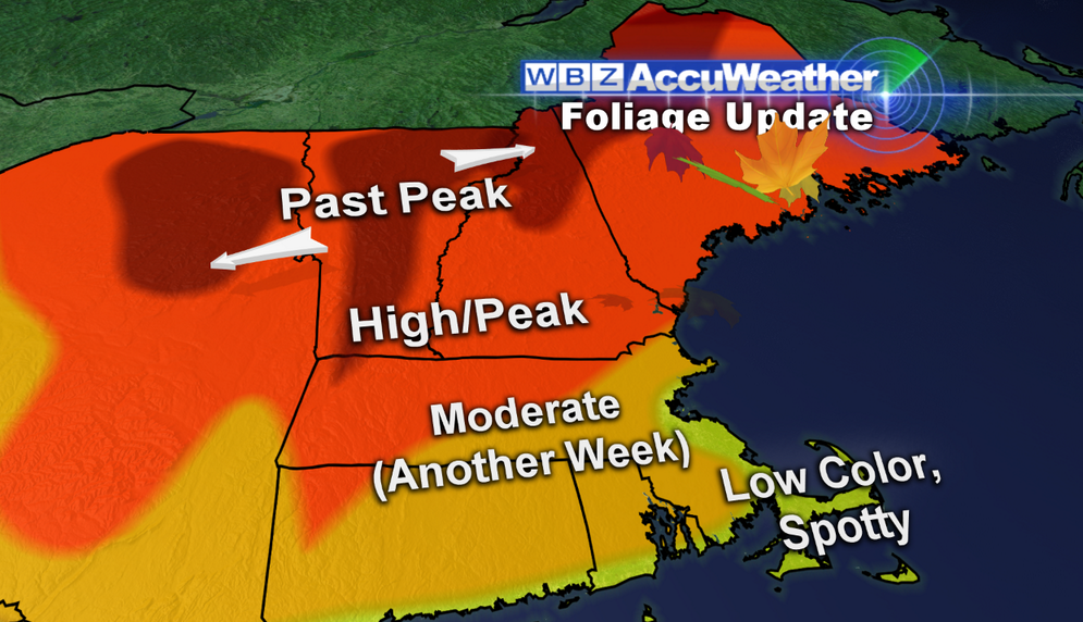
Sunday looks much more promising in the weather department. Any early clouds should give way to quite a bit of sunshine and a great October day. More of the same expected for Columbus Day (Monday), so we'll grade the weekend as a B+. I'd definitely shade my outdoor activities toward the Sun/Mon time frame, but don't think Saturday will offer major issues. Next week looks quite mild until we get toward the end, when a turn to a colder pattern may begin. But lots of time before we get there. Below is a look at our forecasts for some of the big events this weekend. Not too many complaints. If you're foliage hunting, it looks like areas above 2,500' are into full 'stick season' already. Valleys north still have nice color, but we're starting to focus more toward our neck of the woods (pun intended) for good fall foliage this weekend.

Internationally, the big focus is on a massive cyclone in the Bay of Bengal. It's name is Phailin (pronounced pie-leen), and it will be one of (if not *the*) strongest storms ever to hit India. Below is a look at some stunning microwave imagery from CIMSS. It shows the progression of the storm over the past 24 hours, and you can clearly see an eye-wall replacement cycle take place. The original eye wall dissipates, then a new one forms outside it and tightens up around a nearly completely clear eye. This is about as strong as a hurricane can get, with winds gusting over 170mph.
This storm will make landfall on Saturday (our time) with an expected storm surge of over 20', wave heights reaching over 55', and Category 5 force winds. It's also a stunning 820 miles across, meaning that if we placed it in the Gulf of Mexico it would literally take up the entire Gulf. It's feasting off the warm waters of the Bay of Bengal and very limited wind shear.
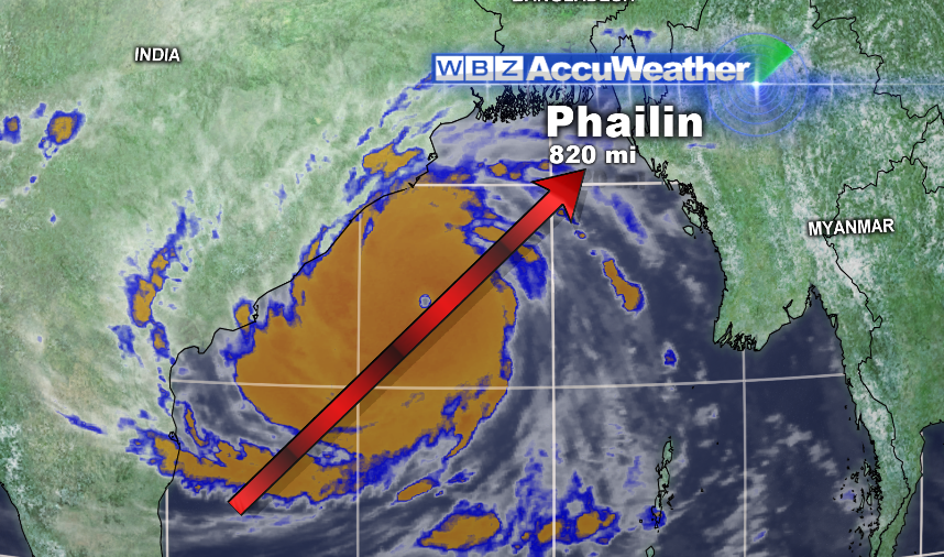
The last time a hurricane of this magnitude came ashore in India was in 1999, when Odisha roared in on October 29th. That storm killed over 10,000 people and caused over $2 billion in damage. The population of India has exploded in the past 14 years, and so we can only imagine what Phailin will bring. Evacuations are underway, and we'll hold our breath and wait to see what happens. Keep these poor people in your thoughts this weekend!


