A 'Top 3' Week To Start Autumn
Find Eric Fisher on Twitter and Facebook
You'll always meet people who love skies to be gray all the time, or who love it cold, or hot, or frequent bouts of wild weather. But I think most will agree, this week isn't looking too shabby. I'd dub it a 'Top 3 Week' - meaning one of the 3 best weeks of the entire year for weather in our area! The 7-day essentially looks like a slightly cooler version of southern California.
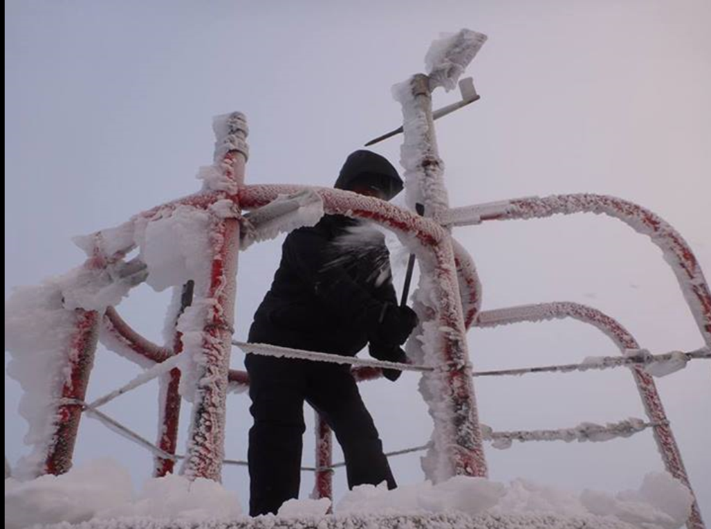
That being said, it SNOWED on this first full day of fall! Well alright, it only snowed on top of Mount Washington in New Hampshire, which has an elevation of 6,288'. But that, combined with rime ice accretion rates at 2-3" per hour and sub-zero wind chills, made for an interesting time on the Rockpile. Here's an image shared by the Mount Washington Observatory this morning. It was the first snowfall of the season there. I've gotten to know a couple of the Observers there, and trust me, they're not upset about this. The typical MWOBS employee is there because he/she is a snowhound and loves the extreme cold weather up there!
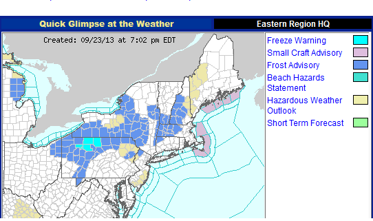
Looking ahead, there are only two real areas of the forecast that are factors this week. One is the chilly air, which will lead to patchy frost tonight. Frost Advisories are out again for NW Worcester County, all of western Mass., and southern NH/VT. I don't think temperatures will get colder than 35F, so any frost should be patchy in nature. A 'freeze' is not expected, where temperatures stay sub-freezing for several hours. With so much great weather ahead, you can play it safe by covering up the garden or bringing in plants in the areas affected. The same areas may go under a Frost Advisory again on Tuesday night, but in general temperatures will be the same or slightly warmer tomorrow night as dew points rise a touch.
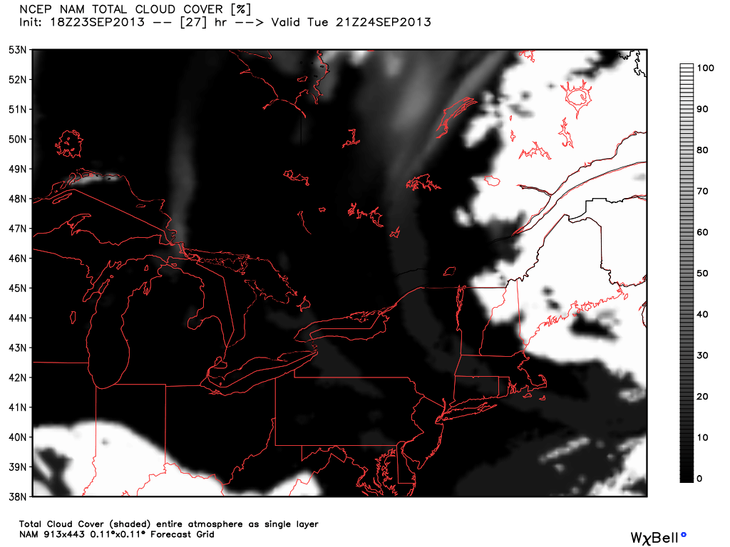
The other issue we'll keep a wary eye on is a storm spinning up across the Canadian Maritime. This will throw some clouds back in our direction over the next couple of days, but most of those will stay across Maine and eastern New Hampshire. A few cumulus here and there are all I expect for Southern New England. With us residing in the middle of a high/low sandwich, the pressure gradient will stay up enough to keep Tuesday quite gusty with winds out of the NW.
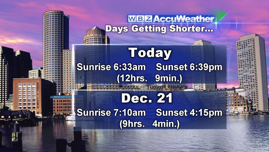
The rest of the week is as high confidence of a forecast as it gets. Seasonably cool, tons of sun, chilly nights, repeat. Light lifting in the weather department! High pressure will crest over the region this upcoming weekend, and quite frankly I'd start making outdoor plans right now. There will likely be a lot of happy brides and grooms now that we're in big time wedding season. A warming trend will come along with all that sun, with no foreseeable rain until at least next week. And enjoy that sunshine, because we know what happens next! We lose approx. 3 hours of daylight between now and the start of winter.
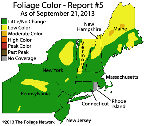
Speaking of foliage and great photo ops, this may be the first really good weekend to take in the colors of northern New England. Some spotters are starting to come in with reports, and the next several nights back in the 30s/low 40s will really help things along. Here's the latest map from Foliage Network, although I expect some more significant changes to this by the end of the week. B&B season has arrived!
As for the tropics, which usually are at least part of the discussion this time of year, are completely and utterly quiet. Here is the home page of the National Hurricane Center from Monday evening. Not often that you're in late September, just past the climatological peak of hurricane season, and there isn't even an area of interest in the entire basin. No complaints there!
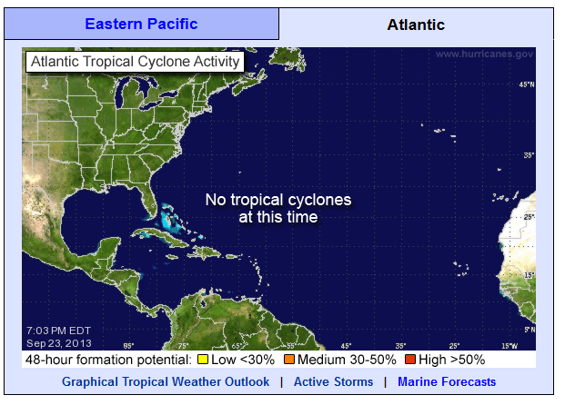
 A Quiet Tropics
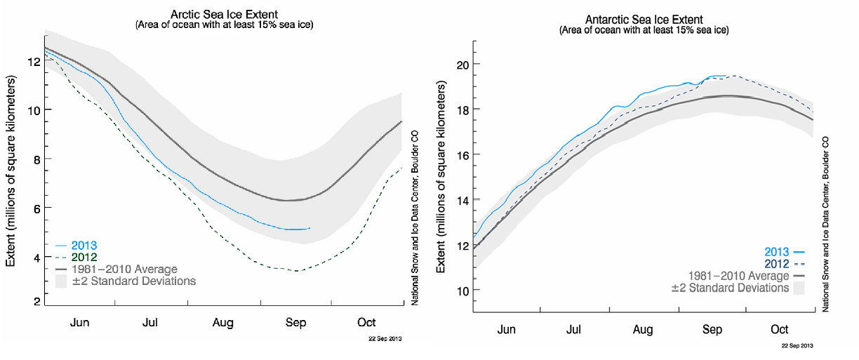
The last weather note for the evening is a look at a very interesting dichotomy. As reported by the Capital Weather Gang, Antarctic sea ice reached a 35-year record high over the past weekend. This is baffling many climate scientists, as the water below the ice is actually warming. At the same time, Arctic sea ice is disappearing at a rapid rate. It reached a record minimum last summer, and this year was 20% below the 30-year long term average. The image below shows the strange trends between the two poles.