Winter Storm Has Arrived
BOSTON (CBS) - This winter storm will mean several things for southern New England - heavy, wet snow, heavy rain-mix, damaging winds, coastal flooding and beach erosion.
Check: Interactive Radar | Current Conditions | Weather Blogs
This is a long duration event lasting 36-to-48 hours total.
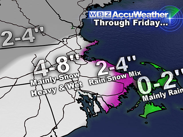
A general swatch of 4-to-8 inches of snow will fall inland within this time period, 2-to-4 inches for coastal areas with a mix-snow, and mainly rain for Cape Cod and the Islands.
Read: Ask The Weather Team
The winds and coast will be the focal point as northeast (onshore) gusts will reach 55+mph during this storm. This will churn the seas and produce 25-to-30 foot waves along with a 2-3 foot storm surge. This will create a major concern for the coastline and beaches during this morning's high tide around 7 a.m., this evening's high tide around 7 p.m., and especially the Friday morning high tide at 8 a.m.
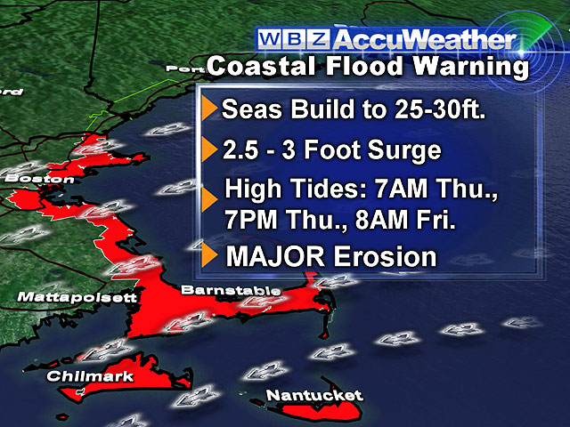
The Friday morning high tide is likely to produce moderate to major coastal flooding as well as major beach erosion. Winter Storm Warnings, Winter Weather Advisories, High Wind Warnings, Wind Advisories, and Coastal Flood Warnings are blanketing our region.
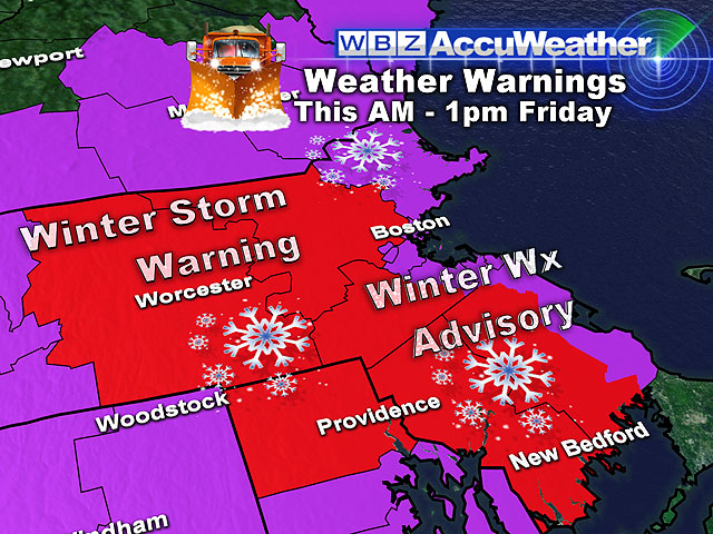
The heaviest bursts and accumulation of snow will occur this evening through Friday morning. Friday morning's commute will NOT be a 'kind' one! Luckily, conditions will gradually improve by Friday evening. Winds will begin to calm down, and the snow-mix will taper off.
This weekend will be a 'Spring Tease'!
Saturday and Sunday will be filled with sunshine. Highs will be in the middle to upper 40's on Saturday and even milder in the lower 50's on Sunday. Get those motorcycles ready!
The mild air will stick around through early next week.
One Alarm Clock Away...
~Melissa :)