Winter Is Coming (No, Really)
BOSTON (CBS) - I think I got a little misty eyed walking outside on Monday - thinking a final few warm and comfortable thoughts before the inevitable pattern shift.
You knew we weren't going to keep wearing shorts and T-shirts right through the winter, and time has come for a change. We start off gradual and seasonable to get a little acclimated thankfully, before a blast of unusually cold November air crashes squarely across New England. And with that, our mental status will set itself to winter mode and beard growing will commence.
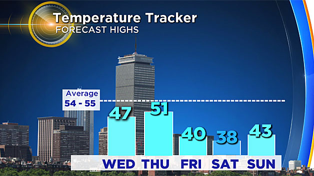
For the next few, it's no big deal. Just finally a stretch of seasonable weather. We'll see highs near 50 each of the next several days, with Wednesday being the coolest and Thursday being the mildest (each by only a few degrees difference). Sweaters, pants, and hot coffees replace flip flops and iced beverages. That's all well and good. Though by the time Thursday night rolls around some big changes will be brewin' instead of the java.
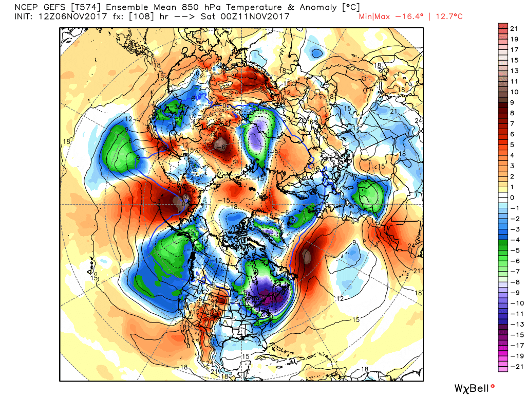
This will be a short lived but harsh pulse of cold that blows in starting late Thursday night. A lobe of arctic air will dislodge itself and swing down across New England. In fact, the air here is expected to be the coldest relative to average of any spot in the northern hemisphere on Friday. Official highs for the day will be set at midnight (in the 40s) before a crash moves in behind the front. Most of the day will be spent in the 30s with a cold winter wind blowing from the northwest, producing wind chills in the 10s and 20s! Compare that to last Friday, when temperatures reached the mid-70s. This is going to be a rapid and jarring change of pace.
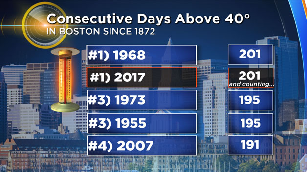
The blast should bring overnight lows down into the 20s and perhaps even some 10s across the higher elevations. It also may bring the first freezing temperature since March to Boston (the city takes much longer than most surrounding spots to get that low). For sure, it will end the record streak of days above 40 degrees. We haven't hit the 30s at Logan since mid-April, the longest such streak on record at over 200 days.
Temperatures this cold also mean that we'll be putting an end to all the warm-season plants and insects. They've had a good run. Our own Bill Shields came into the weather office Monday to say he was still picking strawberries in his yard! The crops, mosquitoes, and planters will all likely be cooked after a couple of nights in the 20s though. It also means that if you've been putting off winterizing the outside pipes, I'd recommend doing it quick! It's still been outdoor shower/irrigation weather until recently so I'm sure many haven't gone through the process just yet. But a sharp temperature drop like this can wreak havoc on pipes.
Will we talk about some record-setting weather?
Saturday brings with it the best odds of breaking one, and the record to watch is coldest high temp for the date. It stands at 38F, set in 1987. Our ocean is so mild right now that I think it will be difficult to do and I am forecasting 40F in Boston as of this writing. But it's close, which gives you a good idea of just how cold this air is for the time of year. With a north breeze over that warm water, we may see ocean-effect showers develop over Cape Cod and the Islands. It'll probably be a little too warm for snow, but perhaps something to keep an eye on. Streaks of clouds are likely to form for sure.
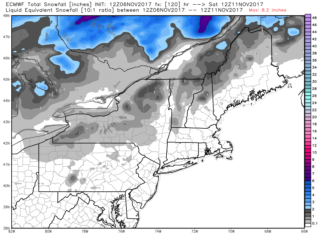
Speaking of snow, the arctic front should come along with a burst of snow showers and squalls Thursday night into Friday morning. These will be most likely across higher terrain, particularly northern New England and perhaps the Berkshires. But I wouldn't rule out some of our first flakes here in southern New England as well. Good news for ski areas that were probably starting to squirm a little with our record-warm fall. Nights will be cold this week and certainly will be extremely cold this weekend and you better believe the snow guns will start firing up. Especially at Killington, which hosts a World Cup event November 25th and 26th. They need this pattern shift like you read about!
The core of this cold moves out pretty rapidly, and we're back up through the 40s by Sunday afternoon. Chilly but considering an average high is in the low 50s a high in the mid/upper 40s isn't too bad. And we'll likely be back up over 50 again by Monday. That being said, the overall pattern looks cool/chilly to stay for a while, so don't expect a big push of very mild air to dominate the region again soon. With three weeks to go it has still been the warmest fall on record, and it will be interesting to see how the chilly stretch dents the standings before the month wraps up.
Regardless, it's time to settle in for the cold season.