Potentially Severe Weather Possible Saturday Afternoon
By Barry Burbank, WBZ-TV Meteorologist
BOSTON (CBS) – The WBZ Storm Watch Weather Alert is posted for this afternoon due to an approaching frontal boundary which will introduce drier air in the region tonight and could lead to strong thunderstorms.
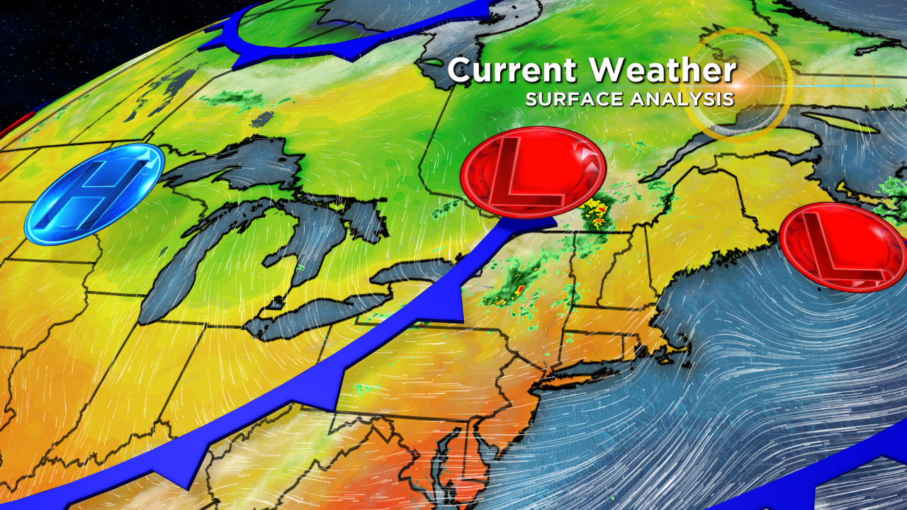
Some of boomers were nasty over upstate New York before dawn today and those have weakened this morning. However, the stage is set for the generation of additional storms as instability increases during the day.
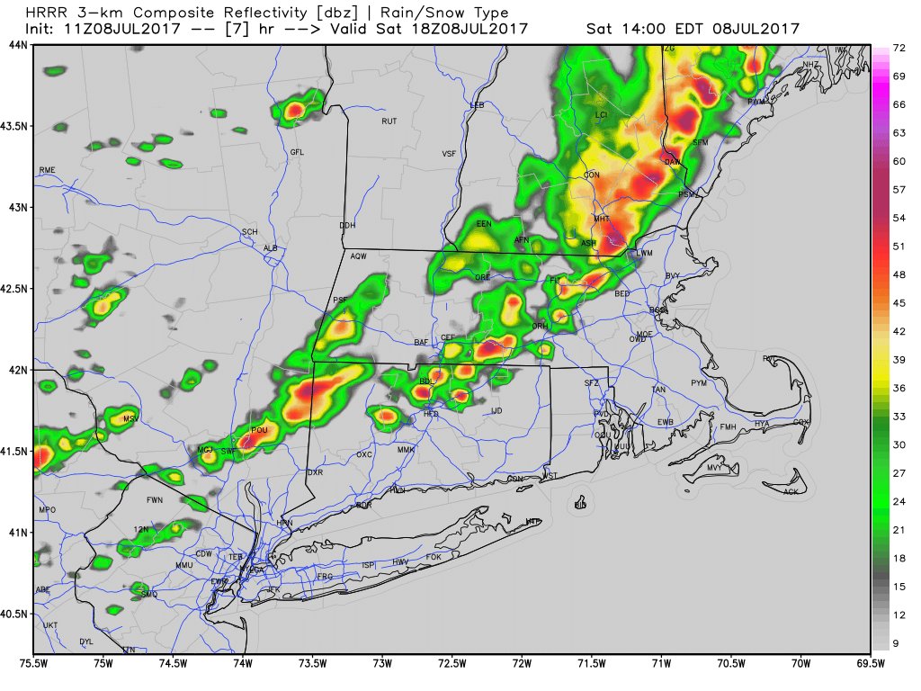
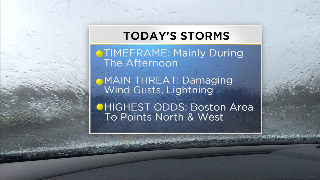
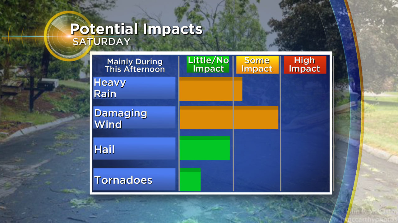
This high-resolution model is depicting a swath of showers & storms crossing central MA on the way to eastern MA from roughly 2 to 4 pm. The available atmospheric parameters suggest that a few storms could produce damaging winds and hail along with the usual dangerous cloud to ground lightning bolts.
The Storm Prediction Center has much of New England in a marginal risk for any severe weather this afternoon. Any storm should be rolling right along so brief downpours of 15-25 minutes are most likely but many areas will not get a direct strike. The risk of any showers or storms decreases significantly over southern Plymouth County onto Cape Cod & the Islands.
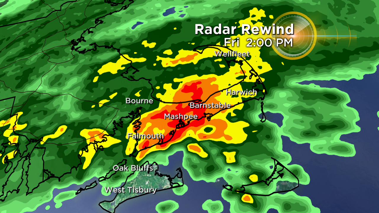
Yesterday, the WBZ Storm Watch Weather Alert was issued early in the morning due to the potential for torrential tropical downpours which materialized over much of Cape Cod.
The National Weather Service had issued a FLASH FLOOD WATCH the night before for southeastern MA, Cape Cod & RI. As The lobe of torrential rain associated with a wave of low pressure approached Martha's Vineyard late yesterday morning, the NWS issued a FLOOD ADVISORY. This was quickly updated in the early afternoon as the lobe lifted up over the Cape releasing its torrents of rain.
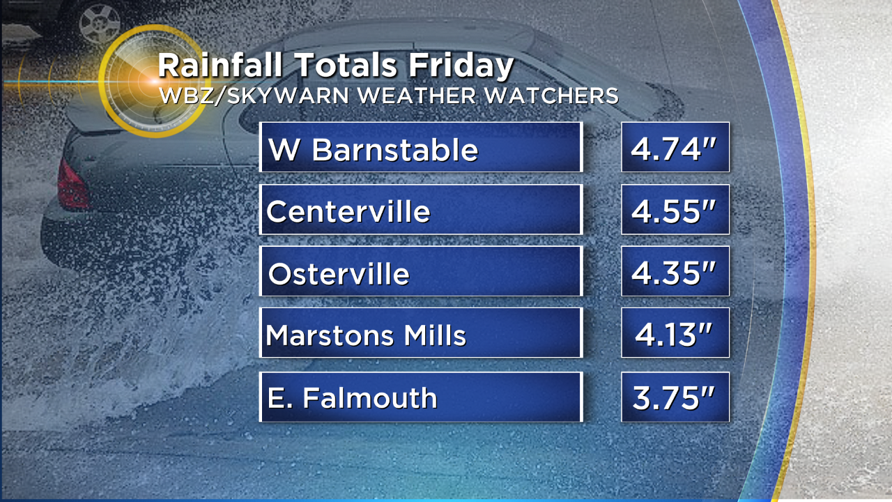
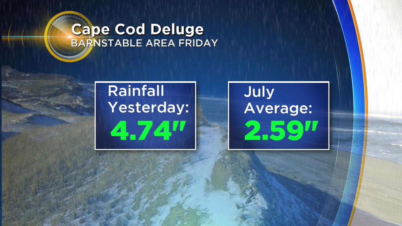
Check out this stat that Meteorologist Eric Fisher displayed last evening. As an example of the 3-5 inches of rain falling on much of Cape Cod yesterday, in the West Barnstable area, the amount falling in a bit less than 2 hours was almost double the amount that falls on average in the entire month of July.
So you can understand why the flooding was so mammoth and widespread! This will NOT be repeated today. In fact, much of the Cape may not receive a drop of rain today!
If any severe thunderstorm warnings are issued by the National Weather Service this afternoon, you will see them displayed as a crawl at the bottom of the television screen on WBZ-TV.
Meteorologist Jacob Wycoff will be updating any pertinent weather information here on social media and here on cbsboston.com
Follow Barry on Twitter @BarryWBZ.