A Close Call With Potential Flash Flooding Friday
BOSTON (CBS) - In winter, it's nor'easters. Living on the edge where 100 miles makes all the difference between shutting down the area for a day or a cold and dry afternoon.
In summer, the tough calls involve thunderstorms. Convective weather (a.k.a. thunderstorms) is notoriously difficult to model. It's the one thing computer models perform least admirably with. It can shift on you in a moment's notice, and Friday features one of those types of setups.
Here's what we have on the table.
A disturbance that will roll out of the Ohio Valley and toward coastal southern New England by Friday morning. If you want to get into some of the technical stuff, this is often a case where it looks like it will dump rain until the very last moment when Lucy takes the football away.
A west to east oriented line of storms tends to cut off widespread rain for us, almost acting like an instability wall. The action gravitates to the source of the warmest moisture-laden air, which is naturally to our south. So a line of torrential rain that looks destined for New England ends up more toward New Jersey and the Atlantic.
This is certainly a possibility for Friday, especially with a near-parallel flow from west to east in the mid and upper levels and weak low-level steering. We'll need a little buckle in the flow to get this to move in our direction.
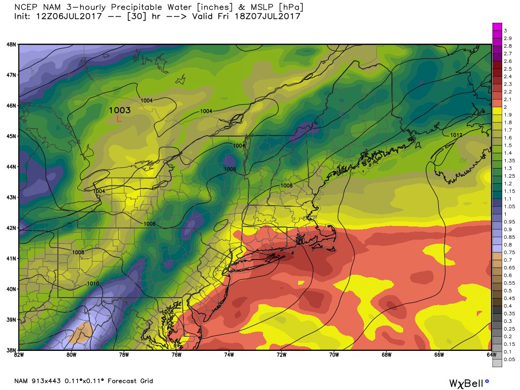
The reason it's a high boom/bust issue is because the air skirting our coastline is downright tropical. It'll have the potential to produce a LOT of rainfall in a short amount of time if it comes far enough north.
BUT here's the fly in the ointment - it's tough to stare down a situation that could have a high impact and say 'Hey I think it's gonna be no big deal, go about your day.'
Because when it comes down to it, you rarely 100-percent know what the weather is going to do until it's happening. If this thin band of torrential rain comes up into southeastern Massachusetts Friday, then there certainly will be areas of flash flooding and localized rain amounts over 2-to-3 inches. So it's a boom or bust situation, and one we must all keep tabs on until Friday morning when it truly becomes clear how this will all pan out.
So here are the details as it stands.
Timeline: 8am through 4pm.
Should this wave of low pressure be able to ride up into the region, rain would break out near the South Coast by 7-8 am and spread northward during the morning to midday. Any rain would be over by 4 pm, so Friday evening plans are looking fine. It'll just be mild and muggy out. Lots of questions coming in about the concert at Fenway. Weather shouldn't be an issue even in a worst-case outcome with this storm!
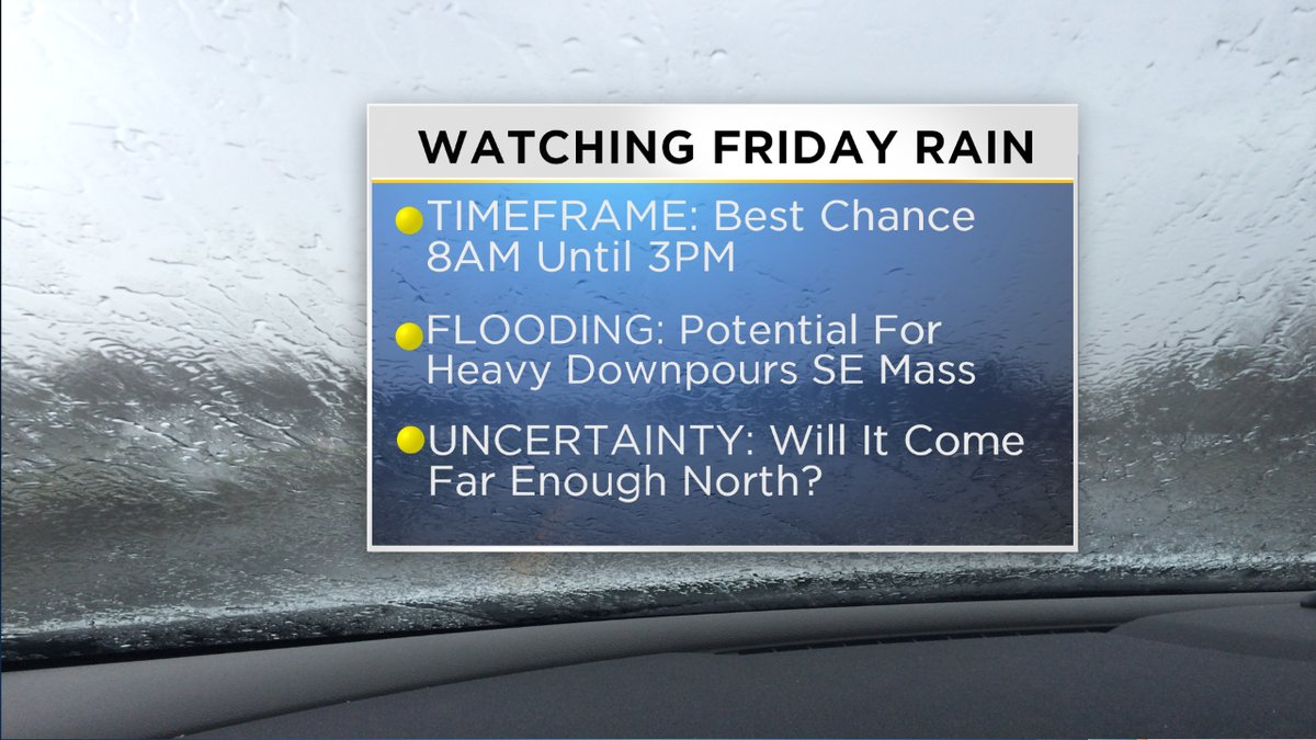
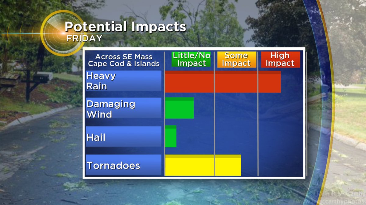
Main Hazards: Flash flooding with rainfall rates 1-to-2 inches per hour is the main issue at hand here.
Provided that warm front can focus a band of heavy rain in southeastern Massachusetts, it would be rain coming down too quickly for drains to keep up. So be alert for some nasty driving conditions, and as always never drive through flooded out roads.
The other issue would be for the potential of a spin-up tornado or waterspout along the South Coast. There will be low LCLs (basically low cloud heights) and lots of low level wind shear along this warm front. It's the type of setup where we can get quick spin-up twisters...so we'll be keeping close tabs on that through the day.
Not expecting damaging wind gusts or hail with any of the rain/storms.
What's the takeaway from all this uncertainty?
My gut says the heaviest rain will be in a thin zone right along the South Coast or offshore, and that most of the region won't see significant rainfall. Some heavy rain in southeastern Massachusetts would actually be a good thing, because it's been quite dry over the past couple of weeks there. Just don't be surprised if you wake up Friday morning and the trend has taken much of this south. If I had to pick an area where I'd be most concerned about flash flooding, it would be Long Island, New York.
Since the impact would be quite high if I'm wrong and it comes farther north, it's a good day to check in with us during the morning to see how things are playing out before traveling or canceling any plans.