Cutoff Low, Weatherman's Woe
Spring is a time for green grass, rain, tulips, and marooned areas of low pressure bringing frustrating forecasts.
A classic element of spring in New England is a 'cutoff low', which is essentially a storm system that gets pinched off from the jet stream and is left behind to wobble rudderless for days on end.
Nearly every year we get one or two of these, and the one on deck looks like a doozy. Long story is below while the short story is that we shouldn't expect many warm days ahead.
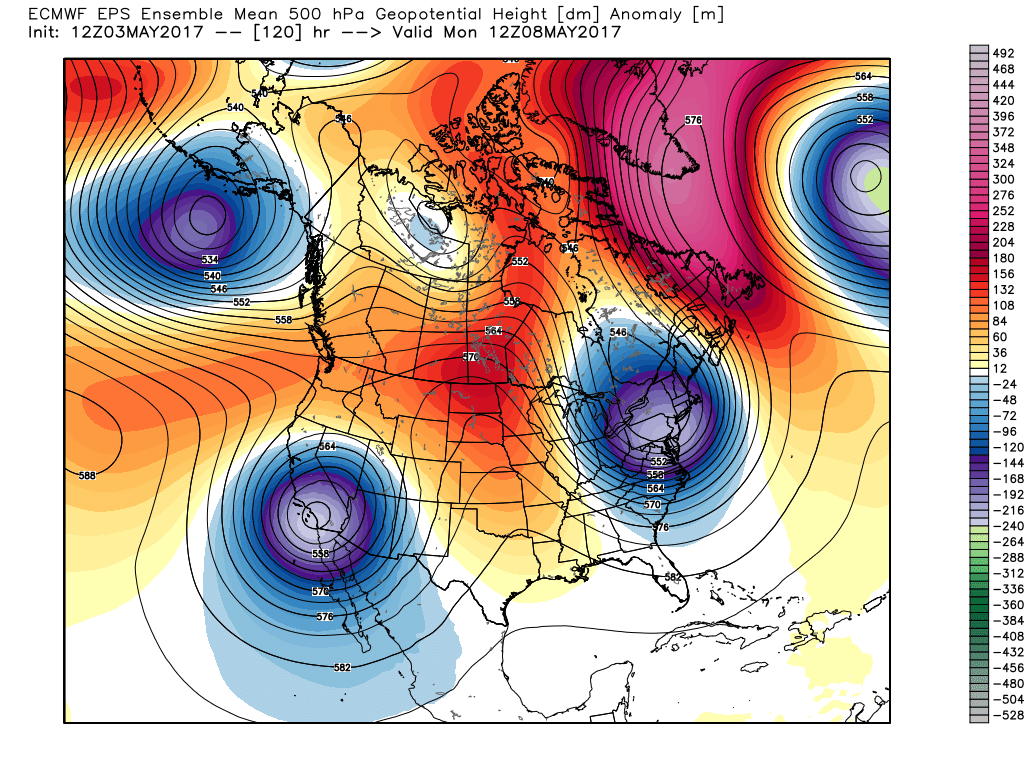
The culprit for this pattern is a massive ridge building over the North Atlantic. When we say 'blocking over the North Atlantic' in a weathercast, this is what we're talking about. You may also have seen references to the NAO, the North Atlantic Oscillation. When we have a strong block like this in place, it's a negative (-) phase of the NAO. This is a bonanza for winter storm lovers in the cold season, because it locks in a cold and stormy pattern for the Northeast. In summer, it can lead to days of heavy downpours, flash flooding, and even severe weather. In spring, it leads to a big stretch of 'blech.'
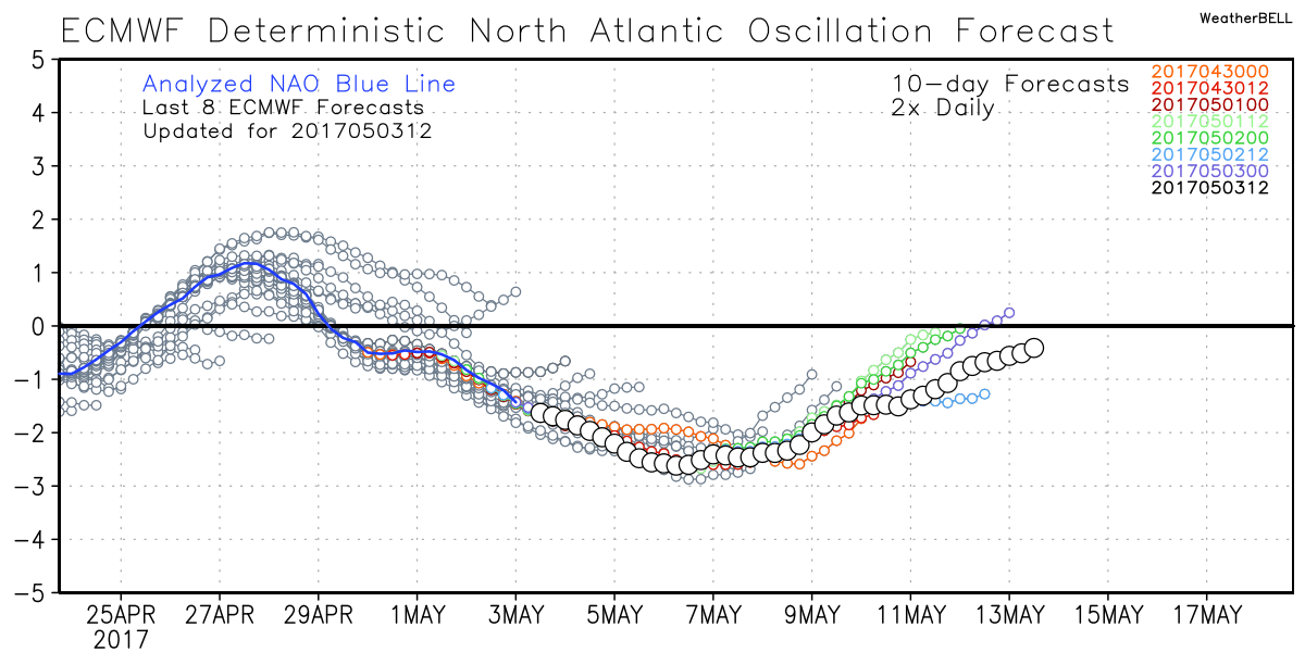
A strongly -NAO is expected to last well into the month of May, at least the first half of the month. Unsettled and cool weather will lock in across our neck of the woods with all the warm air hanging out across the middle of the country. There's a good chance many towns here won't hit 70 degrees again until after Mother's Day weekend because of the atmospheric logjam. Now you know why Barry Burbank's moniker for such a pattern is the 'Wheel of Misfortune!'
While cool weather is a lock, these systems are often 'the weatherman's woe' because they still offer day to day unpredictability. Little windows of sunshine can allow temps to spike quickly...or clouds can dominate more than expected. Spotty showers with small hail come and go throughout such a pattern. And the daily wobbles in the upper low's track can change the forecast on a dime. So there's still going to be some variability mixed in, I think.
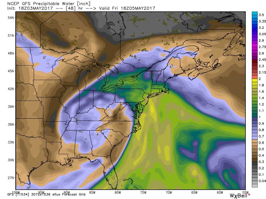
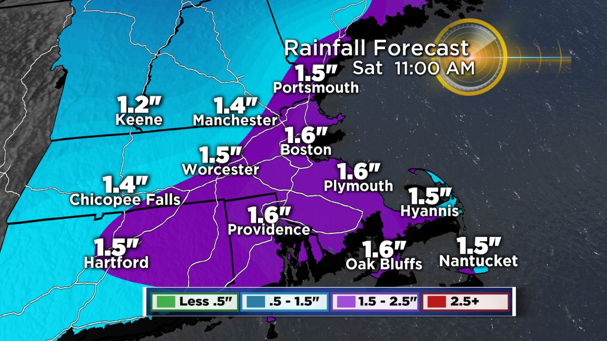
Precipitable water - a measure of the water content in our atmosphere, will be very high for early May on Friday. This will aid in heavy downpours and we may even get some thunderstorms to get going Friday night.
To set the table and get all this started, a strong storm system Friday brings a plume of tropical moisture along with it. We're talking about a 1-2" drenching of rain, with perhaps some areas on Cape Cod and the Islands topping 2" by Saturday morning. That's not enough for widespread river flooding, but it'll certainly be soggy with some rough travel Friday afternoon into Friday night. There's a silver lining to the rain and gusty winds - they may knock down and drown some of the gypsy moth caterpillars that are hatching all around the region, saving us from the mess they produced last year. Plus, the fungus that holds them in check works best when they're on the ground. So perhaps a little hope on that front.
This is the storm that 'cuts off' and proceeds to wobble for days. Fortunately for us, we're at least on the mild side of the wobble this weekend. Highs should reach the mid 60s on Saturday, perhaps even upper 60s if we get enough sun. Low 60s are more likely for Sunday. Each day will bring a round of scattered showers, and many of those showers could feature some small hail and gusty winds.
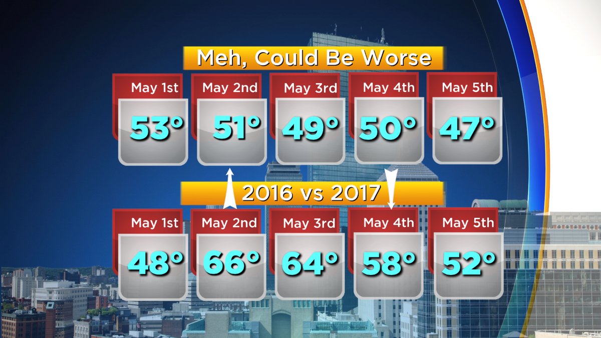
On and on the upper low wobbles next week, but it doesn't look like a soaking stretch. More just spotty showers day to day and more clouds than sun with temperatures reaching the 50s by day and 30s/40s at night. This isn't all that unusual for early May - the average high in Boston is in the low 60s this time of year. And it was actually colder last year, when we didn't even hit a measly 54 degrees until May 8th. But it's not great 'get in the garden' weather and probably not on the wish-list of many.