April Snow - What To Expect For Rest Of Storm And Beyond
BOSTON (CBS) - Welcome to April. Snow, sleet, rain greets you on this first day of the month. But as quickly as this winter storm has come in, sunshine will be back out Sunday with temperatures climbing to around 50 degrees.
Gotta love Spring in New England!
SNOW AND TIMING:
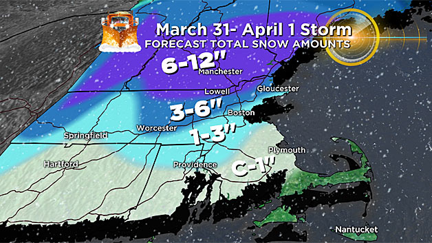
Some woke up Saturday morning to more than a foot of snow while others had none!
It really depends on where you are. From northern Massachusetts right along the New Hampshire border into much of the Granite State, snow totals have been stacking up.
Many will see 6-to-12 inches when it all wraps up, with some locally higher amounts. It's a wet, pasty snow too – which means scattered outages will continue to crop up through the afternoon as the snow clings to everything and weighs it down.
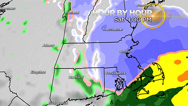
Snow totals north and west of Boston will be in the 3-to-6 inch range as the rain/snow line gradually collapses back southeast through the course of the morning.
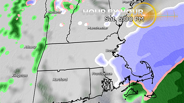
Expect reduced visibility, snow covered roads and some slick travel through the afternoon. The steadiest "burst" of snow on the tail end of this storm will come between late morning and early afternoon before tapering in intensity.
We may even see a brief change to snow on Cape Cod late this afternoon and evening resulting in a quick coating in some communities.
In Boston, a coating to 2 inches is possible by the end of the afternoon.
WIND:
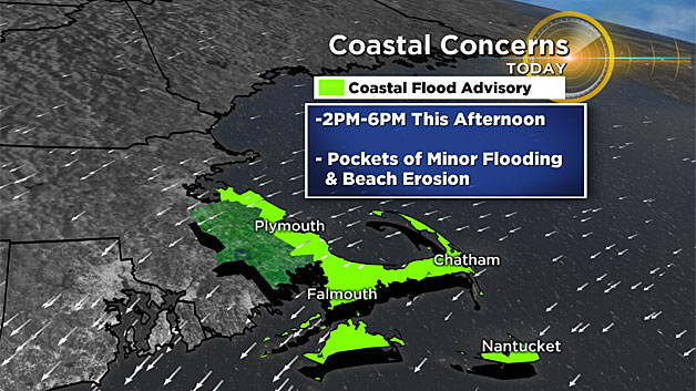
The wind will be strong through the remainder of the day too, with the risk of some damaging gusts focused in southeast Mass.
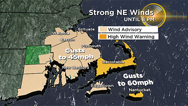
Pockets of power outages are possible, especially from Cape Cod to Nantucket where gusts 40-to-50 mph are already occurring (isolated gusts to 60).
TONIGHT:
As the storm departs Saturday night, temperatures will hover right around or just under that magical 32 degree mark. So any leftover moisture on the roads will freeze up and untreated roads will be slick, so use caution.
BEYOND:
"The sun'll come out tomorrow!" and our temperatures will rebound too. We should be back up to seasonal levels, around 50 degrees. The Red Sox home opener on Monday is still looking good too!

Our next storm arrives on Tuesday, and it will be a soaking rain. The rain should arrive Tuesday morning and last all day, gradually tapering Tuesday night.
After that, our active pattern continues with another disturbance arriving Thursday night into Friday. Another round of heavy rain and potential thunder will impact southern New England. On the backside of this storm, some colder air wrapping in could result in a changeover to some wet flakes, something to monitor in the week ahead.


