Multiple Snow Threats And Near Record Cold Ahead
BOSTON (CBS) - Winter is about to return with a vengeance in New England. Multiple snow threats and near record cold are both in the forecast over the next several days.
Let's give you a breakdown of all the winter threats on the way:
EARLY FRIDAY SNOW
Friday's storm is initially a weak wave forming along a cold front just to our south.
It will start to feed off that clash of air masses as it slides quickly east through the Ohio Valley late on Thursday. A relatively small band of moderate snowfall will form, likely only a few hundred miles wide, but those who end up underneath this band will receive a quick shot of plowable snow.
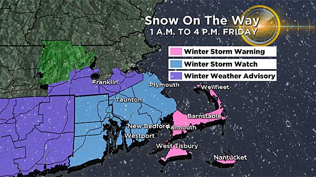
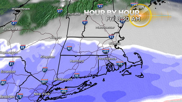
Snow will begin to fall very early Friday morning, spreading from west to east, steadiest and heaviest south of the Massachusetts Turnpike.
The majority of the accumulation will occur between 4 a.m. and 1 p.m. on Friday and in areas across Connecticut, Rhode Island and southeast Massachusetts.
A general 1-to-3 inches of snowfall is likely in these areas, with 3-to-6 inches along the South Coast, Cape Cod and the Islands.
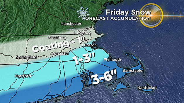
Farther north, along and just north of the Pike (including Boston and Worcester), just scattered coatings to an inch of snow. Northern Mass.. and southern New Hampshire will see just a few flakes and likely no accumulation. The mini-event wraps up by late morning.
WEEKEND: COLD BEATS SNOW
Another more powerful storm system will dive out of the Pacific Northwest this weekend and dig into the deep south. Initially it looked as though this storm could take a turn to the north and make a run at southern New England.
Now it appears as though the storm will be blocked by a strong, cold high pressure area and it will head harmlessly out to sea off the Carolinas.
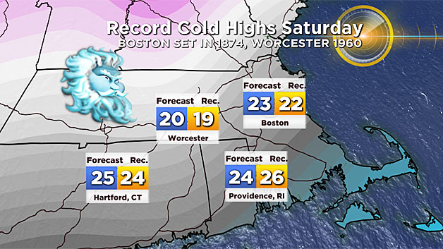
So, instead of more snow, we get a brutal punch of cold air. Near record cold maximum temperatures are forecast on Saturday, with highs only reaching the low 20's.
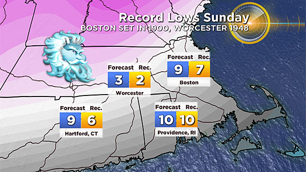
Then, we take another run at a record low minimum early on Sunday morning (low in the single digits).
EARLY NEXT WEEK: STORM 3
Right on the heels of the Sunday storm comes yet another wave out of the Pacific Northwest.
Of course, it is way too early for serious speculation on this one, but early indications are for a more northerly storm track than storm 2 and therefore a more likely impact of some sort here in New England.
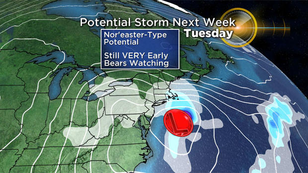
The time frame to watch here would be late Monday through Tuesday and if this one comes together right, it could mean a significant, nor'easter-type snowstorm with hefty snowfall accumulations and strong winds.
Long story short, winter isn't going out without a fight.
As always, stay tuned to WBZ-TV, WBZ NewsRadio 1030 and CBSBoston.com for frequent updates.
Follow Terry on Twitter @TerryWBZ


