More Snow? Potentially Significant Storm Sunday Into Monday
BOSTON (CBS) - On to the next one… or two… or three. It's a very active weather pattern and there's plenty to monitor over the next several days. We'll take it one storm at a time, starting with Friday night.
The next disturbance isn't all that impressive. In fact, I'd go so far as to say it'll be a piece of cake compared to Thursday's blizzard.
FRIDAY INTO SATURDAY
Snow will break out around midnight tonight and continue into the morning.
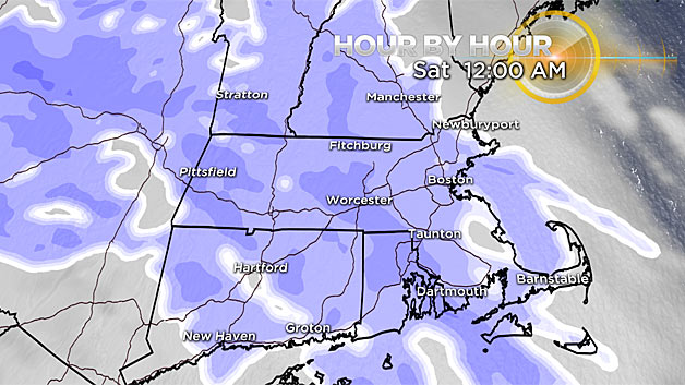
Temperatures will be in the teens this evening, so the snow will be very fluffy in consistency – easy to move around for sure!
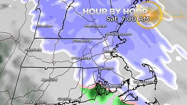
It will be a slick start to our Saturday morning in many spots though as areas of snow wrap up from west to east between 7 and 10 a.m.
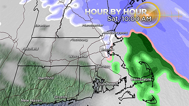
After that, breaks of sun come out and we'll come into the low 30's.
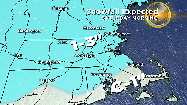
Expect snowfall totals between 1-and-3 inches, although I wouldn't rule out some localized higher amounts around 4 inches in northern Massachusetts.
Saturday midday through Sunday morning will be quiet before our next storm arrives.
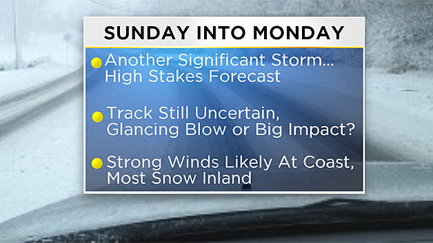
SUNDAY INTO MONDAY
This is a high stakes forecast. Let me explain.
Some light snow and rain will likely break out Sunday midday into the afternoon. Snow will fall steadily at times through the interior Sunday afternoon and evening, picking up in intensity. While we may start briefly as snow at the coast, a changeover to rain is likely with a southeast wind coming in off the ocean.
The biggest uncertainty in the forecast is Sunday night into Monday, as the storm rapidly intensifies and pushes into the Gulf of Maine.
"Bombogenesis" is a term we'll be tossing around Monday morning, regardless of track.
Areas of Maine are likely to experience blizzard conditions and heavy snow.
HEAVY SNOW?
The question is, will we get into some of that in New Hampshire and Massachusetts as well?
It all depends upon how quickly the storm strengthens and how much wrap around moisture gets pulled to the coastline. Either way, the wind is going to increase dramatically on the back side of the storm, and could be damaging at our coastline Monday morning. This is something we'll be monitoring very closely.
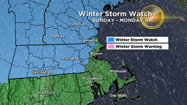
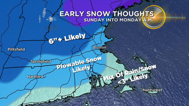
The potential is there for plowable snow all the way to the shore if everything comes together just right.
The highest snowfall totals will be through the interior from this event, especially outside of I-495 where more than 6 inches may fall. With such uncertainty right now, it would be irresponsible to put numbers on a map just yet, but we do want to keep you on alert for this potentially significant event.
The energy responsible for this system is still out over the Pacific Ocean right now! As it comes across the Pacific Northwest today, we'll get a better idea of how the storm will progress. You will certainly want to check back frequently over the next 24-to-48 hours for the very latest on this storm.
After that, our weather looks quiet on Tuesday before another round of light snow for the middle part of the week.