Tuesday Storm Will Bring A Snow, Ice, And Rain Mess
By Barry Burbank, WBZ-TV Meteorologist
BOSTON (CBS) -- Are you ready for some wild gyrations yielding active weather and big swings over at least the next couple of weeks? It looks like the atmosphere will be loaded with parcels of energy to create some very changeable conditions from time to time going forward!
TIMING:
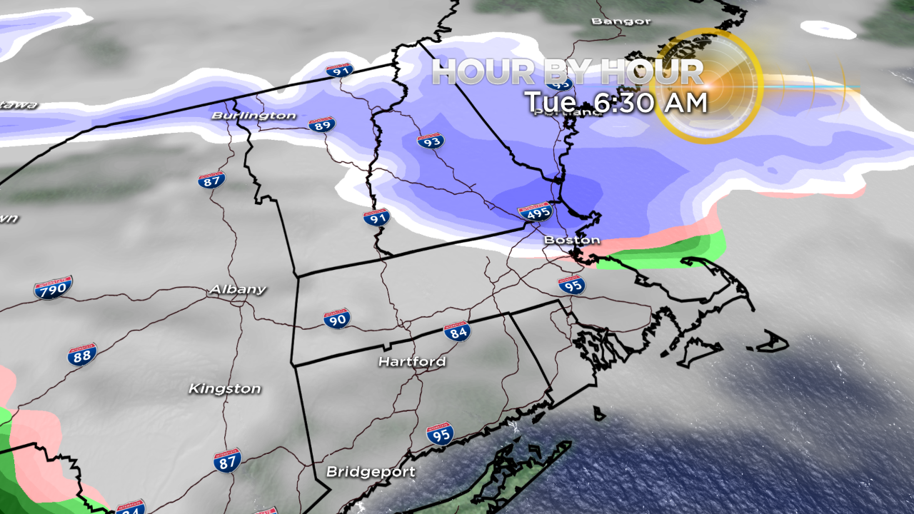
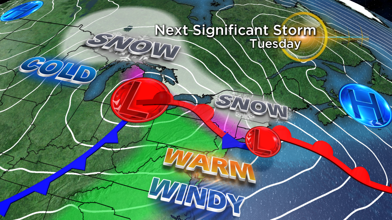
The first storm will arrive Tuesday. Like many of its predecessors, this will NOT be a major storm, but it will be another tricky system to forecast and deal with. Snow will likely develop in a swath across northern New England Monday night. It may expand down into parts of northern Massachusetts before dawn Tuesday. In the meantime, the parent storm will be churning across the Midwest and the Ohio Valley, destined to stay inland across western New York into Quebec.
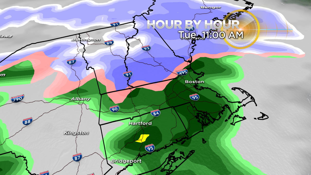
A weak, stable wave of low pressure will likely form on the leading advance of the surge of warm air coming up the eastern seaboard. This wave will trigger the precipitation breaking out across southern New England during--or more likely, just after--the main portion of the a.m. commute on Tuesday. The precipitation will be steadiest and heaviest from midday through the afternoon into the first half of Tuesday night.
TYPES OF PRECIPITATION:
While most of Connecticut, Rhode Island and southeastern Massachusetts will have rain, initially, it could briefly start as a touch of snow and sleet.
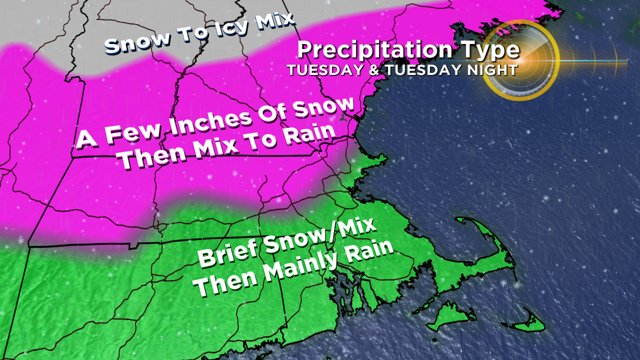
There is a good chance that the cold air will be more pronounced across northern Massachusetts to produce a spell of snow before switching to sleet and freezing rain.
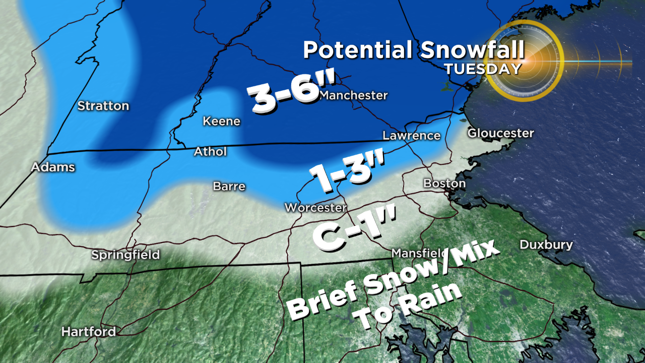
AMOUNTS:
The stage is set for accumulating snow, with up to an inch near and along the Mass Pike building up to 1-3" over the northern half of Massachusetts on the ground by late afternoon. There could be slightly over 3" over the northern tip of Worcester County into the northwestern tip of Middlesex County before a transition to an icy mix. I expect the highest totals of 4-6" from parts of the Lakes Region into central and southern Maine into Tuesday night.
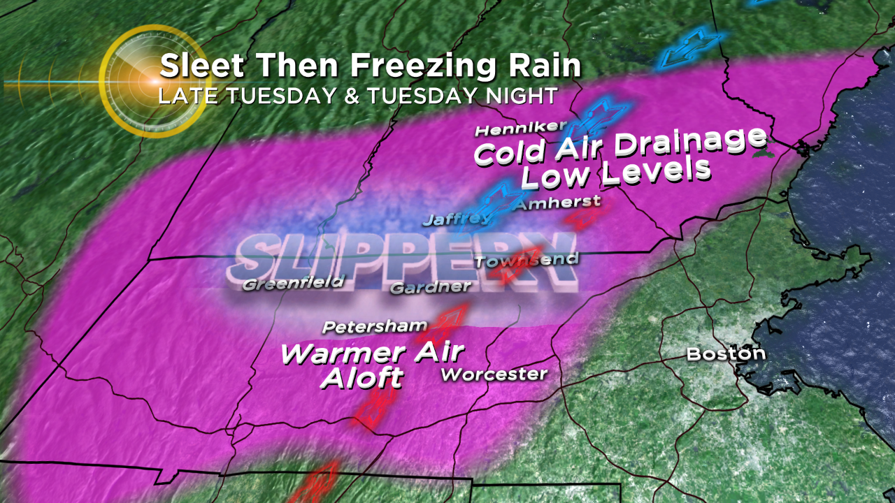
ICING ISSUES:
There are some clues that cold air will be draining down from eastern Canada, Maine and eastern New Hampshire into interior northern Massachusetts. This so-called cold air damming could result in some ice accretion on trees, roads, vehicles, etc., primarily near and west of the I-495 belt that lies near and north of the Mass Pike. Temperatures at the surface may dip into the upper 20s, while warmer air aloft produces rain which falls into the cold low levels near the ground and glazes over everything! East of I-495, sufficient mild air flowing in from the "milder" Atlantic will make plain rain in temperatures well into the 30s and even 40s.
TEMPERATURES & WIND:
Early Wednesday morning, it COULD still be cold northern interior Massachusetts northward with temperatures barely above freezing while it's in the middle 40s to lower 50s south of the Mass Pike onto Cape Cod. The warm air SHOULD overspread the Boston area northward but some valley areas of north central MA northward may not get the cold completely scoured out. Eastern MA has a good shot at 50-55 and possibly as high as 55-60 before the cold front arrives in the afternoon. The cold air will rush in behind the front moving offshore resulting in dropping temperatures through the 40s by sunset followed by 30s through the evening and near 30 by dawn on Thursday.
In the warm sector, the southwesterly wind could become strong and gusty at 20-40 mph Wednesday morning on the New England South Coast resulting in perhaps some minor coastal flooding down there associated with the 8:34AM high tide scheduled height at 10.9 feet. Gustier southwest to westerly winds will develop most other places as Wednesday wears on.
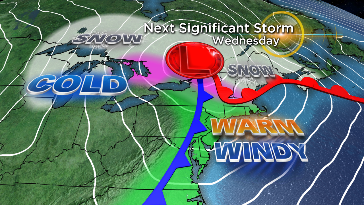
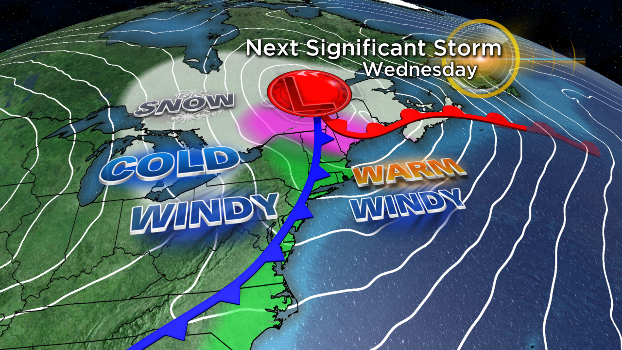
MORE POTENTIAL TROUBLE:
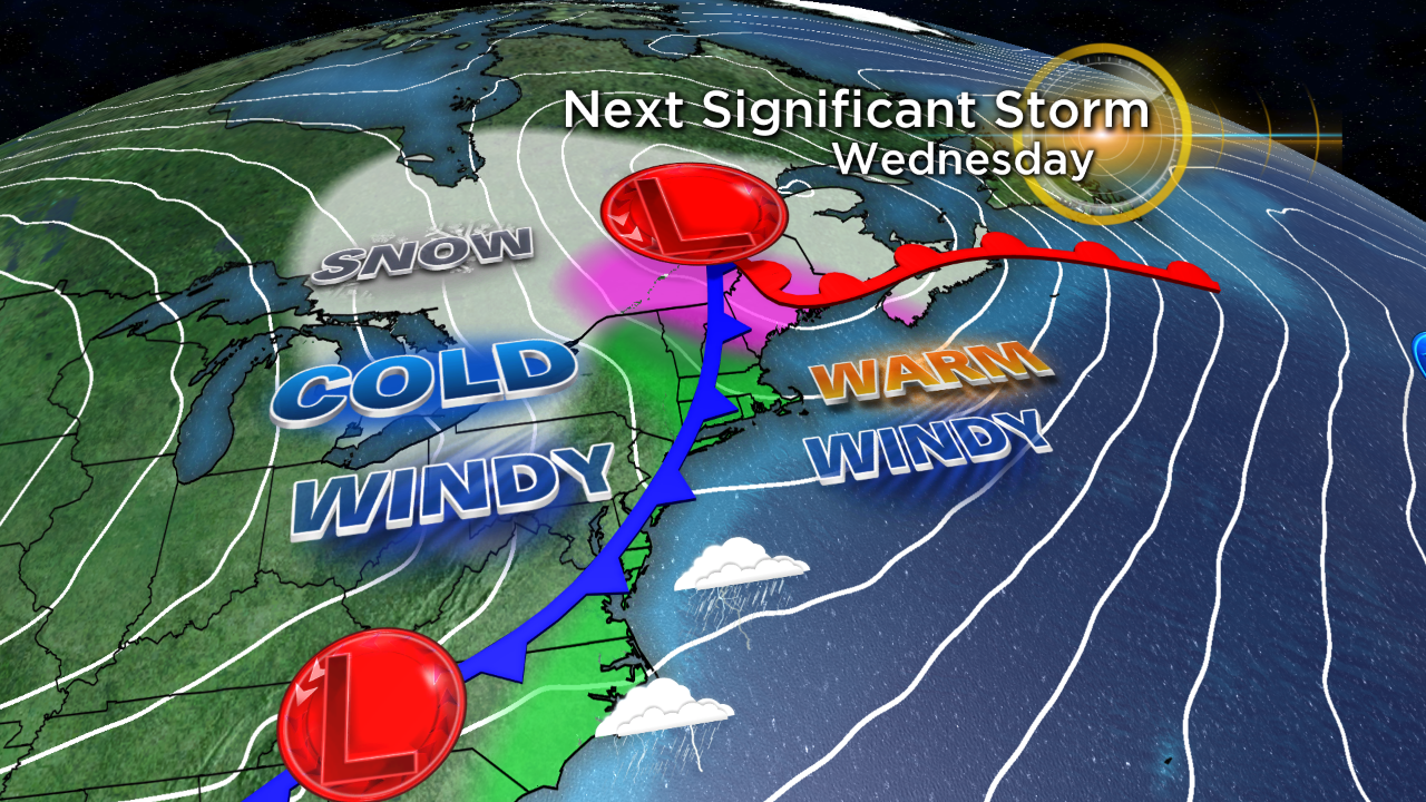
The jet stream will be transiting the next bundle of energy toward the trailing cold front over the southeastern states. Latest indications suggest that a new storm will be blossoming near Cape Hatteras, North Carolina. The steering currents may buckle sufficiently to propel a shield of snow northeastward into primarily southeastern New England. While it is too premature to be highly confident of this scenario at this time, it does seem presently plausible that at least a few inches of snow will fall in eastern and southeastern Massachusetts with perhaps a rain to snow situation over Cape Cod.
LOOKING FARTHER OUT:
We'll be watching some masses of arctic air crossing Canada in the weeks ahead. We MAY get blasted by a few of them before this winter is over. Thanks in large part to the El Nino of 2016, we had an unusually mild winter last year but there was one major freaky aberration. Do you remember the bizarre quick arctic blast that produced subzero cold on Valentine's weekend? There were many new record low temperatures set on Valentine's Day including the -9 in Boston--that was the 6th coldest February morning on record!
Follow Barry on Twitter @BarryWBZ.


