Snow, Ice And Rain All Possible With Storm On The Horizon
By Terry Eliasen, Meteorologist, WBZ-TV Exec. Weather Producer
BOSTON (CBS) – It's the winter of Tuesday slop. It seems just about every storm this season has A) come on a Tuesday and B) been a hot mess of precipitation types.
Each and every Tuesday in January had some sort of rain, snow, ice or mix of all three and our first Tuesday in February will be no different.
This blog will come with the usual caveat when we are talking about a storm that is several days away that hasn't even formed yet. Things will change and you need to stay tuned. The energy for this storm is currently in the middle of the Pacific Ocean, likely poorly sampled and modeled by even our best computers. However, there is decent agreement among weather models (and there has been for days now) that some sort of storm is likely to affect the Northeast in the early to middle part of next week.
TUESDAY-WEDNESDAY TIMELINE
You likely won't see too much on radar during the day on Monday, a relatively weak storm will be headed east, north of Texas and just starting to take shape. By Monday night and Tuesday an infusion of Gulf moisture will energize the storm and a variety of precipitation will begin falling from the Deep South to the Ohio Valley through the Mid Atlantic. Again, it is a bit early for an exact timeline of events, but best guess at a start time here in New England would be during Tuesday morning.
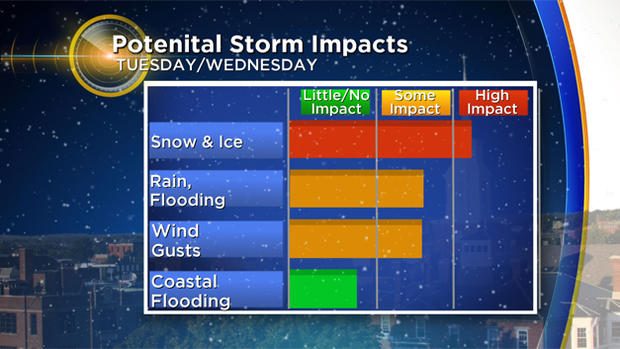
This storm will likely be similar to many others this winter season - starts cold. The atmosphere will be plenty cold enough from top to bottom for things to start snowy on Tuesday. Several plowable inches could accumulate during the day on Tuesday for a good portion of the area.
QUIET MONDAY
But then, like so many storms that preceded it, milder air will begin to infiltrate. It begins to warm several thousand feet above ground level, causing the snow to change to liquid and then refreeze as it falls into the cold air still near ground level. This is otherwise known as sleet. The warm air will continue to flow in and get closer and closer to the surface, changing the sleet to freezing rain (when rain freezes right before or as it makes contact with the ground).
This is likely to happen for a longer period of time in the inland areas like Worcester County that have a hard time getting warm in events like these. In the end though, it appears that all of Southern New England, and perhaps much of Central New England, is destined to get warm and flip to plain rain by Wednesday morning. Rain on top of snow and ice is no picnic for sure, this will likely be another heavy, wet, hard-to-move sludge in the end.
As we continue to warm Wednesday, perhaps even into the 50s along the Coast, the winds will pick up in a big way and there could even be some thunderstorms as the cold front pushes through.
"WILD RIDE"
Again, too early for specifics like snow totals, but this clearly does NOT look like a major snow accumulation. Also, with wind gusts potentially 50mph or higher along the South Coast and over Cape Cod and the Islands, there may be some wind damage or pockets of coastal flooding.
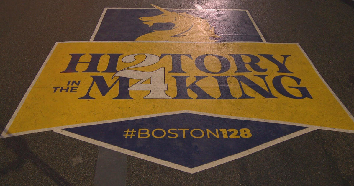
In short, looks like a wild ride for 24-48 hours with a number of different weather hazards for our region. Not exactly great weather for a parade (should there be one for whatever reason) on Tuesday or Wednesday.
With that little football game going on, clearly the weather may not be the first thing on your minds this weekend. I would, however, recommend checking in on weather updates over the next several days, as always, we will have you covered on WBZ-TV and CBSBoston.com.
Follow Terry on Twitter @TerryWBZ