Snowy Friday Morning Commute For Some
BOSTON (CBS) - After highs of 45 to 50 degrees Wednesday, we're going back into the freezer, so to speak, with cold air streaming across much of the country right now.
The core of the arctic air is over the northern Plains and Midwest where temperatures are 5-15 BELOW zero Thursday morning and that's without the wind factored in!
Meanwhile, we're tracking our next snow event here at home. It's not going to be anything too impressive, but it will result in accumulation for some of us, along with slippery travel for our Friday morning commute in spots.
So here's the setup:
A disturbance currently over the Ohio and Tennessee river valleys will slide to the coastline later Thursday and develop into a storm center off the Carolinas. This area of low pressure is going to tap the Atlantic for some moisture and zip on off to the northeast tonight and early Friday passing south and east of Nantucket.
It does come close enough to New England that we get clipped by the northwest fringe of the storm.
TIMING
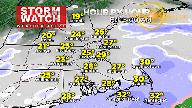
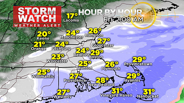
Pockets of light snow and flurries develop overnight tonight, but steadier snow fills in between 3 and 5 a.m. across the south coast to Cape Cod, and pushes northward to the Massachusetts-New Hampshire border by 7 a.m.
Great timing right?
A band of moderate to heavy snow will fall from the far South Shore to Cape Cod for a brief period during the mid-morning Friday, creating reduced visibility and treacherous travel.
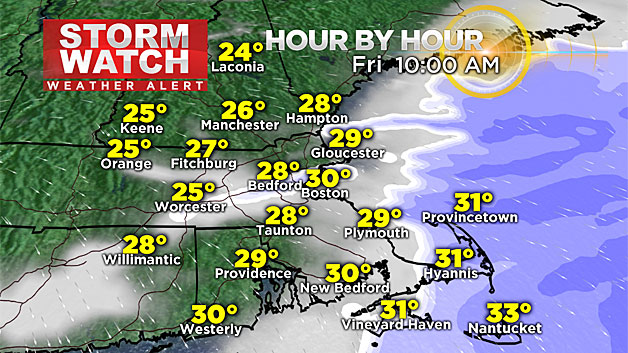
The farther north and west you go, snowfall rates will be lighter, so there will be lesser impacts in these areas. Snow tapers off northwest to southeast by late morning and midday with just some lingering snow showers on Cape Cod until early to mid-afternoon.
The evening commute will be dry.
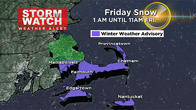
TOTALS
The "jackpot" zone for this event is in southeastern Mass., more specifically, far southern Plymouth County to the Cape and Islands where 1-to-3 inches is anticipated.
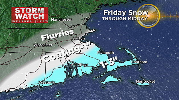
The snow will be a fluffy consistency, so I wouldn't be surprised to see some 4 inch amounts pile up in some localized towns on Cape Cod. For Boston and the tip of Essex County, it's a coating to 1 inch and a mere dusting north and west of that.
WEEKEND STORM?
Now what about our weekend storm potential?
A big ocean storm will be just that, mainly out over the ocean, missing New England.
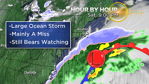
There are still some guidance products that try to graze us with some snow Saturday evening and night, mainly in southeast Mass. (closest to the storm center again).
It still bears watching, so we'll keep you posted on the track and any shifts we see over the next 24-to-48 hours.
Either way, the weekend will be cold, with highs only in the mid-to-upper 20's both Saturday and Sunday!