Harsh, Near-Record Cold Coming To New England
Find Eric Fisher on Twitter and Facebook
Monday morning, some snowfall. "Oh how beautiful!" were the reports from many of our viewers and weather watchers. Ain't winter grand? Well the not quite as fun part of winter will rear its head later this week. Some extremely impressive cold for December (or really any month) will slide down straight from the coldest of arctic origins. We'll have a shot at a couple of record lows, which are rarely set these days. And for sure, it will be dangerous to be outside without the proper precautions.
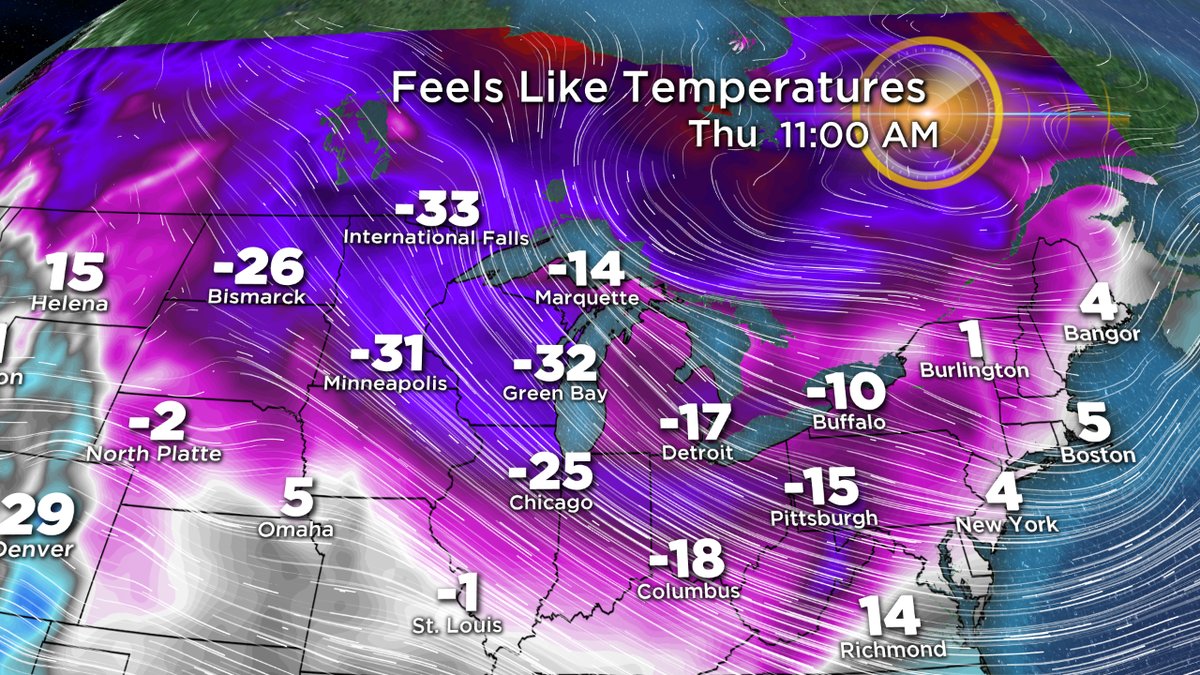
When does it arrive? Thursday morning. The first batch of arctic air will be settling in, and with it likely some snow showers & squalls. Since it will arrive early in the day, it will keep temps from rising all day long. Our early-day highs will stay stuck in the 10s and low 20s for most of the region, which is a solid 15-20F below average for this time of year. Add in some wind and it will be feeling like the single digits during the day, and then subzero wind chill by evening.
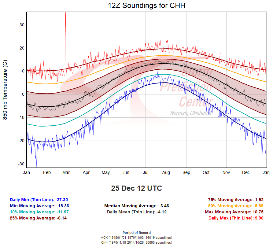
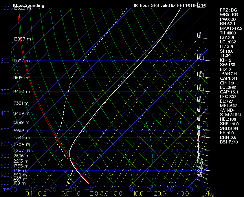
A look at the sounding record for 850mb temps at Chatham, MA. Source: SPC
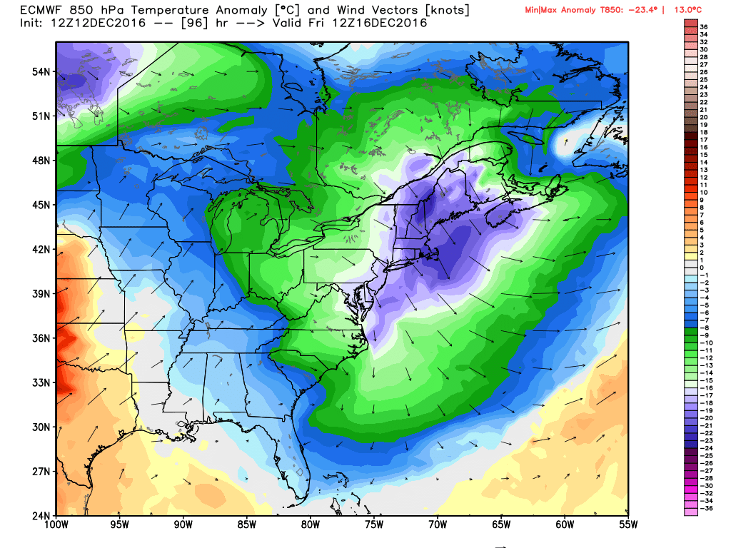
Then the Chuck Norris level cold arrives along with a strong upper-level disturbance Thursday night. This air mass is expected to come close to some all-time levels for December. I took a peek at the sounding record for Chatham [atmospheric soundings are launched twice a day from various sites around the country to get a profile of the atmosphere]. The coldest December reading at 850mb, since records began there in 1970, is Christmas Day of 1983. I've been consistently amazed at how well we have mimicked the strong 1982-83 El Nino and subsequent exit to weak La Nina. It's been nearly exactly the same from last December right on through current time. And I weighed 1983 as a heavy analog to help forecast this coming winter. That December was BRUTAL across the Lower 48, much like what we're seeing now. And if you're wondering what the end game was here in New England - it was a pretty typical winter in terms of overall cold and snow when all was said and done.
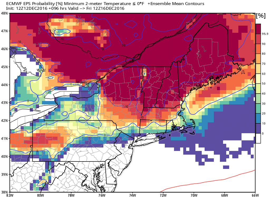
In any case, guidance has 850mb temps at about -25C Friday morning. That would be in the top 2 or 3 for the month of December. Pretty spectacular stuff! That's higher up in the atmosphere, but above is a look at the Euro EPS probability of subzero surface temperatures on Friday morning. You can see that it's pretty much a slam dunk for a wide swath of New England. Even here in southern New England, many could see subzero air temperatures. I think Boston and far SE Mass may stay just a few degrees above the goose egg, but not by much.
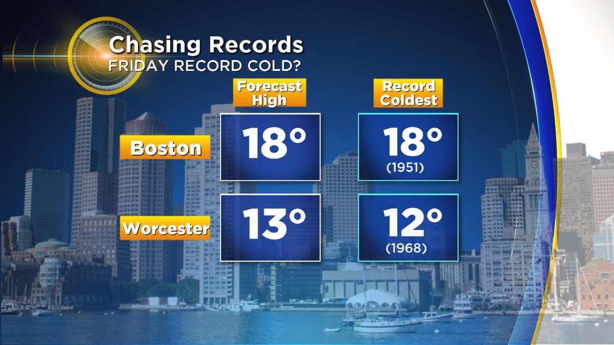
While we may not quite get to record low temps, we could still set record coldest 'max' temps on Friday. If we only get to 17F in Boston, that would do the trick. We'd have to stay at 11F in Worcester. A tall task but definitely not impossible, and certainly the coldest air we've had here since that frigid Valentine's Day back in February!
The harshest stretch will be Thursday afternoon through midday Friday. This is where wind chills should end up in the -10 to -25F range, which can be dangerous if exposed to the cold and for pets as well. The overall weather pattern is in rapid motion though, with high pressure moving in during the day. That should at least allow winds to weaken under sunny skies. And it should also allow for more subzero temps and single digits on Friday night, though with no real wind chill to speak of.
Another interesting note - you may know that nearly all weather happens in the lowest layer of the atmosphere, called the troposphere. The 'roof' of the troposphere is the tropopause, where temperatures stop getting colder with height and then start to rise in the stratosphere. Well the GFS has the tropopause all the way down to about 10,000 feet on Friday morning. You can almost smell the ozone. A cold atmosphere is a thin atmosphere, since very cold air is also quite dense.
And then just like that, the southerlies return! The next storm system moves in Friday night/Saturday, and will start off as snow. Too early to be talking totals, but with extreme cold in place and southerly winds moving in, we have potential for some plowable snow to kick off the weekend. However, as warmer air keeps riding in, it'll get us into the 30s and 40s by Saturday afternoon and change snow to a wintry mix and eventually rain. The warming continues Saturday night, and we could spike in the 50s by Sunday morning across southeast Mass and 40s elsewhere. Never a dull moment, that's for sure. As soon as the warm-up comes, the cold will roar right back and settle back in by Sunday evening/night.