Stormy October - But Are We Still In A Drought?
Find Eric Fisher on Twitter and Facebook
The gales of autumn have arrived! We've had a wonderfully stormy October across much of the area, delivering a widespread 5-9" of rain since the start of the month. To put that into perspective, Boston has now seen more rain in October than all of June, July, August, AND September combined! Those four months brought only 5.30" of rain, while this October is now up to 5.32" with a chance for a bit more. Worcester has seen even more rain thanks to Friday the 21st, which brought torrential rainfall to central Massachusetts. So the obvious question we've been getting a lot of - are we out of the drought?
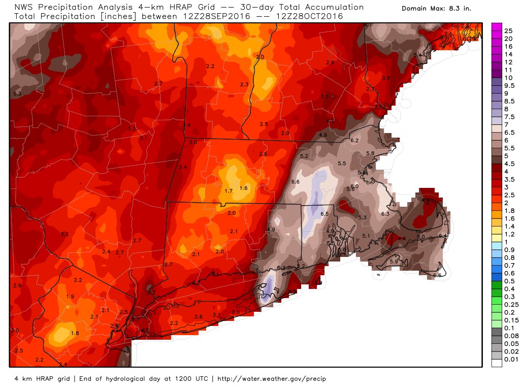
Estimated rainfall over the past 30 days - Source: Weatherbell
The answer to that is a very emphatic NO. It's been great to alleviate short-term dryness. Especially since the ground is not frozen yet, allowing water to seep into the ground and give a helping hand to the woefully low water table. Plus, some plants and trees are still alive to enjoy a bit of that benefit. And yes you're going to see puddles and find areas of squishy ground. But the problem is that this drought started at the beginning of 2015, and we worked up some massive deficits in that time. Parts of the area, especially those on the northwest side of Boston to southern New Hampshire, are missing a whopping 20" of rain during that time. A stormy month isn't going to cut it to bring reservoirs back to where we'd like them, or the water table up enough to erase worry of wells going dry. That being said, it's a nice start.
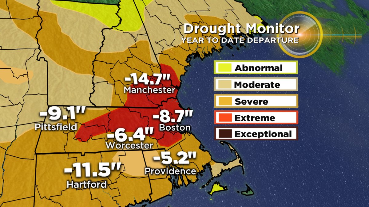
Current rainfall deficits for 2016. Most saw similar deficits in 2015 as well. Source: Drought Monitor
Let's look at it this way: The average amount of precipitation (both rain and the liquid equivalent of any snow that falls) from November through March in Boston is 18.32". We would need to DOUBLE average rainfall every single one of those months to get back to even for the worst-hit areas. Or in other words, every one of those months would need to be a Top 10 wettest on record (for each respective month). It's been so dry up until now that we've forgotten how stormy New England weather can really be. We should be getting 3.5-4" of rain every month just for it to be a typical one. We have a lot of work ahead of ourselves.
Now it doesn't have to all come that quickly. Months like the one we just had are fantastic. Stringing together a few stormier than average months, with perhaps a big drenching storm per month, would do wonders. We'd go into next growing season with quality soil moisture and replenished reservoirs. Wells might not be back to their full capacity, but they'd get us through a summer without worry. We don't need a Noah-esque biblical rain. But certainly everyone should be rooting for an active winter.
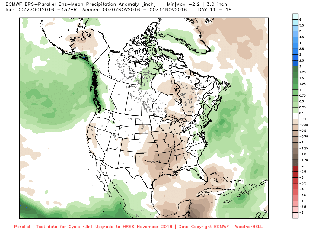
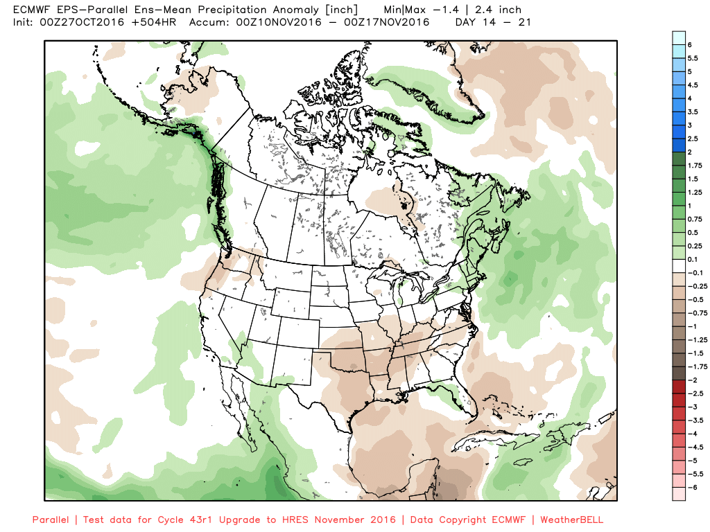
There isn't much rain lurking in the next 7-10 days as a big ridge dominates Lower 48 weather. But the pattern shift we've been talking about for several weeks now is still looking likely, with a trough digging in across the eastern U.S. bringing stormy weather starting around November 10th. So although we may start off mild and dry, I'm still expecting some solid rain (and maybe some snow) for the middle and end of the month. Hopefully the pattern will deliver and we can continue to chip away.


