Will Wintry Weather Pay A Visit This Week?
Find Eric Fisher on Twitter and Facebook
The weekend got the juices flowing for winter junkies. Snow fell at a steady clip across the higher elevations of New England, even adding up to over a half foot in some of Vermont's highest peaks! This week brings the coldest air of the season southward for Tuesday and Wednesday, and perhaps a chance for us to experience all the glory of 'wintry mix.' Yes, the times they are a changin'
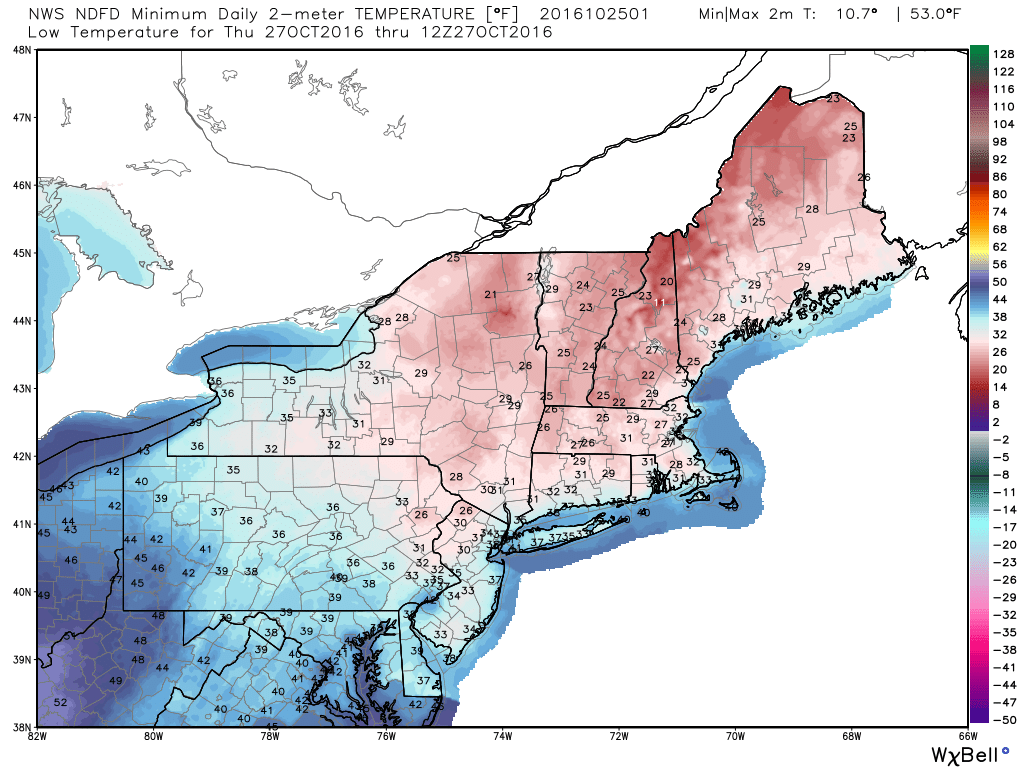
A look at expected temperatures Wednesday night. Source: Weatherbell
The setup we're watching will all come down to timing, so it's not set in stone at this time. But one thing we know is that there will be quite a bit of cold air around Wednesday night. The daytime won't even make 50F, and temperatures should cool down rapidly after sunset. One question mark is - how quickly will clouds be moving in? If we stay relatively clear for at least half the night, we'll fall right down into the 20s. An earlier arrival of clouds could hold us in the 30s. That will make a big difference before the approaching storm arrives Thursday. Right now, I do think many areas will see the 20s to near freezing Wednesday night.
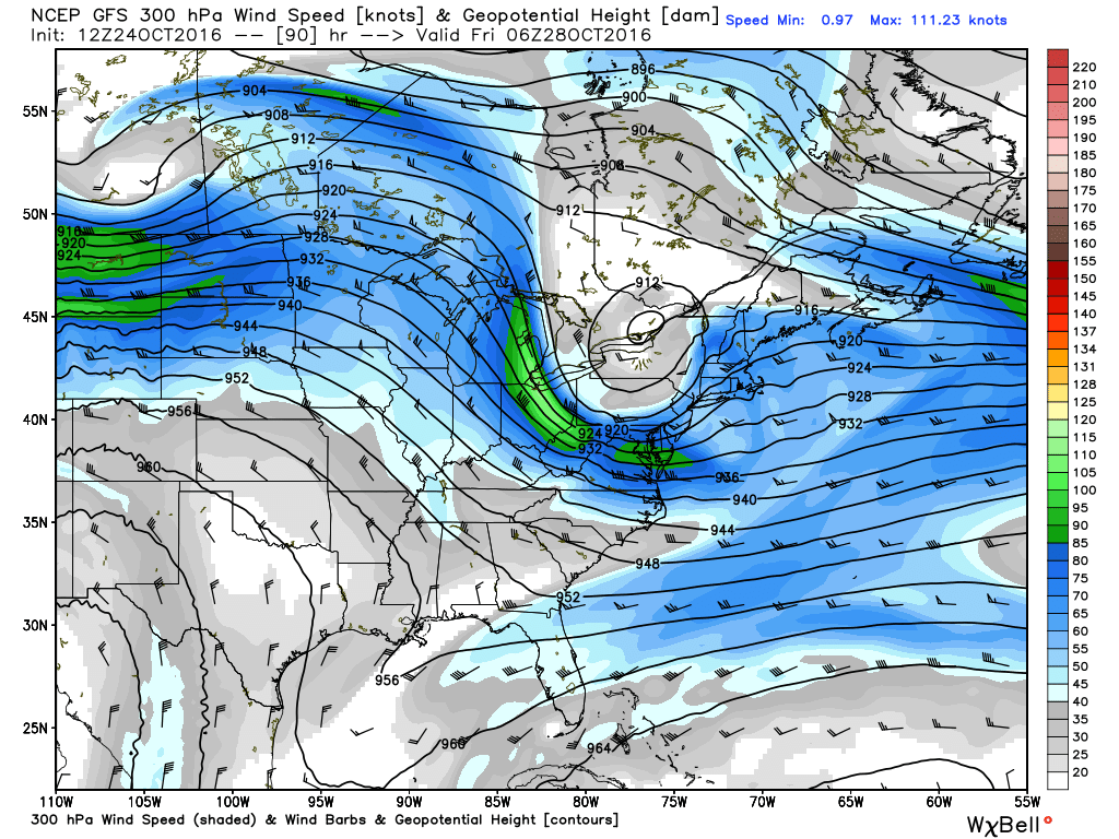
Great look for a developing storm with divergence aloft ahead of a jet streak right over southern New England, and a potent disturbance at 500mb which also features significant divergence in the mid-levels. Good sign for strongly rising air! Source: Weatherbell
Once we get into Thursday, a potent little storm will be developing and heading our way. The upper air setup looks great for some heavy precipitation to develop. Plenty of divergence aloft, a strong vort-max pushing in, and a warm front stretching into southern New England. Great ingredients for significant rainfall at the very least! But how much of it will fall as icy precipitation?
The air will initially be quite cold at the surface and throughout the lower levels of the atmosphere. This should be conducive for much of the precip to begin as snow, especially away from far eastern New England where a component of the wind will be off the ocean which is still very mild this time of year. The best odds of a thump of snowflakes favor the Berkshires, Monadnocks, Worcester Hills, and points farther west/north. Warm air should race in aloft after this, but cold air lingering at the surface could keep sleet/freezing rain in play for a few hours. This is what we need to keep a close eye on over the next couple days. How quickly can warm air work in will determine if it's novelty sleet pellets/snowflakes or something that could have a more significant impact on Thursday travel.
Another variable in favor of some wintry weather is that the air will be very dry at the onset. That means there should be some evaporational cooling taking place, allowing air temps to fall before reaching saturation. There's also a cold air damming signature with high pressure over eastern Canada, which should hold colder air in place longer than models may indicate. This would be especially true in the valleys where dense cold air can hang out longer than across the coast or higher elevations. On top of that, winds almost always tend to end up more northerly than depicted on models in advance, especially away from the immediate coast.
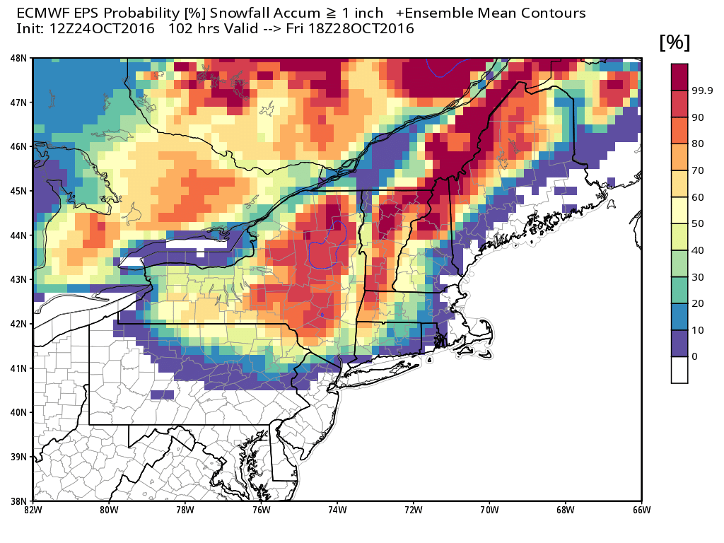
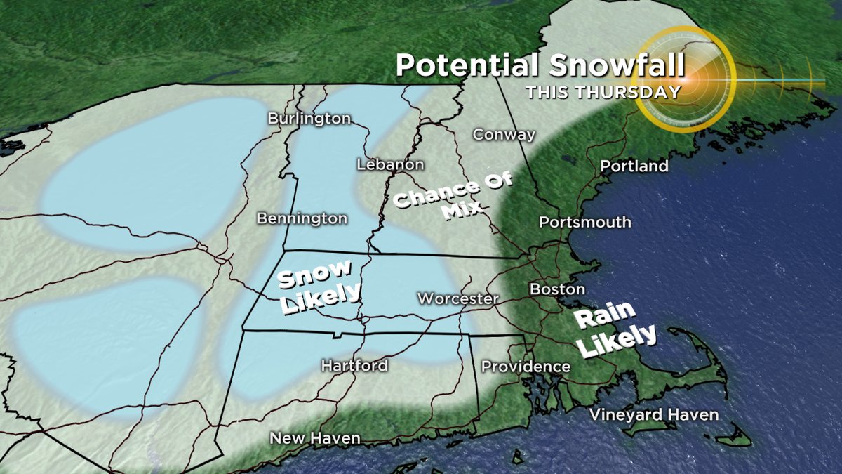
Euro's EPS showing high probability of accumulating higher elevation snow. Note how quickly those odds go down for eastern New England with ocean influence keeping air temps a bit too warm for accumulation. Source: Weatherbell
So bottom line is that I think there are pretty good odds that (areas west of 128 in particular) will deal with at least *some* wintry precipitation on Thursday. The duration of it is still in question, and what we'll have to answer over the next two days. Once the icy stuff ends, we should get some drought-denting rain on top of it. A solid 1-2" is looking like a pretty good bet, adding on to what's been an excellent month to start decreasing the rain deficit. We'll get another shot for some rain on Saturday as well, easily making this the wettest month in the Boston area since December 2014.
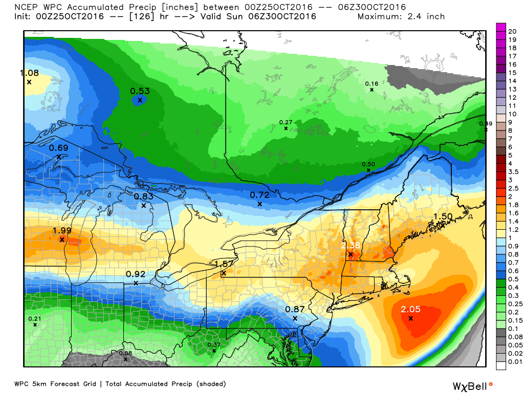
The WPC's rainfall outlook Thursday through Saturday. I agree, with high odds of 1-3" of rain across the region. Source: Weatherbell