Big Heat Stays Away To Start June
Find Eric Fisher on Twitter and Facebook
Graduation season is in full swing, parties are on the schedule every weekend, and wedding season is ramping up. Yep, it's the time of year for big outdoor plans every single weekend. Which usually leads to a lot of stressed out emails and calls to the weather office. We'd love to dish out warm and sunny weather for every one of these events, but unfortunately that would turn us into a desert. New England is known for fickle weather and changeable weather, and we've got plenty of that in the forecast here in early June.
This weekend is example A, with a pleasant start and a soggy finish. Temps will top 80 inland for an ideal afternoon, while sea breezes will keep coastal communities from getting much warmer than the low 70s. Some morning cloud cover to fend off, but otherwise all good for those aforementioned outdoor plans.
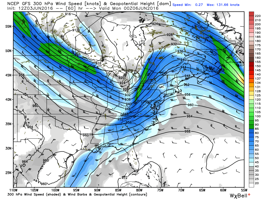
Nice jet stream look on Sunday evening with lots of difluence aloft across New England. This helps to create ascent, which in turn means clouds and rain. Source: Weatherbell
Then a great setup for rain moves in. Air advecting (moving) into New England will be full of moisture, with PWATs over 2" on Sunday. (PWAT = precipitable water and is a measure of how much water vapor is in the column of air above us). Plus, lots of difluence aloft as a jet streak approaches. Good recipe for overruning rain. This will likely start off as a band of showers and drizzle early in the day, with the main slug of heavier rain tracking across northern New England. Then we'll get another slug of rain moving into southern New England late Sunday and Sunday night. That's the one that will produce our highest rain totals, and by the time Monday morning comes around I think most towns will have topped 1" of rain. The higher end totals (perhaps 2"?) will be northwest of Boston, with the lower totals southeast of the city. That works out well for us because the driest area over the past few months has been the Merrimack Valley, North Shore, and New Hampshire. Very much needed for the gardens after a dry spring.
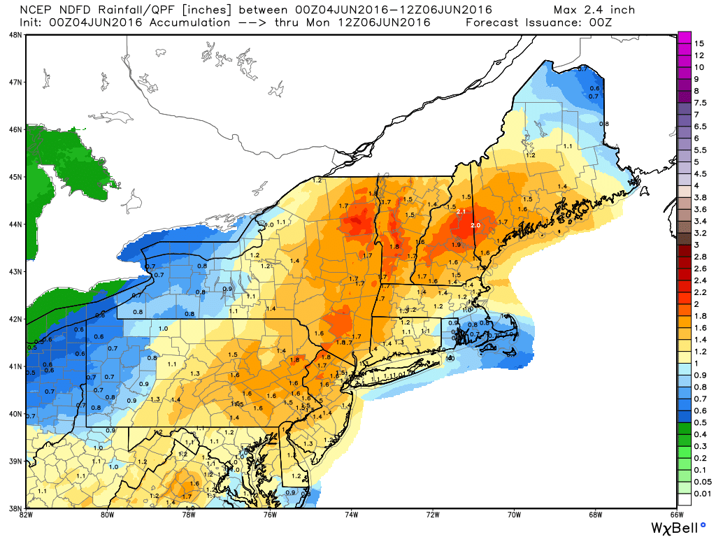
Latest NWS forecast for rain totals Sunday into Monday morning. Source: NDFD
How about a preview of next week? A very active pattern with multiple disturbances swinging down into New England around a deep low in southern Canada. This means several chances for rain, and also some cool temperatures by mid/late week.
Up first on Monday, there's enough lingering instability behind our Sunday storm to help a couple showers pop. Not expecting too much here, and temperatures should soar up toward 80F in the afternoon. On Tuesday a stronger disturbance approaches from the west with plenty of wind energy. There's not a whole lot of moisture to work with, but there should be enough to produce sct'd showers and thunderstorms. Once again high temperatures will be near 80F.
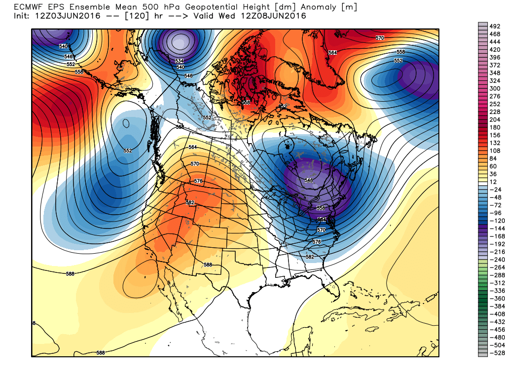
Big trough digging into the east during the middle of next week, bringing unsettled weather and cool temps. Source: Weatherbell
Then we get into the core of this deepening trough for the end of the week. With tons of cold air aloft by Wednesday, we'll get a deck of stratocumulus clouds forming with minimal daytime heating. A few more sct'd showers will also fall from those clouds, and highs will struggle to reach 70F with the limited sunshine. A couple more disturbances rotate down through the trough on Thursday and Friday, although the exact timing is still a tough call. Each of these will probably give us another round of showers, and also a good dose of wind. Gusty (dry) northwest winds will blow Wednesday right on through Friday, and the air may feel more like autumn than summer with low dewpoints in place. It's like that most of us stay below 70F Wed-Fri as this cool air mass dominates.
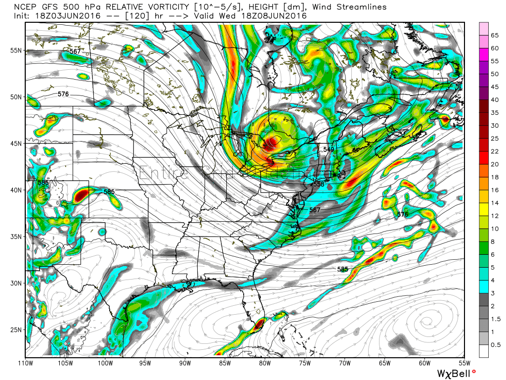
Toughest thing about next week's forecast will be timing out each of these individual disturbances. While a big ridge grows across the central U.S., several of these shortwaves will dive down into our neck of the woods with chances of showers and storms. Source: Weatherbell
All told, no one is expected to near 90F again anytime soon, at least through mid-month. There are signs of us heating back up after that. But I think the general theme this summer will be for truly hot stretches to be scattered, not the rule. An extremely +PDO in the Pacific should help force ridging in the western parts of North America, so that even when we get on a hot streak the tendency will be for this setup to fight back.


