Elevated Brush Fire Risk Peaks On Thursday
Find Eric Fisher on Twitter and Facebook
Winter has snow and summer has thunderstorms, but spring has an issue tied to it that often flies under the radar. April is prime brush fire season, typically lingering into May. We don't see the massive blazes that plague the western U.S., but these brush fires can quickly become a hazard and in some cases destroy property. A few have popped up already this week, including a 4-alarm fire in the Stony Brook Reservation of Hyde Park. Conditions look right to have several more burn across the region over the next couple of days.
What makes April ripe for brush fires? The lack of foliage is a big player - very little has bloomed or greened up yet. So we have many dry, exposed fuels on the ground ready to ignite. Even with a wet start to the month, we've now had just 0.25" of rain over the past two weeks. Dead leaves/limbs can dry out quickly this time of year, and so many of these fuels are ready to burn. April is also a month known for its wind as the atmosphere transitions between invading warm air masses and the slowly retreating colder air of winter. Few calm days dot the April calendar.
You also have very strong sunshine this time of year, now just two months away from the summer solstice. And to top it off, the air hasn't become routinely humid yet. The dry, bare ground tends to heat up easily, and so days are characterized by low relative humidity as the spread between the air temperature and dew point temperature grows quickly.
When all these factors come together, the National Weather Service issues Red Flag Warnings. When winds are expected to reach/top 25mph along with relative humidity levels dip below 30% - the warnings get hoisted. They don't necessarily indicate that fires will start (since 95% of fires here are man-made and unrelated to natural causes), but are meant to alert everyone when conditions are right for fires to spread quickly or uncontrollably.
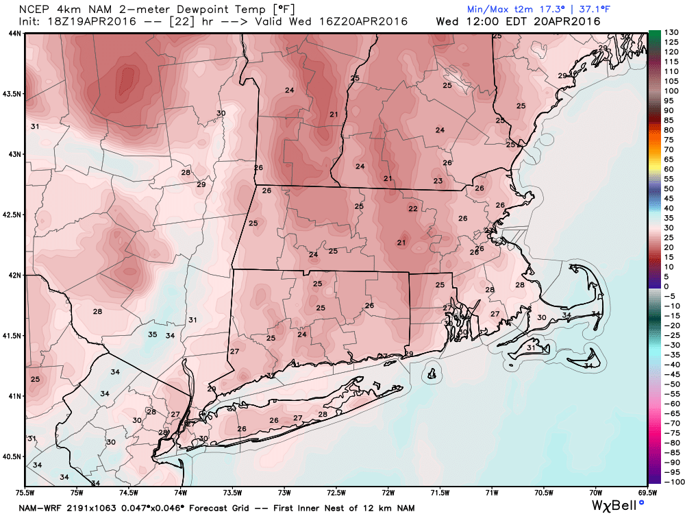
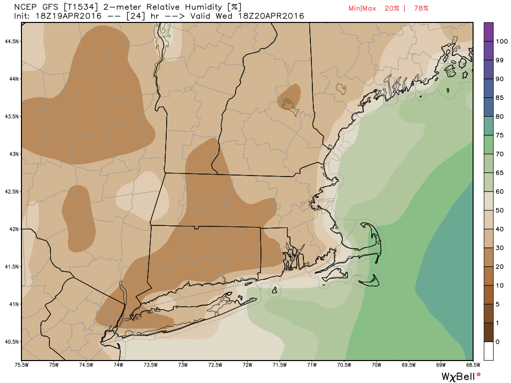
On Wednesday, the wind criteria will be borderline. The gustiest winds will be in the morning (out of the north-northwest), but will then diminish as the day goes on. However, very dry air is in place. Relative humidity values should fall to or below 20% with dew points in the low 20s and air temps topping 60F inland. We'll likely spot a few brush fires around New England, but I wouldn't expect them to spread too quickly without too much wind.
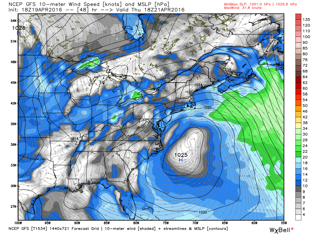
Thursday should be the peak day of fire activity as winds increase and temperatures rise. High pressure drifting off to our south will help pump in the south-southwesterly winds, gusting 20-30mph during the day. Temperatures will soar up above 70F, and there still won't be much moisture in the air. So being careful with any open flames and not flicking any cigarettes outside will be the order of the day. I guarantee that if you take a hiking trip up to Blue Hill to enjoy the day, you'll notice at least a couple brush fires on the horizon. Most of them are more nuisance than dangerous, but they tax local resources as firefighters race to control the flames and keep them away from homes and businesses.
Humidity rises on Friday and chances for showers/thunderstorms also move in, so this risk should diminish significantly to end the week. However, they may get hoisted again this weekend if we don't squeeze much rain out of the Friday front. Hopefully a few good downpours will help dampen the landscape (right now it looks like a good bet).


