Back To Winter: Snow And Winds On The Way Sunday And Monday
BOSTON (CBS) – Enjoy the spring-like temperatures and rain while you can! We switch back to winter Sunday morning and it will stay cold for a while.
Watch: Pamela Gardner's Latest Forecast
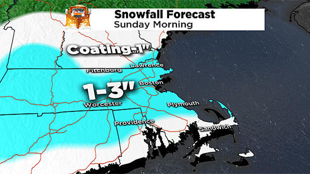
SUNDAY SNOW
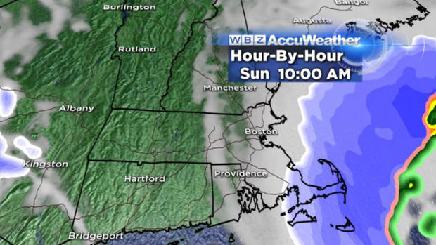
A quick moving, but powerful clipper moves through southern New England Sunday morning.
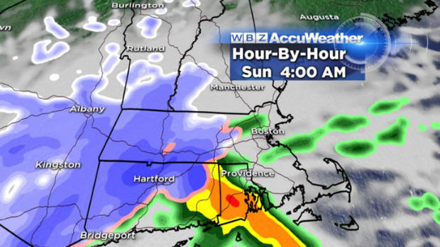
The timing for the snow will be 4 a.m. to 10 a.m.
There may by thundersnow in southern New England, and even snowfall rates of up to 1 inch per hour.
Since the system will be gone by noon, we are going with a projected 1-3 inches of snowfall accumulation. Isolated locations and higher elevations in Worcester County and northeastern CT may see 3-5".
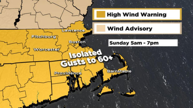
SUNDAY WIND
After the morning snow, the wind takes over.
Wind gusts could near hurricane force (50 to 70 MPH), especially on the outer Cape. Be on guard for scattered power outages and damage.
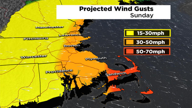
A high wind warning is out for Boston and southeastern Massachusetts from 5 a.m. to 7 p.m. Sunday.
MONDAY SNOW
We are more uncertain on the Monday storm.
Forecast models have another low pressure system moving out of the Great Lakes and into New England between 9 a.m. and 4 p.m. Monday.
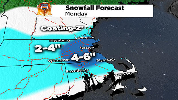
With it being a slower moving storm, we could see higher snow totals than Sunday's storm.
The track of this system is still wavering between forecast models and runs. And this snow totals map will probably change as we get closer the event.
Stay tuned with WBZ-TV and CBSBoston.com for more updates!
Follow Pamela Gardner on Twitter.


