All Aboard The Roller Coaster
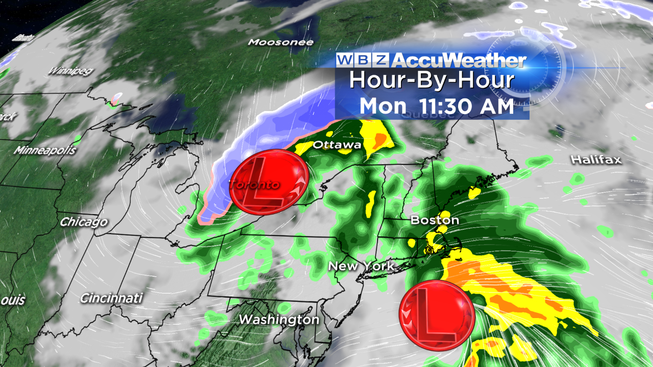
After a chilly rain Monday morning with leftover showers in the afternoon, these two storms will merge over the Canadian Maritimes to create a powerful system that will generate howling wind here starting after midnight tonight and lasting into much of Tuesday.
Some gusts of 35-45 mph are likely. A backlash of snow will fall over portions of the northern mountains tonight into tomorrow and some favorable upslope locations could get a few inches of snow!
Down here, we'll just see intervals of passing clouds amidst all the wind.
All aboard the roller coaster ride! Here we go again but this is typical in spring for massive gyrations in temperatures.
Winter is trying to hang on but warm air wants to win the battle from time to time as well. The steering currents/jetstream will be dramatically shifting this week and over the upcoming weekend into next week.
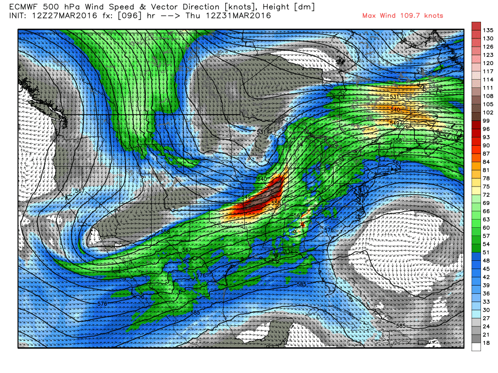
The southwesterly wind will escort a surge of warmth into the Northeast on Thursday and Friday. Temperatures could approach 70 degrees on either or both days if sufficient breaks of sunshine occur. It all depends upon any minor upper air disturbances cranking out a couple of spells of showers. The present timing suggests a few showers early Thursday then some drying to enable the sun to pop out during that day. A weak frontal boundary will settle into southern New England Friday. If it is too moist, showers may linger on Friday but it could also dry out allowing for some sunshine to break out. So it is a bit of a tossup but upper level temperatures support some warm days until the currents change.
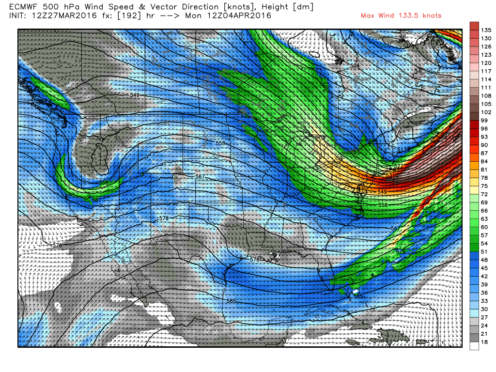
The second map depicts air streaming right out of central Canada into the Northeast a week from today. As the sharp cold front passes across the region next Sunday, rain showers will probably turn to snow showers in the afternoon even down here in the Boston area. Temperatures will tumble into the 30s during the day then fall to the upper teens to middle 20s Sunday night. They will only rise to the middle 30s a week from today.
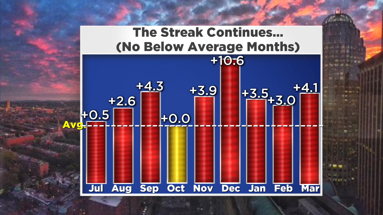
Sooner or later, the streak of months with above average temperatures has to break down. The last month with below average temperatures was last June with a mean temperature of -3.0 degrees.
Could April be the next below average month?
With the rapidly weakening El Nino, analog years reveal a temporary cooling part of spring namely April followed by above average temperatures for the summer especially if La Nina comes on quickly. This happened in 1988 and that was a very hot summer with 25 days at 90 degrees or higher in Boston.
The summer of 1982 is another good analog year and that was a sweltering summer with 30 days at 90 or higher in Boston with more than 40 days in many of the interior suburbs!
Check out a very interesting blog by Eric Fisher regarding his thoughts about the upcoming summer. My preliminary prediction for this summer calls for above average temperatures with 20-25 days over 90 in Boston. Boston had 14 last summer and only 8 in 2014.
For me, the last two summers were the best in many many years.
Do you feel the same way or were they not hot enough for you?