Major Update To Track Of Sunday Night Storm
BOSTON (CBS) –I wondered if the major NCAA Bracket Buster loss of Michigan State was a bad omen for me yesterday afternoon. Sure enough, as the evening progressed, the arrival of new forecast guidance revealed that all of the pieces were not going to fit into the atmospheric puzzle to produce a nor'easter. Model runs from Wednesday and Thursday especially via the most reliable model indicated phasing of parcels of energy resulting in bombogenesis and a powerful storm near New England.
Earlier yesterday, there were some signs that the connections would be tardy meaning that the developing storm would not fully deepen until it reached the Canadian Maritimes. Consequently, with a slight eastward shift, the heaviest snow was progged to be poised over the Boston to Providence corridor so we assigned 4-8" in that channel. Note we did not officially assign any amounts on Thursday's weathercasts but thought that 6-12" was plausible.
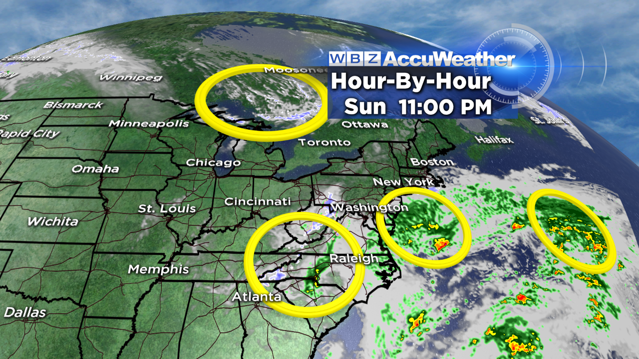
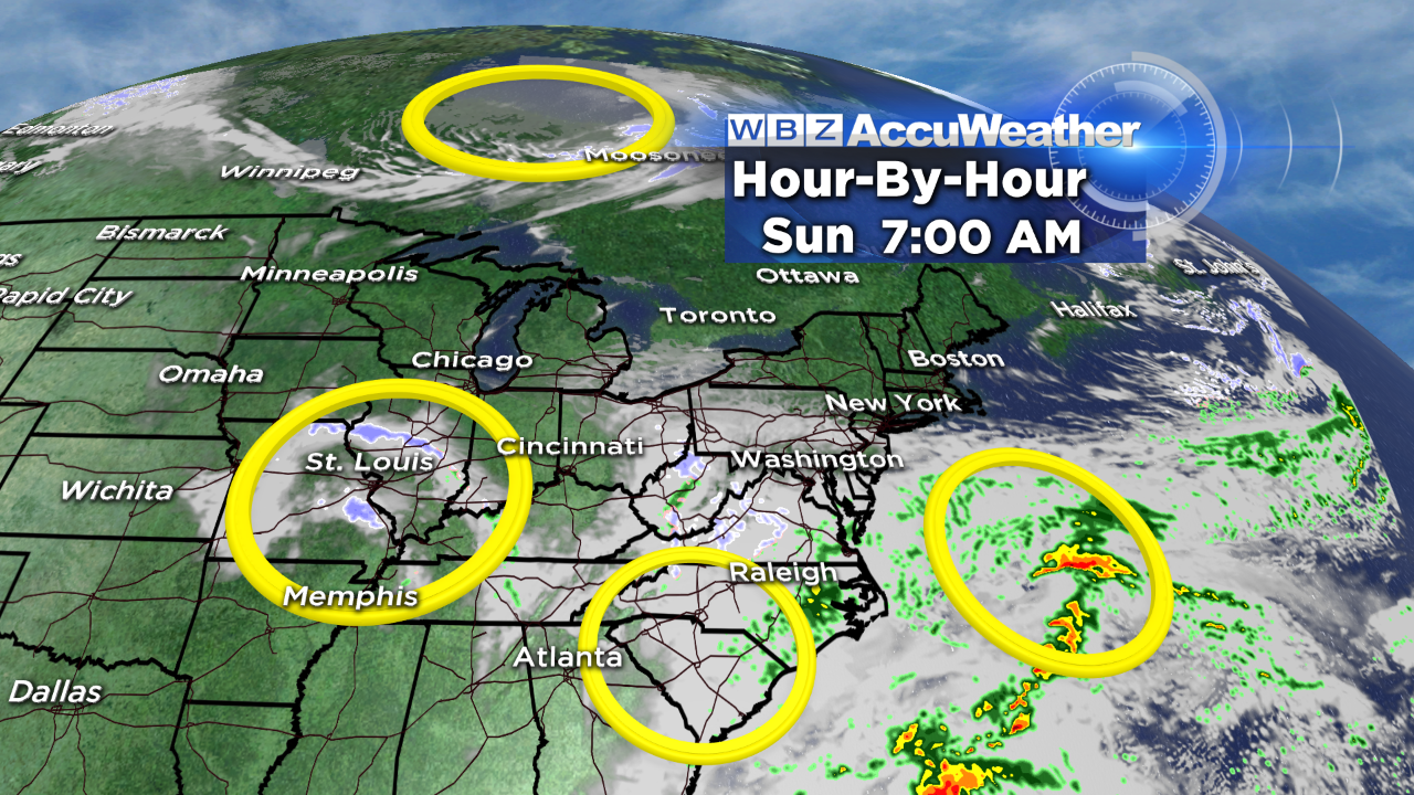
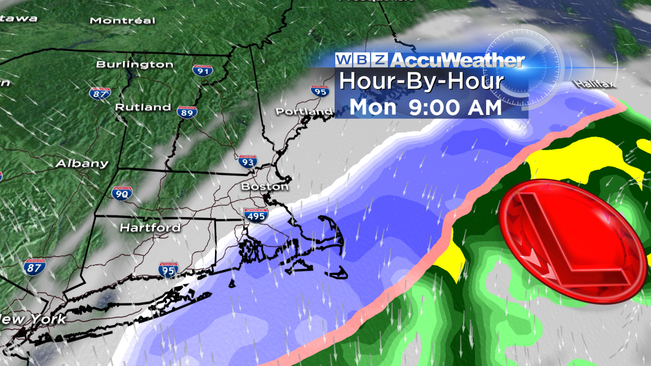
It appears that a couple initial parcels of energy and moisture(the golden rings) are destined to stream out rather swiftly underneath New England during the weekend. You have to realize that the atmosphere is very complex and fluid and to create a storm of significance takes almost a miracle sometimes. Timing, speed, and direction are crucial elements. So we lose the first two rings out to sea, the third ring is more potent but is being governed or directed by the fourth ring up in Canada which is giving the third ring a boot farther offshore. These two will not phase until they both arrive over the Maritimes so rapid intensification will occur up there. As the moisture field sideswipes the region later Sunday night into Monday morning, a shield of snow will mainly fall over southeastern MA perhaps up into the Boston area but the city, according to the latest model guidance, is now expected to be located underneath the outer fringe.
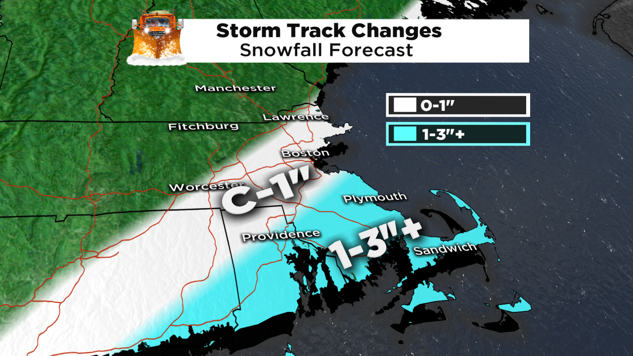
Et voila! If you didn't want a snow storm at the beginning of official spring, this forecast amendment is very pleasing to you. The snow will occur late Sunday night into Monday morning then it will shift offshore followed by a clearing sky and rather gusty westerly winds of 15-30 mph and highs in the lower 40s. One caveat, you should follow updates the rest of the weekend because there could still be some modifications to this scenario.
I am not completely confident of the above solution just yet and I need further confirmation from the European model runs today.