Not So Fast: Developing Storm Not A Blockbuster, But Snow Now More Likely
BOSTON (CBS) – I've gotta say, being a meteorologist just isn't all that fun right now.
Typically some of the most complex storms come around this time of year. Like I said a few blogs ago, the transition from winter to spring can be a bumpy one.
Many times Mother Nature just can't make up her mind and all the fancy-schmancy, high-tech weather models and their trillions of calculations are rendered useless. That just about sums up where we are at right now with regards to the potential nor'easter Sunday night and Monday.
Have you seen the Movie, "Men in Black?" In this movie, which I think has a few sequels by now, Will Smith and Tommy Lee Jones have this little gadget that allows them to remove certain memories and images of aliens from people's brains.
I bring this up because right about now I wish I could wave that shiny tool in front of the TV screen, wiping out all the different forecasts you have seen over the past 48 hours. We need to start from scratch; we need a do-over ... a mulligan.
So let's start over. Here is what we know right now.
TIMING
The Timeline has been pushed back a bit.
The initial parcel of energy is going to slide harmlessly to our south Sunday morning and afternoon, so the daylight hours of Sunday will be quiet and dry.
Between 7 p.m. and midnight, light snow will overspread the area from south to north, reaching the Massachusetts/New Hampshire border by 12 a.m. Only a coating to an inch or two (South of Boston) will have accumulated by midnight.
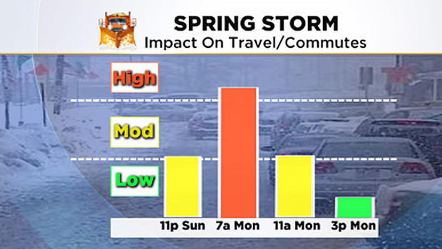
Between midnight and 7 a.m., the heaviest snow and majority of the accumulation will occur.
Heaviest bands will be over southeast Mass. and along the immediate coastline. Winds will be somewhat gusty near the coast, especially over Cape Cod and the Islands. Several inches of snow will likely accumulate in this timeframe.
Between 7 a.m. and noon on Monday, the storm will move past our latitude and gradually the snow will diminish from west to east. Another few final inches could accumulate in Eastern Mass Monday morning. Winds will shift from northeast to northwest.
After noon, just a few leftover snow showers and flurries are expected.
ACCUMULATION
The snow amounts remain a very tough call.
Latest thinking:
North and west of Boston, 2-to-4 inches including most of Worcester County and Middlesex County (west of 128) and Essex County west of Interstate 95. This includes Fitchburg, Worcester, Lowell, Marlboro and all of Southern New Hampshire.
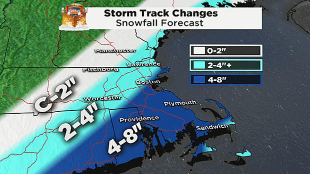
From I-95 and points east and southeast, 4-to-8 inches. This would include the City of Boston (although I would favor closer to 4 inches there), Providence, Plymouth and all of Cape Cod. Also, the immediate coastline including the North and South Shores are included in this projection.
COULD THERE BE MORE?
Certainly not much more, but I could see a few towns creeping above 8 inches. Most likely location if this were to occur would be Bristol and Plymouth counties in southeast Massachusetts.
WINDS AND FLOODING
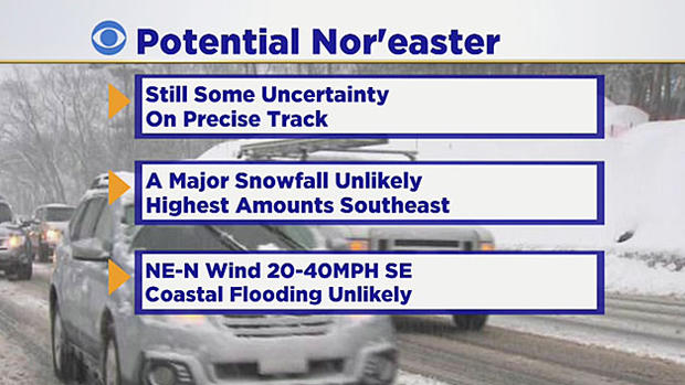
We are not anticipating any major wind or coastal issues.
Gusts to 40-plus miles per hour are possible over Cape Cod and Nantucket. Otherwise 15-to-30 miles per hour should just about do it. The immediate coastline from Boston to the South Shore could occasionally ramp up from 30-to-40 miles per hour early on Monday.
There are no Coastal flooding concerns.
NOT A BLOCKBUSTER
This will NOT be a blockbuster storm. Most of the haggling and hair pulling is ultimately over a few inches of snow and placement of the heaviest totals.
The snow will be heavy and wet, so shoveling will be a bit of a struggle. Cannot rule out scattered power outages in towns that receive upwards of 8 inches along with some gusty wind.
Clearly this is a very difficult and changeable forecast.
We will continue to update as we go along on WBZ-TV, WBZ-AM Radio and CBSBoston.com.
Follow Terry on Twitter @TerryWBZ


