March Madness: Friday Snow To Big Warmth Next Week
BOSTON (CBS) – It's been a soggy start this morning but thankfully the last of the wet weather will be pushing offshore by late morning. We've already reached our highs for the day as temperatures will now fall through the remainder of the afternoon, dropping into the 30s by early this evening. Gusts to 35 mph will create wind chill values in the 20s by late afternoon!
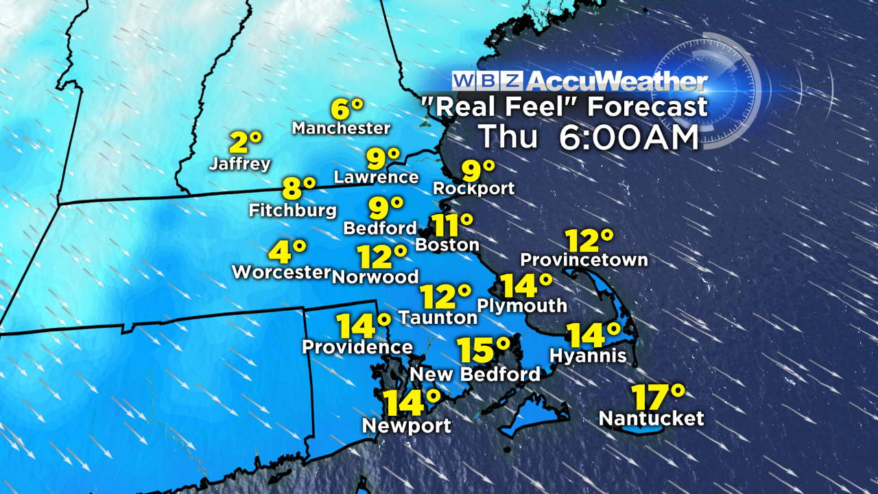
And tonight? Even colder. Clear skies and a continued active wind will mean single digit 'real feel' temps in many communities tonight and tomorrow morning. Hope you didn't get too excited about our recent warmth and put away the winter gear just yet…because on top of the cold, we've got a shot at snow to end the week.
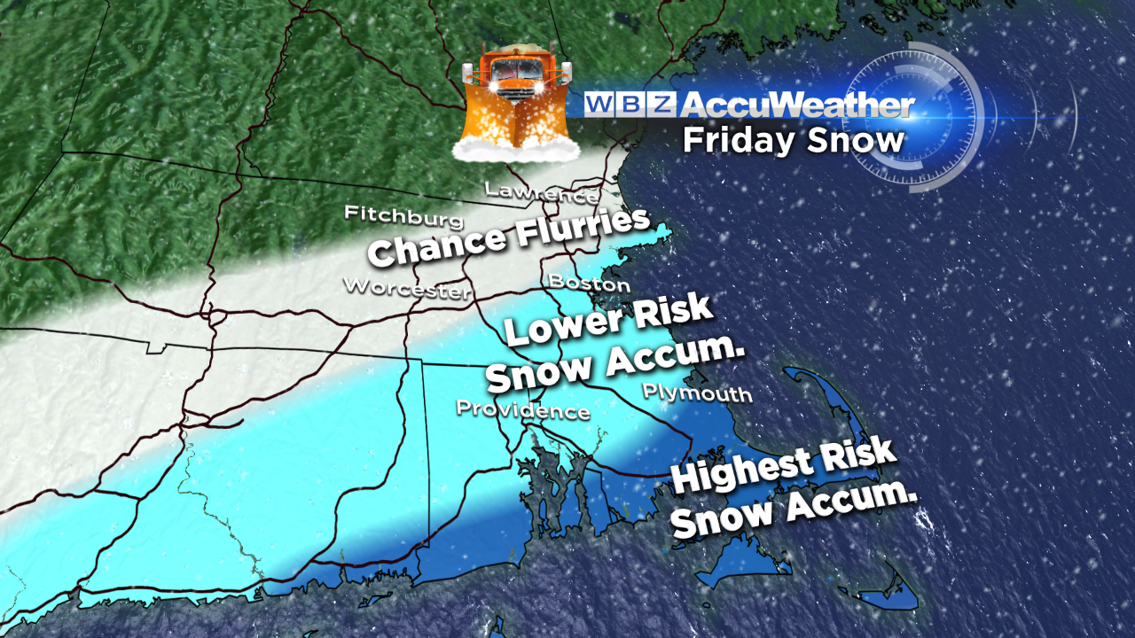
Low pressure coming out of the Ohio Valley on Thursday will redevelop and strengthen off the Carolina coastline Friday morning. The storm will be a big one - but should pass too far south of New England for a significant impact.
It still bears close watching as a shift in track would have implications on snowfall amounts. At this point, I'd say a general 1-3" is possible...with the highest risk of that occurring on Cape Cod (closest to the storm center) Stay tuned for important updates in the next 24 hours!
The weekend is looking good – although it will be cooler than 'normal' with highs in the upper 30s both days. After that? A BIG time warm up.
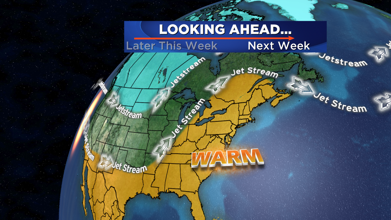
Temperatures in the 60s are likely for the middle/end of next week…our first 70+ reading inland is certainly in the realm of possibility.
Follow Danielle on Twitter @DanielleWBZ4


