More Snow Chances Ahead
Find Eric Fisher on Twitter and Facebook
And just like that, it was winter. These next two weeks are likely to be the most active/wintry stretch of the season after a couple of easy livin' months. So enjoy the quiet weekend, break out those skis/sleds for the first time, and take in the winter scene. But there are a few storm systems to watch next week alone, so here's a quick look.
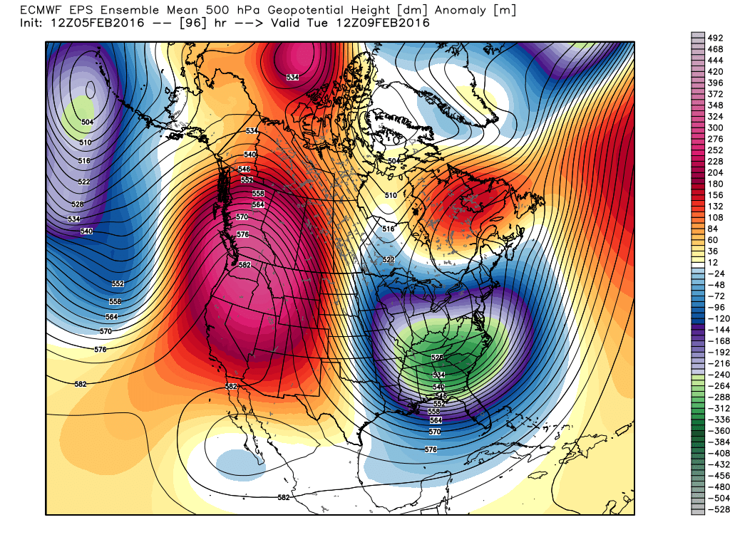
The big picture is that a huge ridge is going to start building across western North America, helping a deep trough carve down into the eastern U.S. This will bring the coldest air of the season into the Southeast and all the way down to Florida where I'm sure they'll be crying because highs are in the 50s (boo-hoo). What does it mean for us? A few potent packets of energy diving into the east and coming up the coast, plus a long stretch of chilly weather.
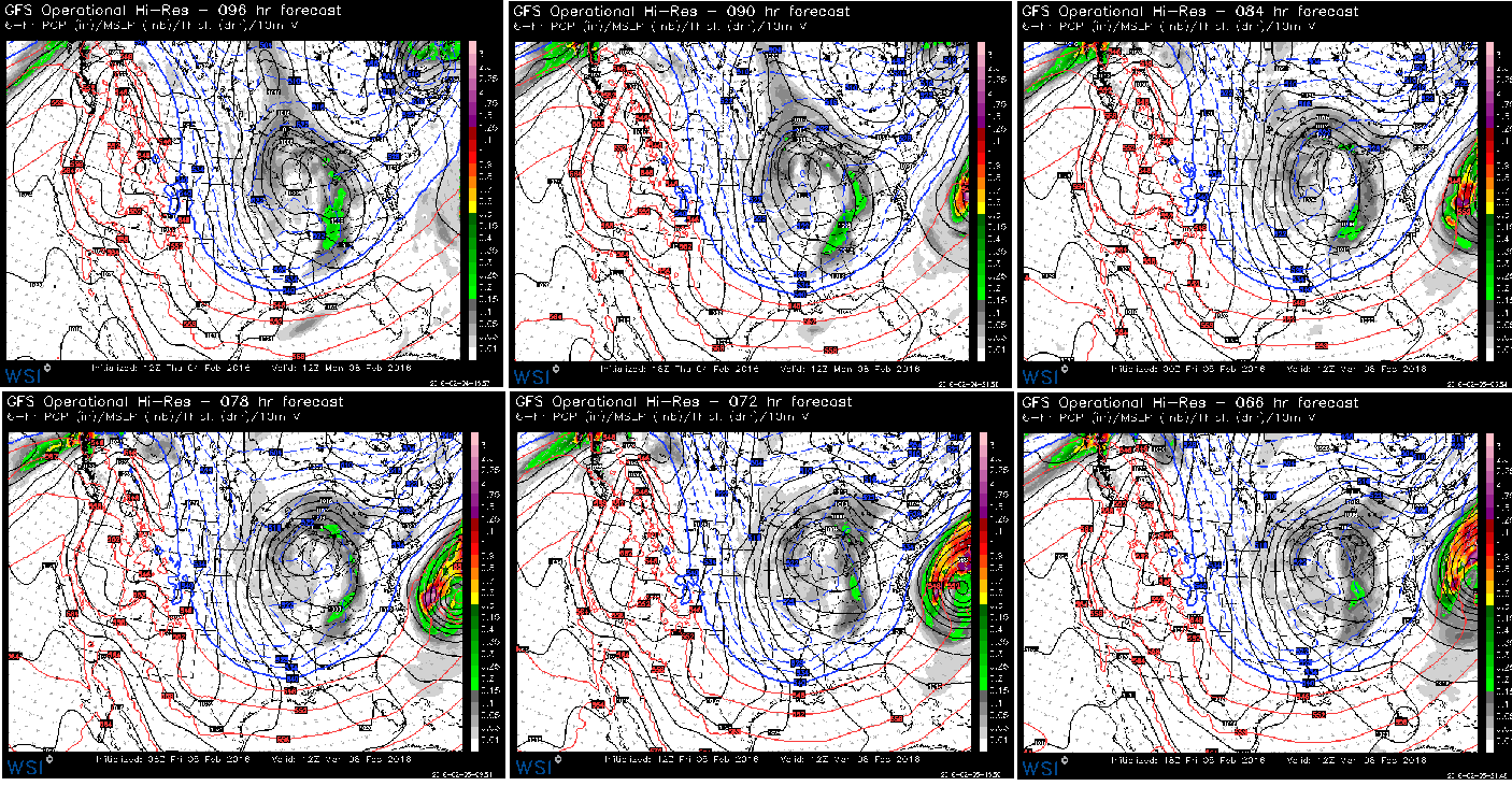
The last 6 GFS runs show the progression that's become common this winter. A little farther west every single run. Will be hard to escape new snowfall on Monday. Source: WSI Energycast
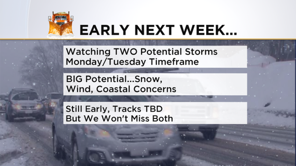
Storm number one rapidly develops off the Carolina coast on Sunday, and could even bring a strip of snow there as it heads out of town. All guidance has this bombing out and becoming a powerful low, and the trend like all the other systems lately has been farther west over time. At this point I don't see much of a reason to think all of this will head out to sea, and we should stay on our toes as this westward jog could bring some significant snow and wind into New England on Monday. Hopefully in the next 24 hours this will become clear and we can start talking totals and areas to watch. Astronomical tides are on the high side, and since this is a much more powerful storm than what we just saw there's the potential for more coastal hazards.

Storm 1's energy off the Carolinas, while storm 2's energy is diving into the Midwest behind it. Source: WSI Energycast
Right behind this storm is another, and the biggest question here will be whether or not storm 1 will steal a bunch of energy and dominate the scene, or whether it will stay east and allow the trailing short-wave to tuck in along the coast as our main event. The timing for that would be starting during the second half of Tuesday, Primary Day in New Hampshire. I'm leaning toward the first storm being the main one for us, but if it jogs out to the east then storm 2 will bring snow (and maybe some rain near the coast) on Tuesday into Tuesday night.
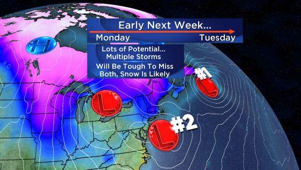
I think the main takeaway is that we're in a volatile pattern, and there's very little chance we will miss both of these storms. So snow is in the forecast for the beginning of the week, and there's a good chance it will be significant (6"+) for parts of the area. More details to come!
One other system I'm keeping an eye on this coming week will be some 'Clipper' energy diving down through the Great Lakes. The ECMWF has this, but the GFS does not. I think it makes sense with the pattern, and this could bring another shot of snow around Friday. Regardless of how this one pans out, guidance is in great agreement that there will be plenty of cold around for Valentine's Day Weekend. #CuddleWeather? Raw model data says it's the coldest air of the entire winter, but we'll see if it moderates some as we get closer. I definitely wouldn't plan on any 50s or 60s again though over the next 10 days, so make sure the firewood pile is stocked up.