Winter Kicks In
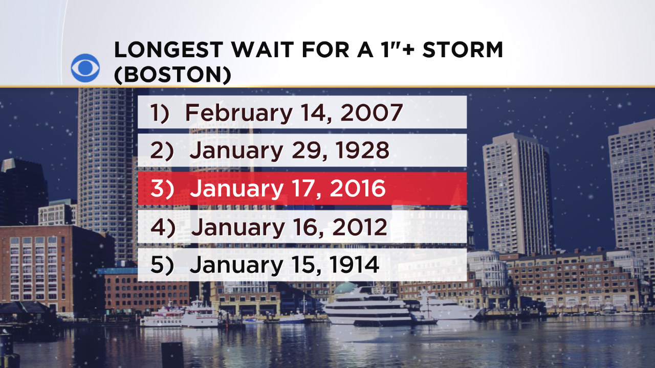 Boston should finally receive its first 1"+ storm overnight into early Monday. So that puts this season in 3rd place for the longest wait. The city almost went into 5th place for no measurable snow through December 31 but 0.9" was measured on the 29th following record-breaking warmth just about the entire month.
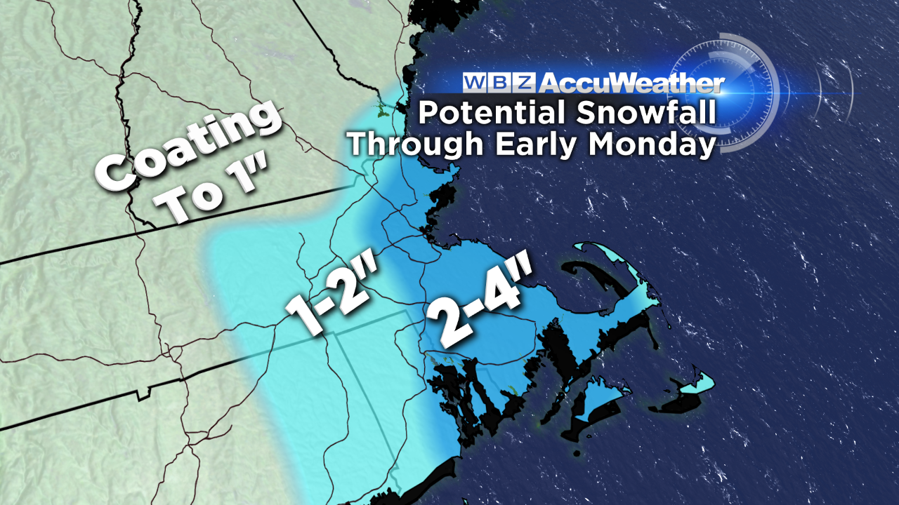 This holiday weekend storm is not destined to blossom into a surprise blizzard. Most locations will receive a coating with up to 1-2" probable in places. There could easily be a narrow strip of enhanced snows along a convergence boundary extending from portions of Plymouth County to just east of Boston and perhaps extending up to the outer section of Cape Ann. In this zone, 2-4" are possible with a few isolated higher amounts of 4-5" not out of the question. Outer Cape Cod should have an eventual switch from rain and some sleet mix to snow with a coating up to an inch or so there.
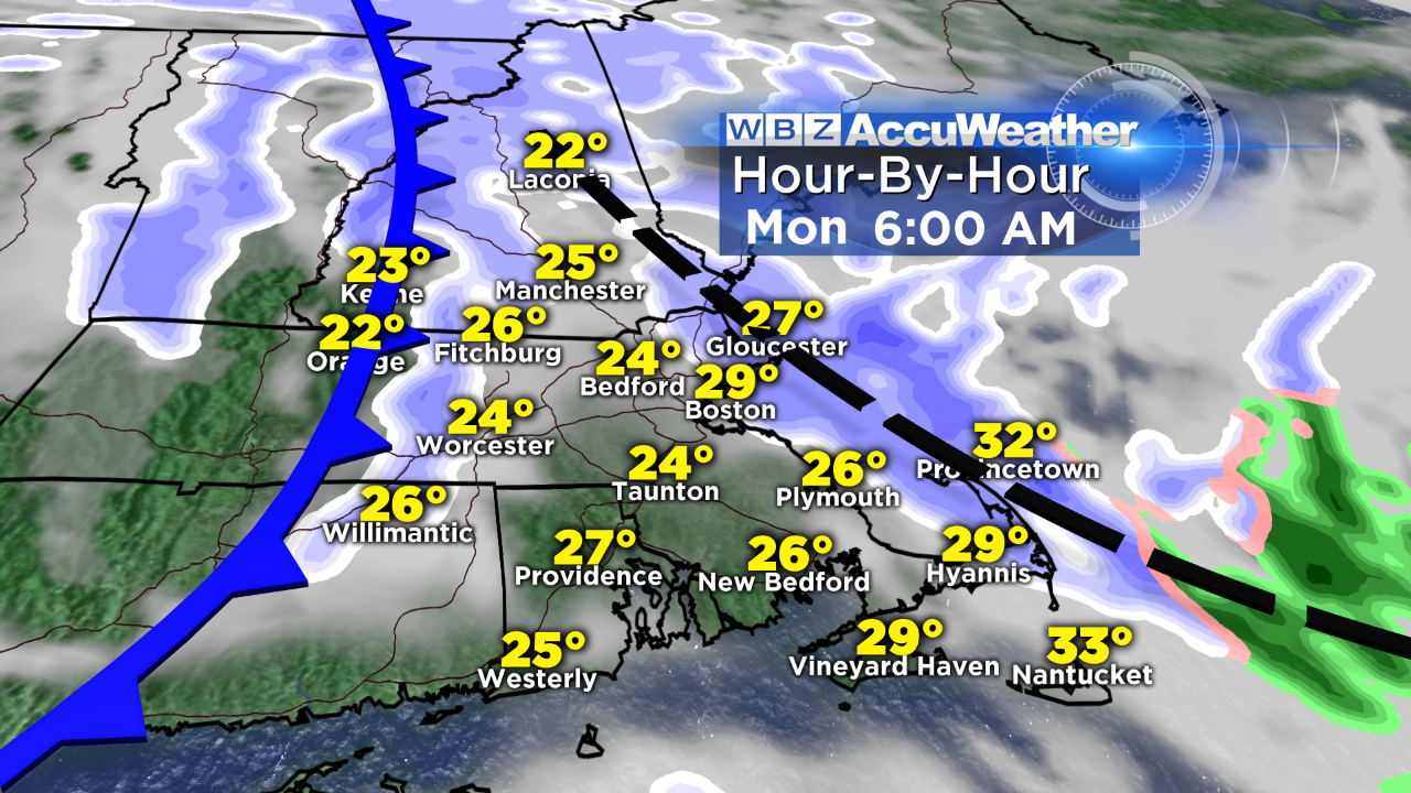
Early Monday morning, the convergence boundary will shift off Cape Ann and the strong cold front will barrel eastward from Worcester County with a line of snow showers and isolated snow squalls. These will introduce the very windy weather which will exist through Tuesday. Gusts during this time will frequently spike up to 35-45 mph with a few striking 50 mph in favorable places on hilltops and along the coast. The wind will create real feel temperatures in the teens tomorrow afternoon, single numbers above and below zero tomorrow night and early Tuesday morning and mostly upper single numbers to lower teens on Tuesday afternoon!
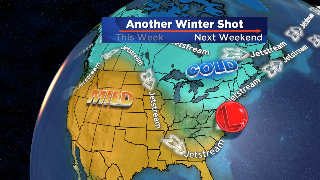
The wind decreases but is still cold and brisk on Wednesday and Thursday. Expect light wind on Friday ahead of the next storm threat for Saturday. It is too premature to be highly confident of the impact of this storm presently.
We all remember that other than the snow near Thanksgiving, last winter really didn't kick in until January 24th with 5" of snow followed by 24.4" on the 26th-27th! It was the beginning of 100" in 39 days. That insane amount will NOT be repeated this year but some El Nino years have been snowy from late January through February. Anyway, we will be following the twists and turns of this one throughout the week. The storm will not begin until early Saturday morning.
Make it a great week!