Winter Slowly Taking The Reins
Find Eric Fisher on Twitter and Facebook
Sunday's radar. This is mid-winter, right?
I have to admit, I had a 'What are we doing here?' moment on Sunday while watching a line of strong thunderstorms track through Vermont. On January 10th. Even with recent 'chill,' Monday made 62 of the past 72 days with at or above average temperatures in the Boston area. And after last winter, I can't help but yawn when 'big cold moving in!' is mid 20s. We had weeks of highs colder than the mid 20s last season. Winter lovers were definitely due for a let down after an epic run in early 2015.
That being said, we've been slowly dipping into winter like you gradually test the waters while sinking into a hot tub. Each week a little bit colder, a few more mentions of snow or ice in the forecast, a couple more wind chill maps. And turns out we have two chances for snow this week. In a sneaky way, winter is taking the reins.
Most of Tuesday will be a dynamic and rapidly changing setup as a potent ball of energy plows into New England. I won't go into too much detail here, because the best up to date info will be on-air on WBZ-TV and online via Twitter or this website (or our app, CBS Boston Weather)! But here's the gist -
- A dynamic storm will bring snow showers/squalls after mid-afternoon
- The strongest squalls are expected from the Boston area north & west, with some rain mixing in south and east
- Poor visibility during the evening commute could make for hazardous travel. Earlier is better when it comes to the drive!
- Totals will be low, but impact could be high with the sun down, snow flying, and temps dropping below freezing.
Be cautious traveling overnight, as areas of snow will taper down but winds will pick up and temperatures fall back through the 20s, freezing up anything that's wet. This storm will explode off the Maine coast (in turn, covering much of Maine in snow) and will send a big blast of chill down our way. Wednesday is looking like our most uncomfortable day of the week, with highs stuck in the 20s and strong NW wind gusts that could howl as strong as 35-50mph. That means wind chill values down in the 0s and 10s and a good day to hang out indoors.
The cold sticks around on Thursday but the wind starts to diminish, and Friday looks nice and comfortable as temps head up toward 40. It's the weekend where most of our focus is, so here's a peek at what could end up having an impact on the Patriots playoff opener at Gillette.
What We Know:
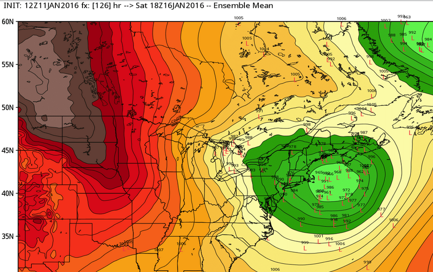
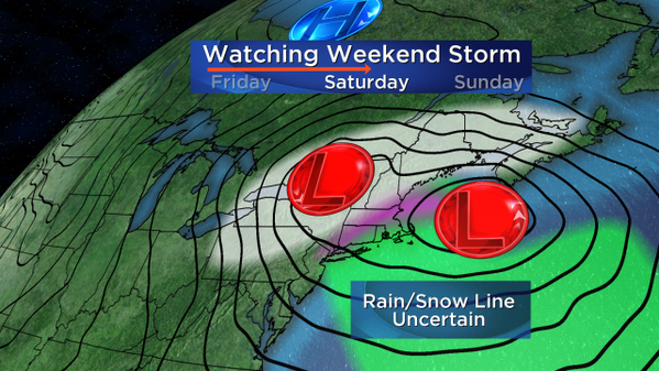
- The timing has become more clear for this weekend's storm. Just a few days ago, there were a lot of questions about when different disturbances would swing on through...anywhere from Friday through the following Tuesday. Well now there's moderate to high confidence that late Friday night into Saturday will feature the stormiest weather.
Good agreement that low pressure will be moving in sometime late Friday night and Saturday. Source: Weatherbell
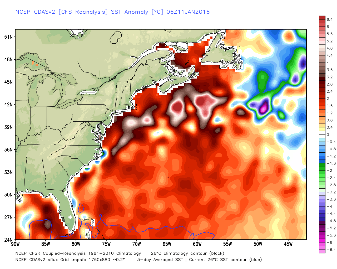
- Cold air will be limited. With the initial low tracking up into the Great Lakes, there will be a push of milder air into southern New England aloft (above our heads). Thermal profiles, or temperatures at different levels ascending in altitude, are marginal all the way through. And there doesn't appear to be a strong high to block in the cold. In addition to all this, the ocean is very warm for this time of year, and onshore winds will blow mild air into shoreline communities. All told, this will make it difficult to get a pure snowstorm in the area.
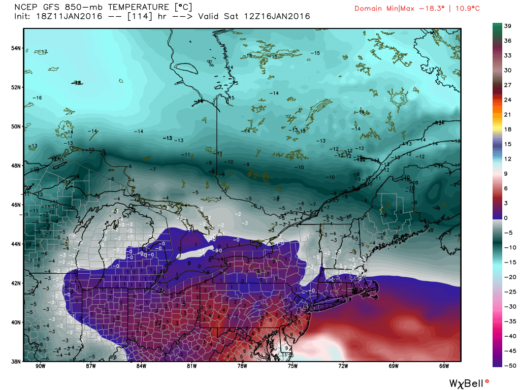
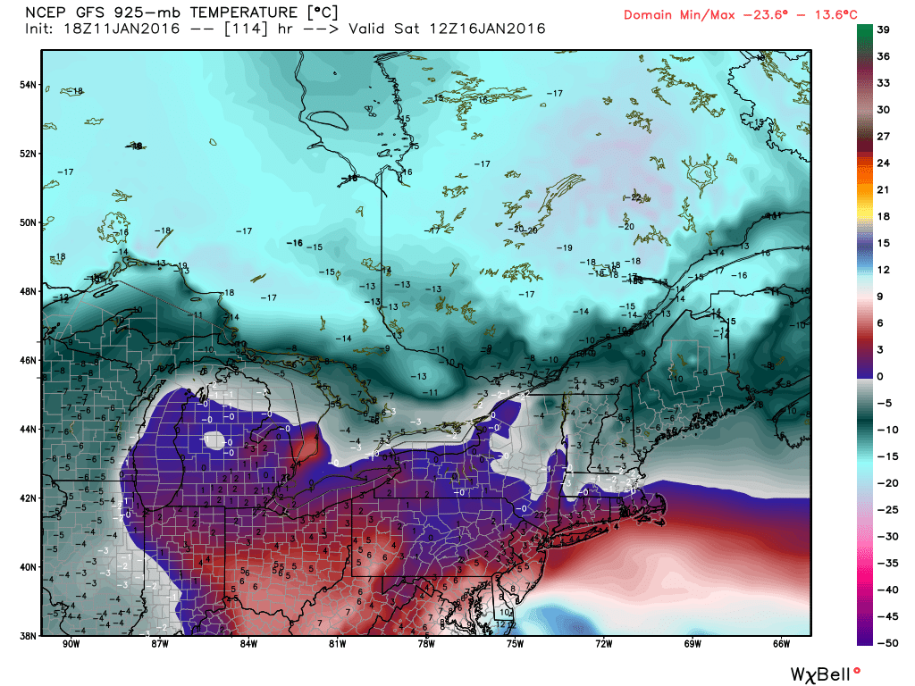
- A coastal low will take control as energy is transferred down toward the mid-Atlantic coast, and this will be our primary storm. It's expected track is historically a great one for snow lovers, but it may not end up being the case for the reason above. What we will likely end up with is a mix of snow and rain in the area, with rain favored in southeast Mass and near the coast, and snow favored inland.
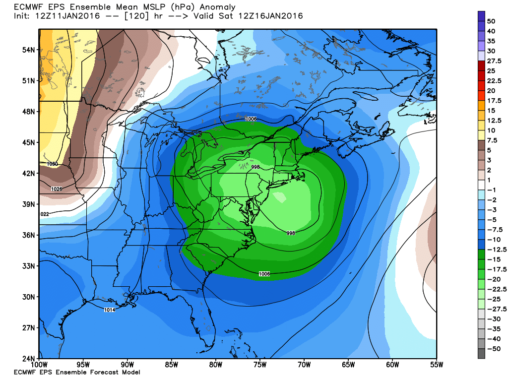
A cluster of lows among the ECMWF EPS members just offshore to our east (typically good for snow), but still a wide spread and lots of uncertainty this far out. Source: Weatherbell
What We Don't Know:
- Exact timing - while Saturday is favored, the precise start and end times are not known this far out. It will be a couple days yet before we can get confident about those kinds of details. So don't go rearranging plans.
- Rain/snow line - It's much too early to figure out where the line will be drawn. If the storm becomes powerful enough, it may be able to draw down some colder air from the north and/or dynamically cool the column of air down. I think there's definitely potential for this to happen, but we're in 'wait and see' mode for now. If anything, I think models have been under-doing the potential strength of the coastal low. Won't be surprised if subsequent model runs later this week start to juice it up.
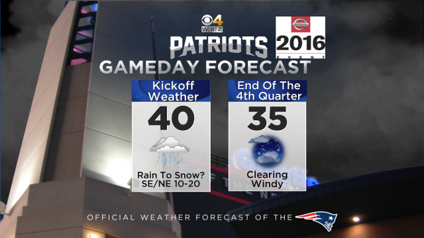
- Patriots impact - If this storm speeds up, it may arrive Friday night and be winding down by kickoff for the Patriots vs Chiefs. If it slows down, we may be in the thick of heavy rain...maybe even a late transition to snow. If the storm draws in a lot of mild air, Foxboro could be 'mild' and well up into the 40s. But a slightly different track could bring temps down the freezing. So lots will likely change through the course of this week, and maybe we'll get our first snowy playoff game in some time? Would be a lot more fun than the wet deluge they played in during the AFC Championship last year!