Rain And Snow Coming Late Tuesday
BOSTON (CBS) - After Sunday's record warmth, it's back to the reality of January today as temperatures hold steady near 34 degrees before dropping late this afternoon.

JUST COLD THROUGH TONIGHT
The gusty chilling wind will decrease during the afternoon and become calm just after sunset. Under a mainly clear sky much of the night, expect low temperatures in the lower 20's in Boston down to the middle teens in suburbia by dawn when some clouds will be arriving. Sunshine will yield to a mostly cloudy sky by midday Tuesday and as the wind turns southerly up to 5-to-15 mph, it will warm to the upper 30's.
RAIN-SNOW TIMETABLE
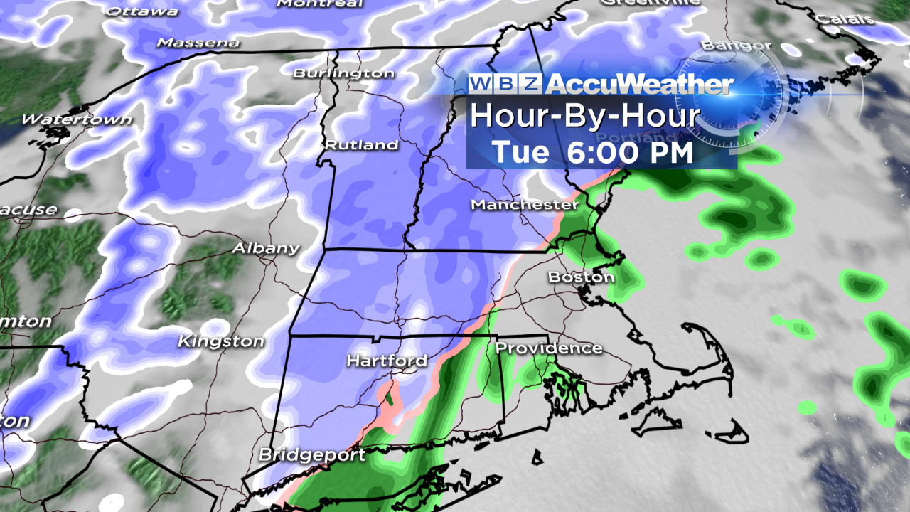
Snow will overspread much of western and parts of northern New England during tomorrow afternoon with a risk of a few rain showers developing over southeastern Mass. as well.
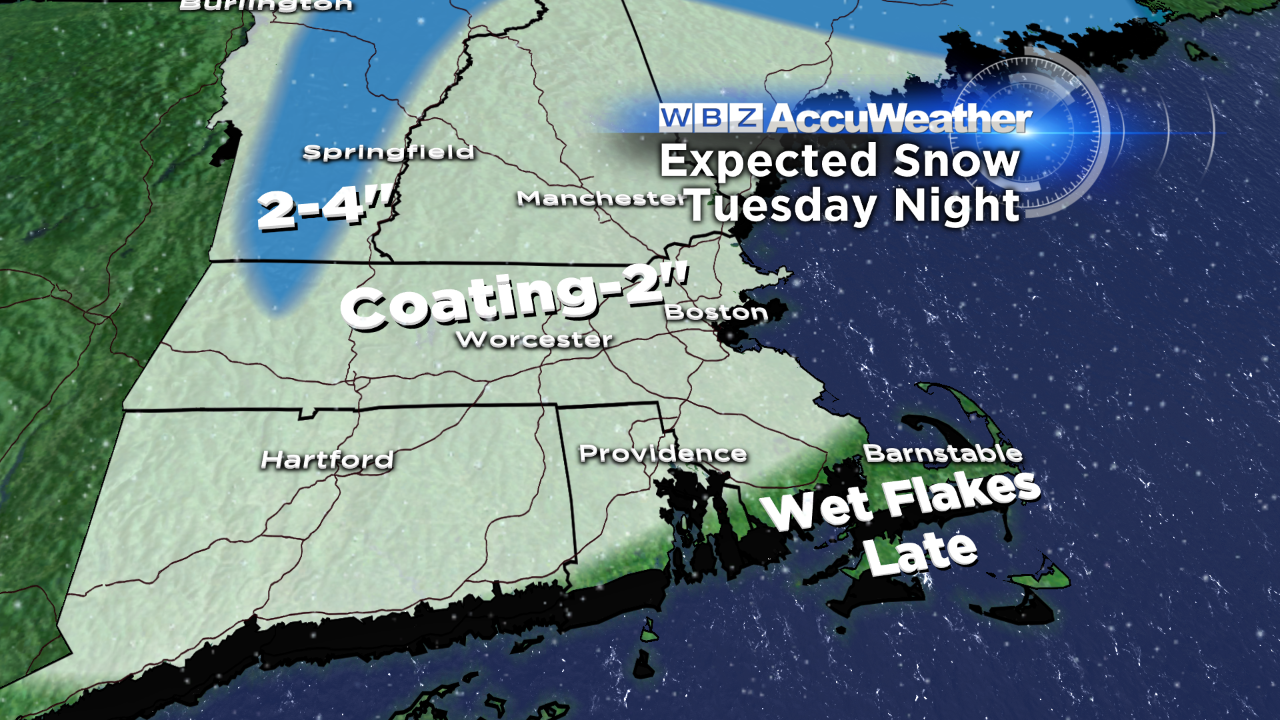
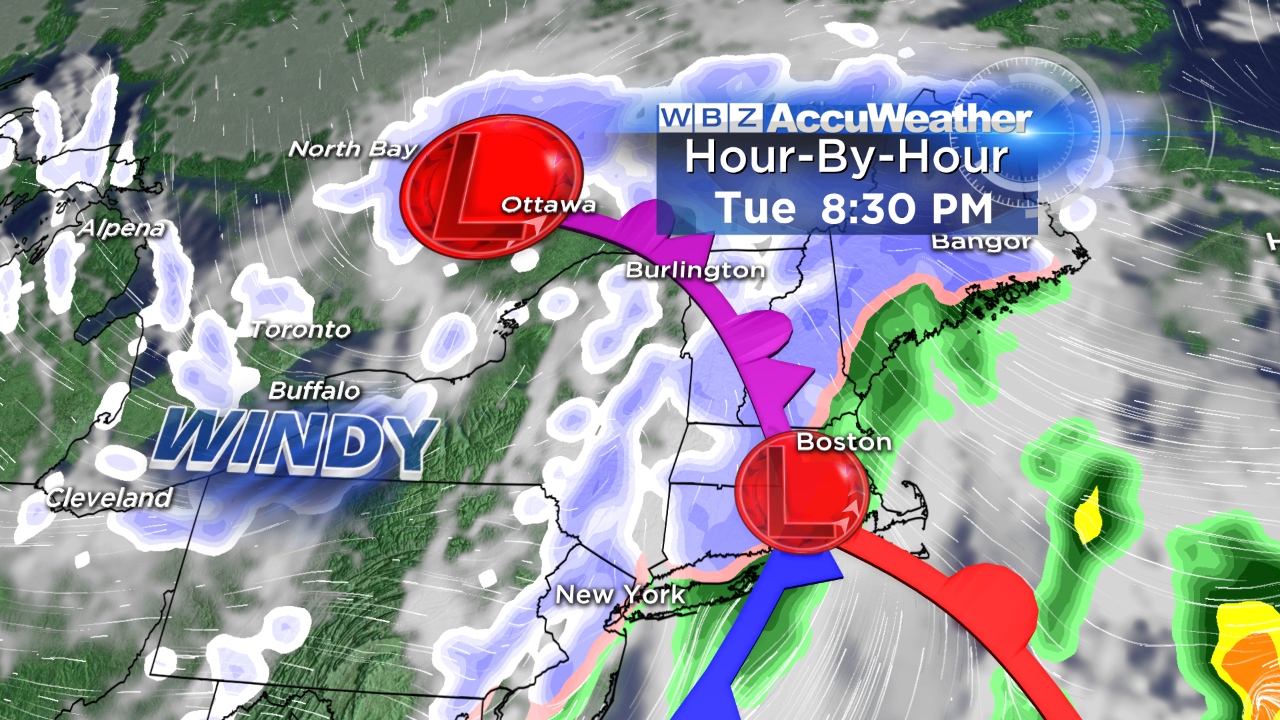
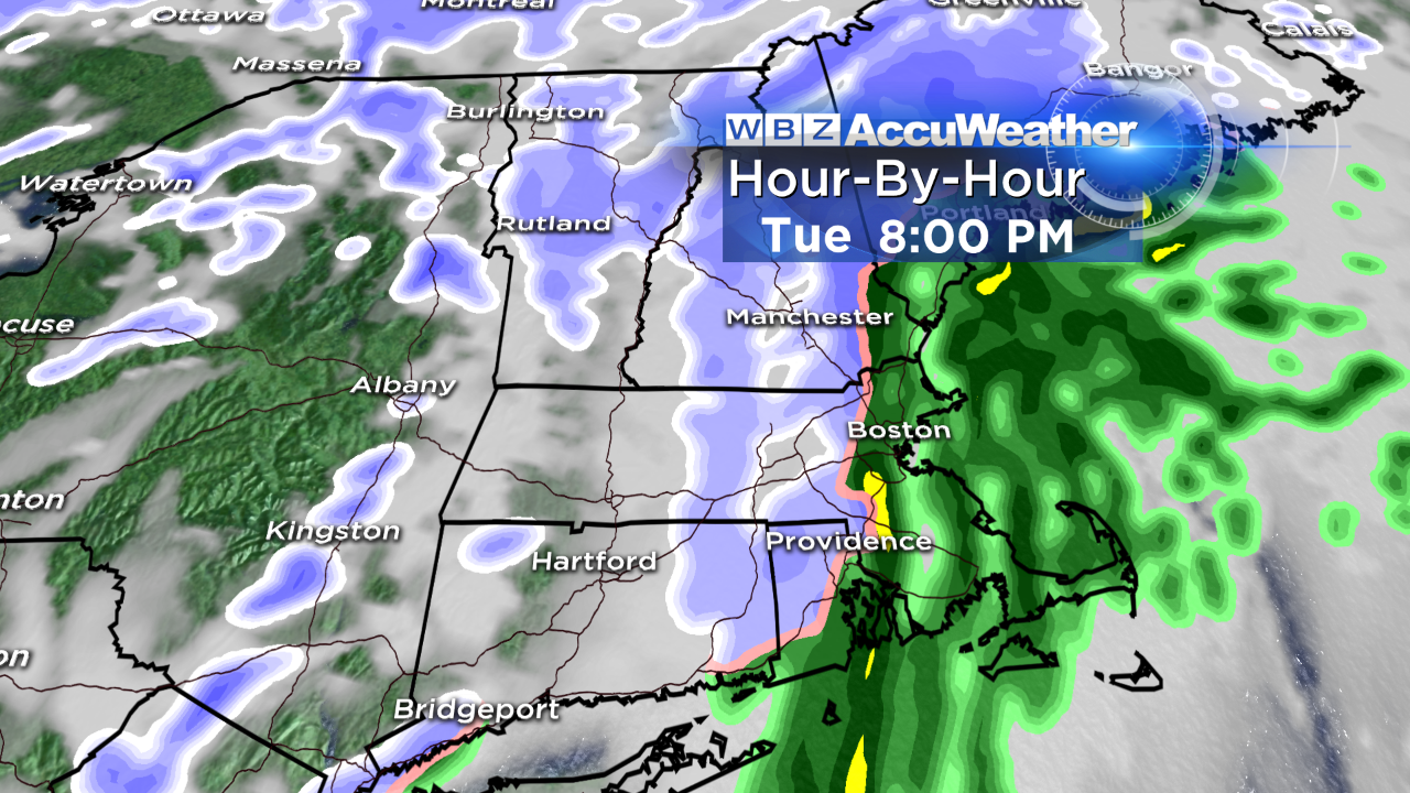
The main burst of energy arrives tomorrow evening in eastern New England so snow will move into the region north and west of Boston with the rain/snow line setting up in the I-95 corridor. It appears that this line will shift to the coastline as the evening unfolds resulting in 1-to-2 inches mainly west of I-95 perhaps extending into northwestern Bristol County and far western Plymouth County. East of that to the coastline, less than an inch to a coating is anticipated at this time.
Over most of Cape Cod, it will be primarily rain showers with nothing more than a few wet flakes near the end. Consequently, some roads may become slippery during the evening and overnight as the package of precipitation exits the coastline by 10-11 p.m. with clearing, colder and windy conditions to follow.
SECONDARY STORM DEVELOPMENT
This bout of wintry weather will be produced by a clipper system which is currently tracking toward the upper Mississippi Valley from the northern Plains States. It will gain extra energy later tomorrow leading to a weak secondary storm forming over southern New England tomorrow evening.
This should spike the intensity of the precipitation briefly tomorrow evening as the storm rushes away and intensifies sharply east of New England. This will produce another spell of rather powerful winds late tomorrow night through Wednesday.
Expect howling westerly winds of 25-45 mph through that period with taming conditions Wednesday night and Thursday. This rush of cold air will result in high temperatures near or just under 30 on Wednesday but the real feel temperatures will be in the teens to lower 20's again.