Core Of Arctic Air Moves Overhead Tonight
An arctic front is pushing through the region this morning delivering our first real dose of bitterly cold air to New England. In fact, temperatures today won't rise at all; we'll gradually fall through the 20s this afternoon. Add a strengthening north wind on top of that and we're talking real feel temps in the teens at the warmest time of the day.
Flurries and light snow showers will dust the ground in spots as they come through this morning– but won't amount to much. It's the ocean-effect snow bands that we need to be more concerned about. What is ocean-effect? Cold air blowing over the relatively warmer ocean water (especially for long distances) picks up moisture and carries it ashore. These bands are often very localized and can dump accumulating snow in one town and nothing in another. We'll watch the placement of these bands closely through the day and update you as necessary, but Cape & Islands residents can expect a general 1-3" of fluffy snow from this afternoon until tomorrow morning, with isolated amounts up to 4". The remainder of the eastern MA coastline could see a coating – especially from Cape Ann to the South Shore.
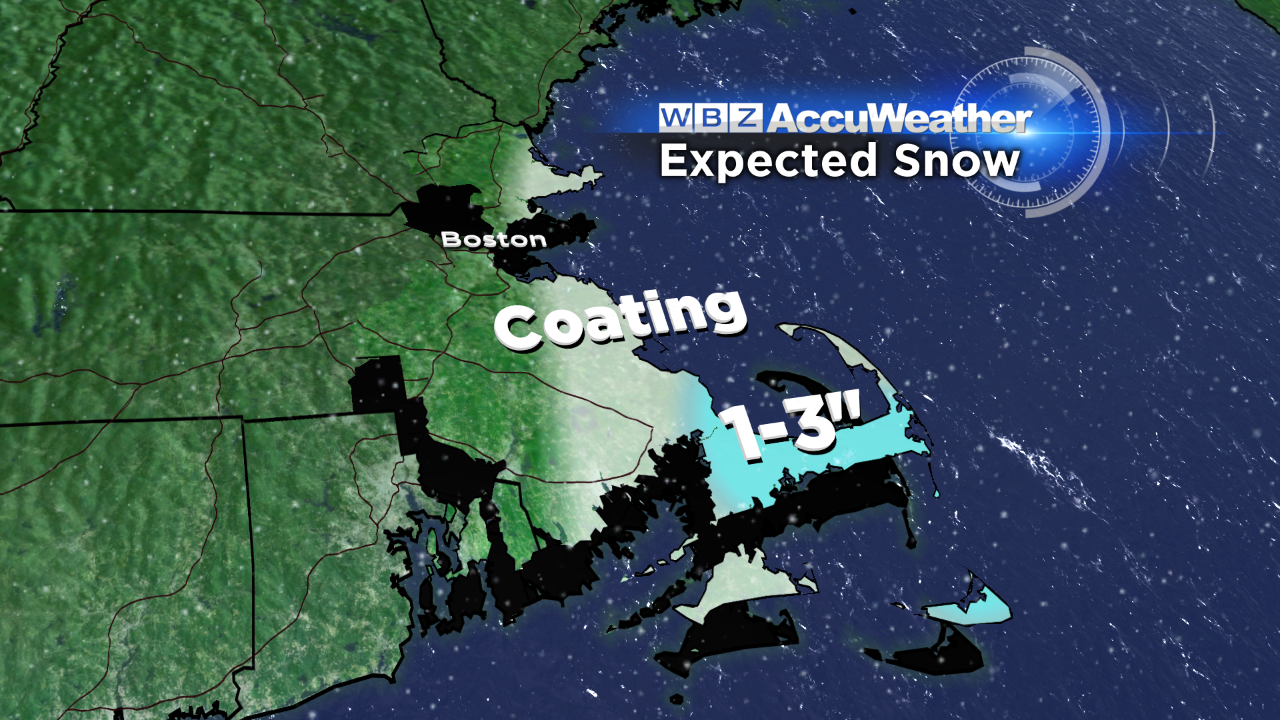
Snow expected from Monday afternoon until Tuesday morning (Image Credit: WBZ)
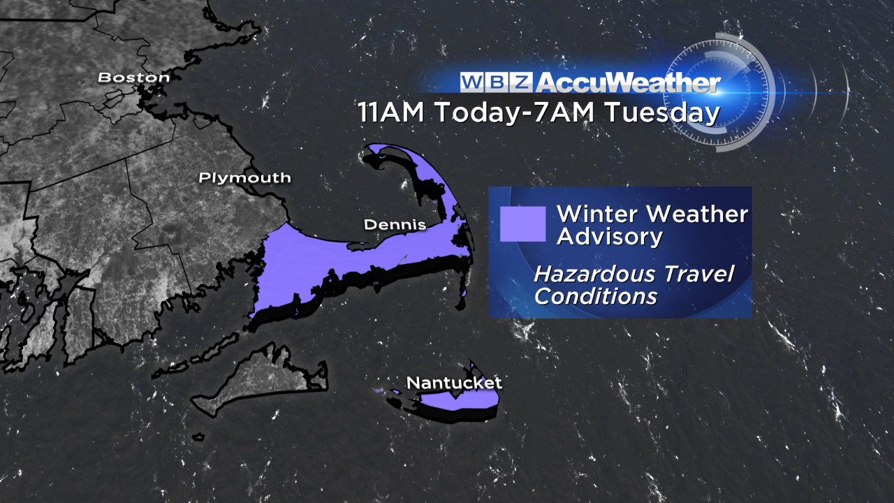
Winter weather advisories posted for the Cape & Nantucket (Image Credit: WBZ)
The core of the arctic air moves overhead tonight. Tomorrow morning our temperatures will dip into the single digits and teens – the coldest since back on March 6th. The wind will still be active in the morning too (it subsides somewhat during the afternoon Tuesday) creating sub-zero real feel temps in some communities.
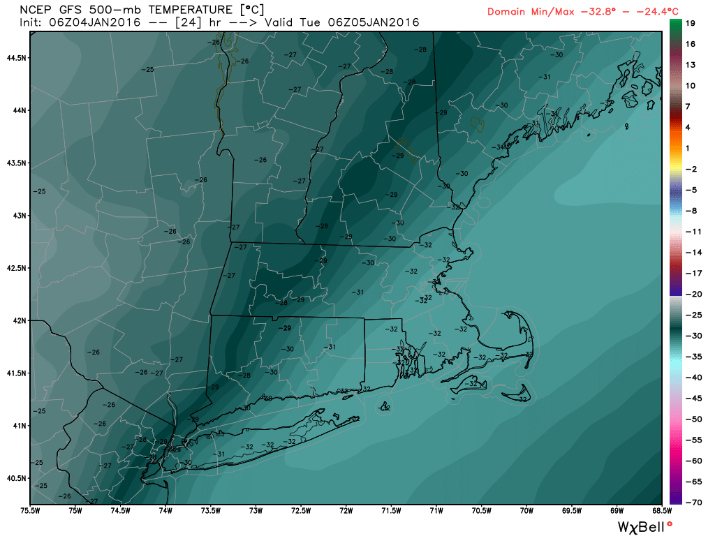
GFS 500mb temperature for 1AM tonight...about 25 degrees BELOW zero above our heads! (image credit: WeatherBELL)
It's quick rebound on Wednesday though as high pressure shifts offshore bringing a return southwest flow of "milder" air. We'll stay in the 40s with quiet weather through the end of the week before our next chance unsettled weather this weekend. Right now it doesn't look like we'll be dealing with a major storm. In fact, we may stay warm enough to see rain in southern New England. But it's one to watch…interior southern New England may hang on to enough cold air to see some snow or wintry mix. Stay tuned!
-Danielle