First Snow Of The Season
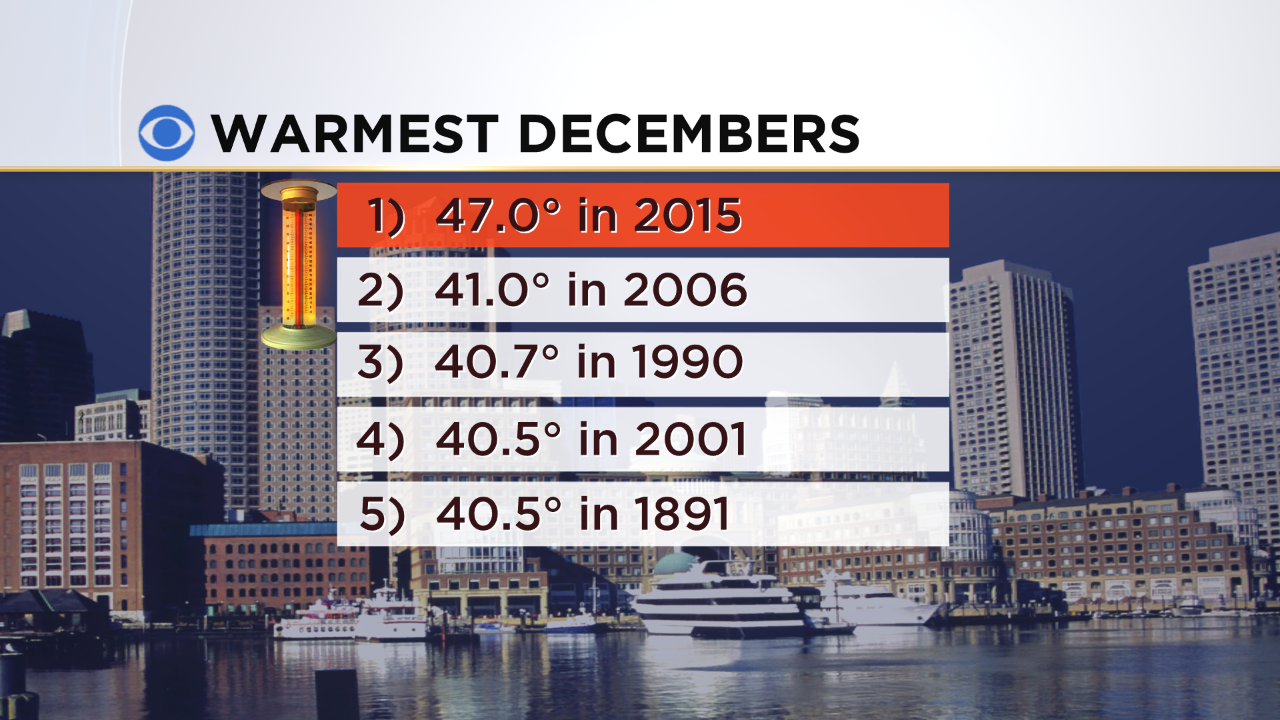
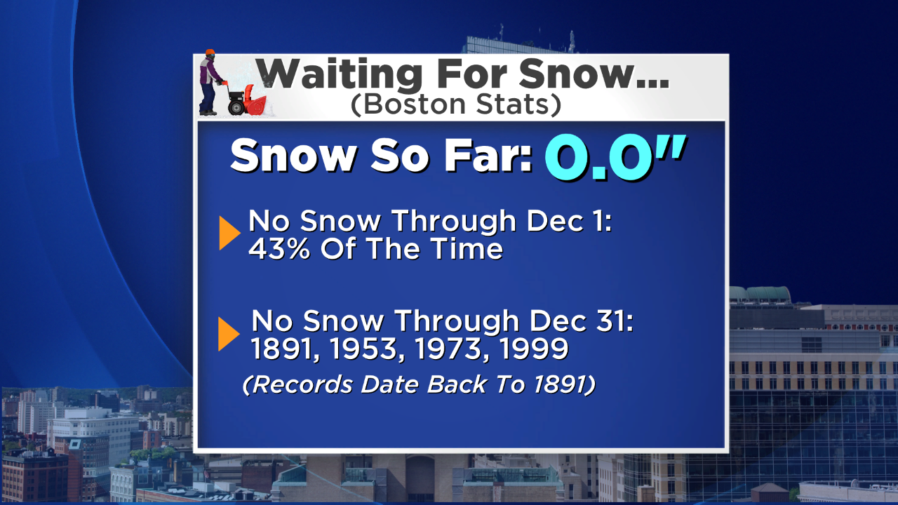
Warm December: This very bizarre month will enter the books as the warmest December ever on record in Boston! So far, above average temperatures have occurred every day of the month except the first day and today was the 20th day that the temperature has reached or exceeded 50 in the city! Well, get ready for a reality check starting tomorrow morning as temperatures will dive to near 32 or less by dawn and hold nearly steady much of the day. Furthermore, with plentiful cold air draining in from Canada tomorrow, the stage is set for our first snow of the season Tuesday morning. This almost became the 5th season on record that no measurable snow has fallen in Boston through December 31st.
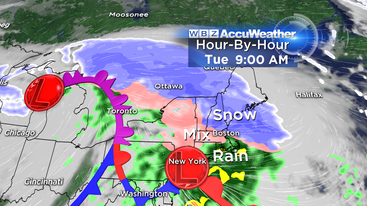
Storm Timetable: Snow is destined to break out during the early morning hours of Tuesday prior to dawn. I expect first flakes in the Boston area between 2 and 3am. There could be a decent thumping of light to moderate snow with perhaps a few intervals of heavier snow during a 5-6 hour period before warmer air arriving at various levels of the atmosphere produces transitions to various types of precipitation.
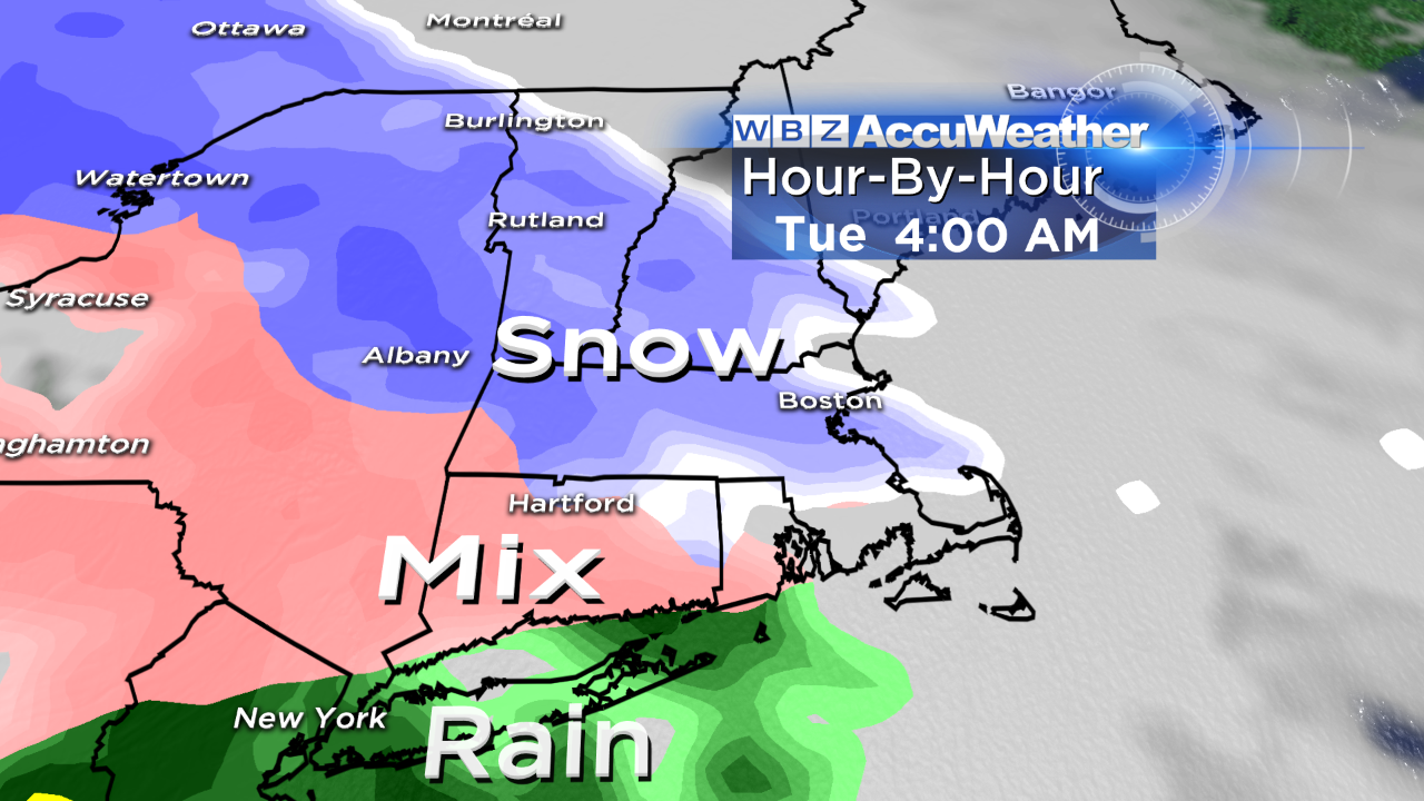
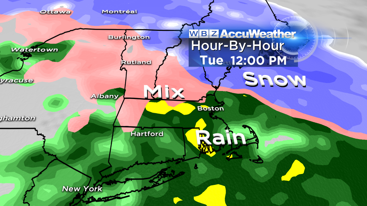
Snow will change to sleet along the coast and then to rain as milder air flows in from the ocean. Meantime, as warmer air moves in aloft, the sleet will switch to a spell of freezing rain farther inland especially over areas from western Middlesex County into Worcester County where an ice buildup of 1 to 2 tenths of an inch is possible.
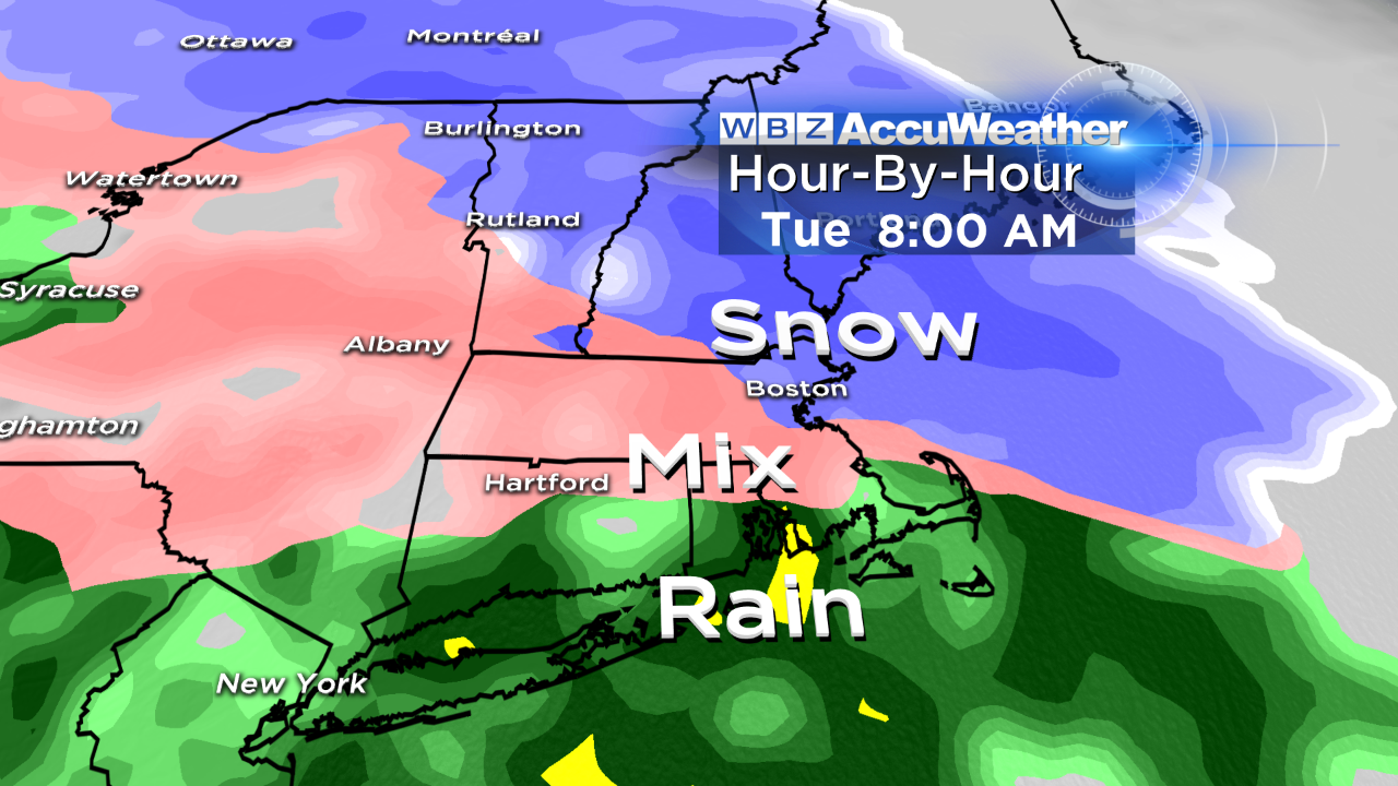
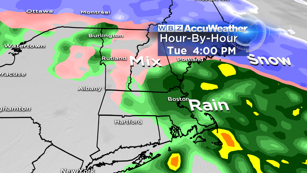
Eventually, warmer air with temperatures rising to the middle and upper 30s will penetrate farther inland putting an end to the icing. The precipitation will be heaviest through the morning then lighter in the afternoon with leftover mist ending during the evening.
Storm Impact: This NOT a major storm but any small amount of snow and mixed precipitation can cause dangerous traveling conditions. The first snowfall of the season is usually trickier as drivers become reacquainted with the hazards of slippery roads. Since it is a vacation week for many families and schools are closed, the impact will be lower but caution and allowance of extra travel time is always the key.
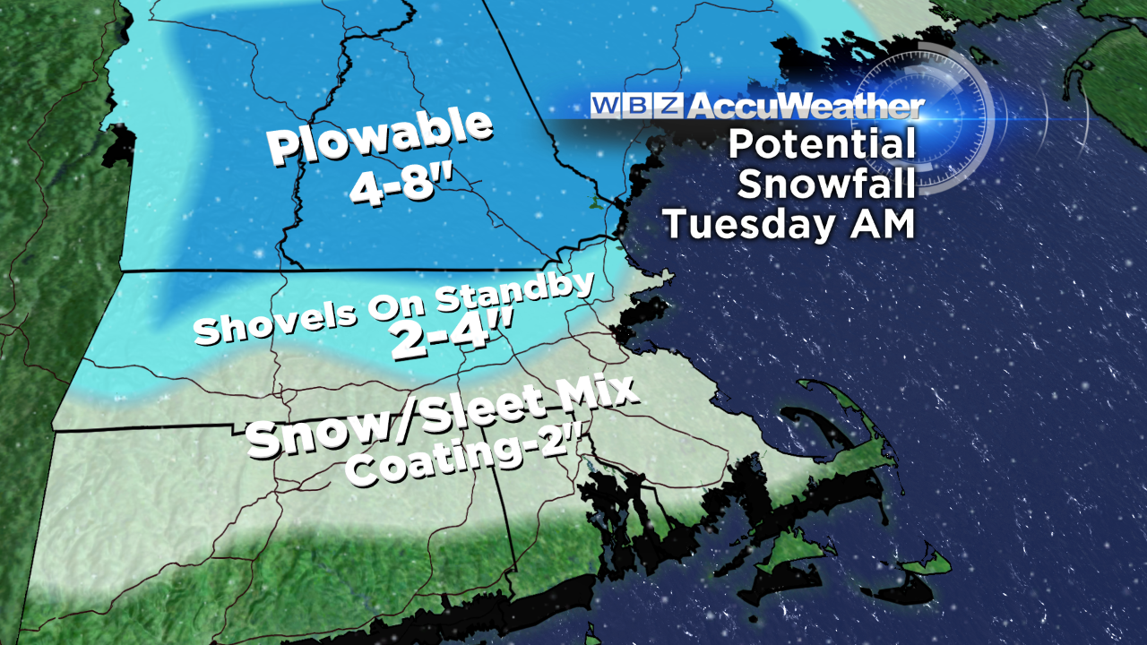
The greatest amount of snow will fall across northern New England where more than 4" will accumulate most areas leading to a few jackpot locations of 6-8" from portions of east-central NH into western ME. Lower totals of near 4" at the NH/MA border will taper down closer to 2" along the MA Pike and an inch to a coating across CT and RI into southeastern MA except the outer Cape where only traces of snow may briefly show up on some roads and grassy surfaces. The wind will be brisk easterly with some gusts up to 20-35 mph along the coast as the secondary storm develops over NJ and tracks eastward with the center remaining near or just south of Long Island.
Forecast For The End Of 2015: For First Night celebrations, present guidance suggests that temperatures will fall from the upper 30s late in the afternoon to 30-35 at midnight as we ring in the New Year of 2016. The weather should be partly cloudy to clear with a bit of a breeze but no strong gusty wind. After that, the jet stream will escort a chunk of very cold air into the Northeast next weekend with strong, gusty winds and temperatures falling into the 20s Saturday afternoon then down to the teens Saturday night!
Have a great week and take it easy on the roads Tuesday!