Searching For Snowflakes
Like the sound of peepers (small frogs) on the first warm spring night indicating change in the air, there's a sound currently signaling a shift. It's the steadily increasing drum beat of the snow lovin' crowd. Call them winter warriors, call them sultans of the subfreezing, call them yetis if you'd like. But this group starts to get antsy by mid November, and the call becomes more frantic as December comes knocking. "Bring us dendrites or bring us death" be thy battle call, but will Mother Nature answer their demands?
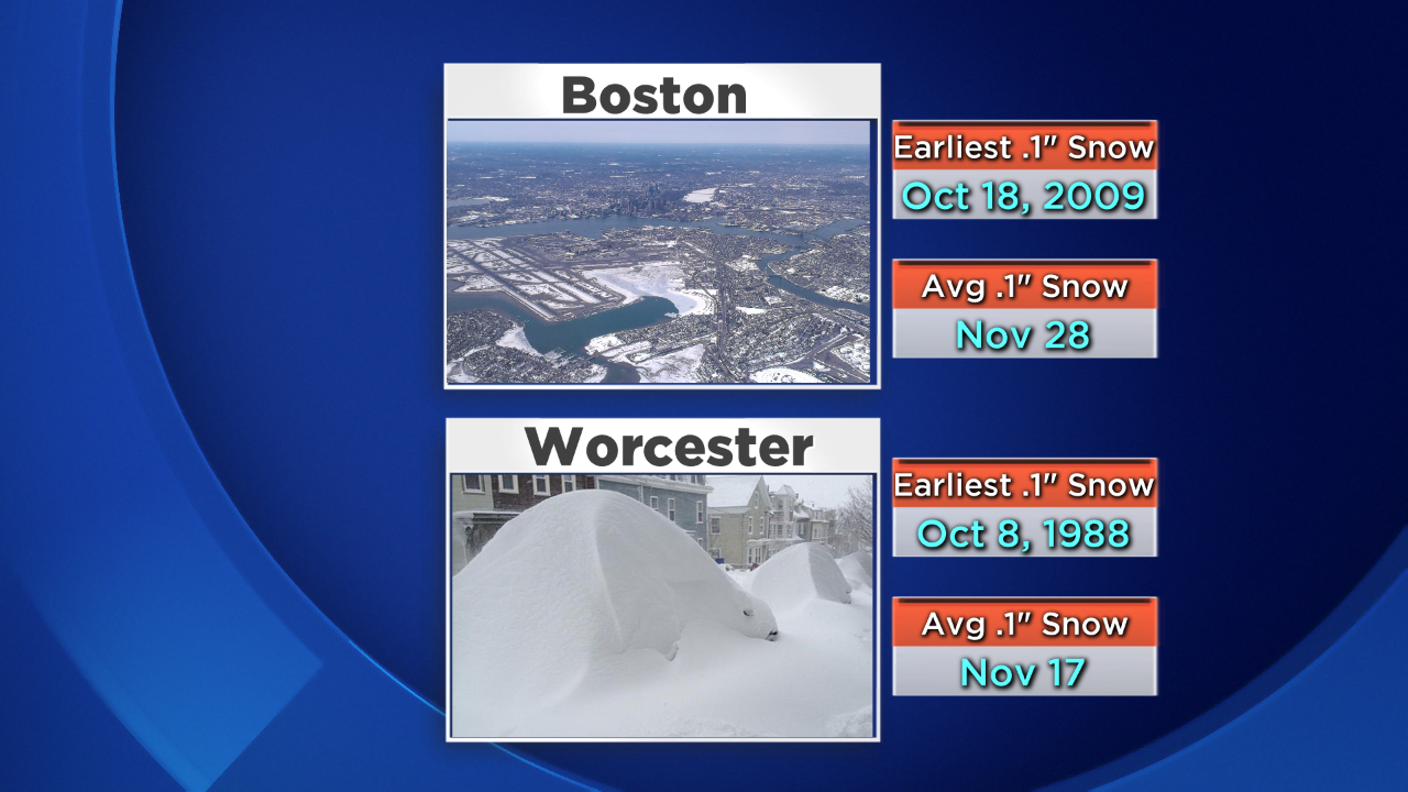
Certainly it has not been a banner start to the young season. Neither Boston nor Worcester have picked up any measurable snow, which means we will move past the average date of the first snow in both cities. No reason to panic there - 43% of the years in Boston record books have seen no snow in October/November. And there's a pretty good chance you'll see SOME snow in December, because only 4 years have gone all the way to January without measurable flakes. Those years are 1891, 1953, 1973, and 1999 (the last three pretty paltry snowfall years overall with 23-37").
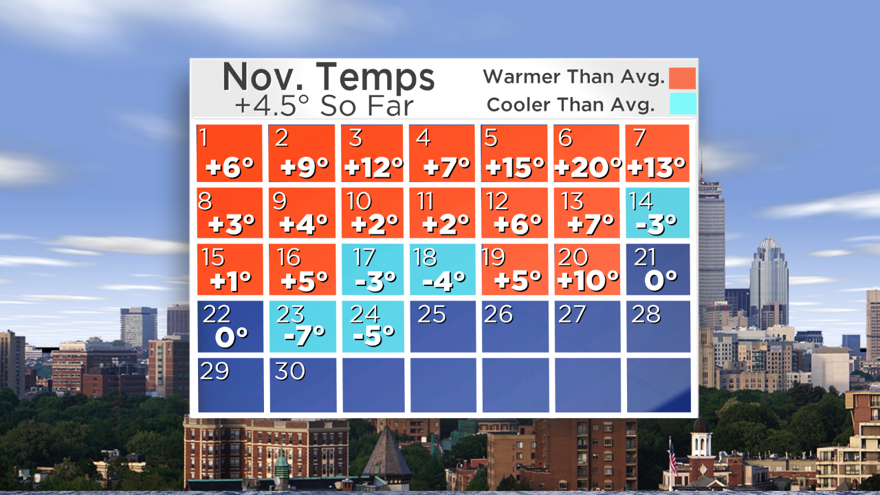
Depending on how mild it gets on Thursday/Friday and when a front cools us down Friday night (with a midnight high expected for Saturday)...we could be looking at a Top 10 warmest November on record. It will be close; within a couple tenths of a degree.
But let's not get ahead of ourselves here. There's a lot of time between now and New Year's, the air is getting colder, and the odds start increasing that we can stir up a winter storm. The elephant in the room that's fighting back against those odds is El Nino, which continues to hover near record levels in the Pacific and is really starting to show up in terms of its impact on U.S. weather. There is an interesting twist so far - this November has much more closely mirrored the strong El Nino of 1982-83, but featured the exact opposite impacts of 1997-98. Goes to show you that while El Nino strength is a valuable forecasting tool, no two events are exactly alike. WSI's Mike Ventrice wrote a good blog post about how the current El Nino has undoubtedly linked up with the atmosphere, connecting ocean changes to atmospheric currents.
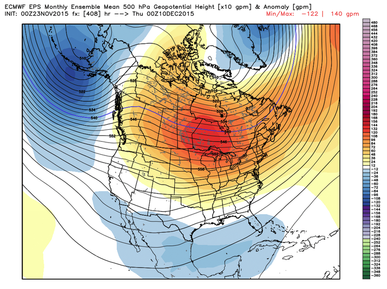
Looking at some longer range tools like the ECMWF Weeklies and the CFS, we can start to infer what's going to happen down the road. And if you're one of those snowhounds, you may want to avert your eyes. What we're seeing are classic El Nino outcomes, which don't often bode well for snow in the northern states. The most notable persistent features developing are a strong Gulf of Alaska trough and a sprawling ridge of high pressure along the U.S./Canada border. Both of the above models keep this pattern firmly in control all the way through Christmas. There are also hints of a storm track staying along the southern states during this time, occasionally lifting up into the Mid-Atlantic.
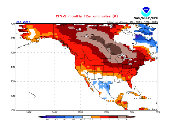
The CFSv2 has been steadfastly showing possible record warmth in December for much of Canada and the Upper Midwest. I feel like it may be a bit overdone here in New England and we'll end up a little cooler than it's projecting, but the signal is certainly not a cold one.
Strong high pressure in the area or just to our north should lead to a suppressed storm track heading into December, keeping most of the precipitation shunted off toward the Southeast and Mid-Atlantic. It's important to note that - 1) It can still snow with above average temperatures and 2) No model is perfect. However it's hard to argue with the consistent trend we've been seeing, and how it 'fits the mold' with expectations for this winter. No one I've heard from or read figured this coming December to be a cold one for the northern states.
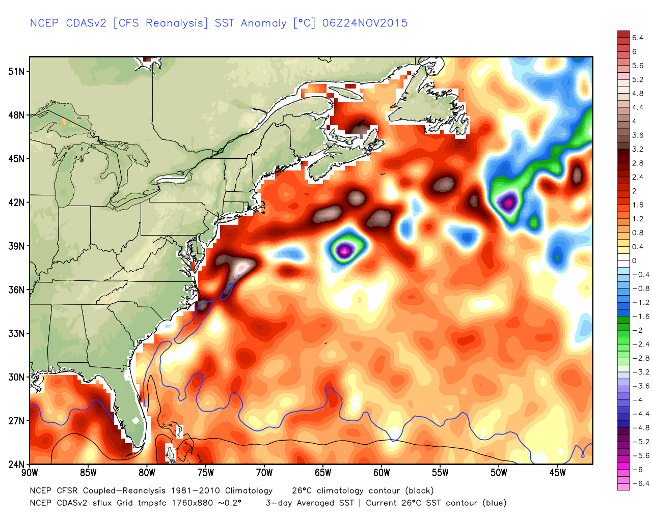
To sum it up from where we sit, I don't see any solid chances for notable snow through mid-December. Also working against us is a mild ocean, with Atlantic surface temperatures well above average (mainly in the 50s). That means that any coastal storm that could possibly fight through the ridge and nose up into New England would likely induce a surge of milder air and keep most of any snow potential well inland. We would require a strong high over southeastern Canada funneling in cold air, and even then we'd probably be talking about more of an ice threat than snow.
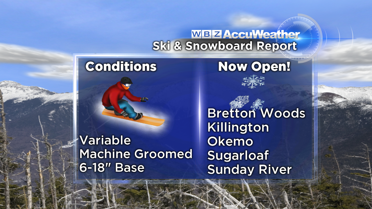
So hang tight - our Winter Outlook was looking for this kind of December and we still think the better odds of snow and cold will come later in the winter this time around. In the meantime, at least it's been cold enough to MAKE snow! Lots of dry air and cold temps this week have spurred the ski areas to fire up the snow guns and cover their slopes with powder. Friday's warm-up is brief, and the weekend will be plenty cold to make even more snow with minimal melting.