A Taste Of Winter In The Soaking Rain Tonight
BOSTON (CBS) -- The Midwest was hit with their first winter storm of the season on Saturday. That system is centered in Canada now, with a cold front extending southward through New England. This means a mainly cloudy day with spotty shower chances for us, but we aren't home free yet.
Another center of low pressure will develop along this same front that pushes just off our coast this afternoon. That low will spin up abundant moisture, bringing Cape Cod, Boston and even southeastern Worcester County heavy rain this evening. There will be a sharp cut off between heavy rain versus no rain. Here is a rainfall forecast map to show the cut off.
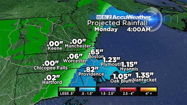
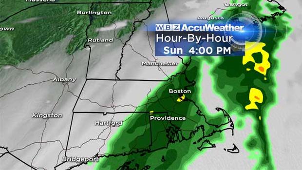
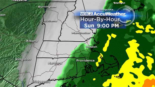
The rain continues overnight, tapering off from west to east and moving off of the outer Cape by 5 am Monday.
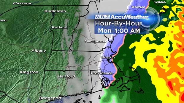
Temperatures will be a factor in the precipitation overnight. As we fall to near freezing around midnight, some snow will mix in with the rain. The ground has been so warm for so long, that we don't expect any accumulation. All precipitation will come to an end by the Monday morning commute. There may be a couple of slick spots on side roads because of that brief wintry mix and icy cold temps inside the 128 belt.
The weather turns cooler & windier Monday afternoon with everyone at least enjoying sunshine, highs in the lower 40s. Great travel weather sticks around through at least Black Friday.

Thanksgiving Day will be mostly sunny with a high of 55. Gobble Gobble!
Follow Pamela on Twitter @PamelaWBZ4