Popping Leaves And Falling Temperatures

 How sweet it was! The weather for the long Columbus Day Holiday Weekend was certainly close to perfection. I hope you enjoyed it to the max at soccer tournaments, football games, on the fairways, on foliage tours, hiking, biking, running, walking or whatever it was to that made you smile in the pristine balmy fall conditions.
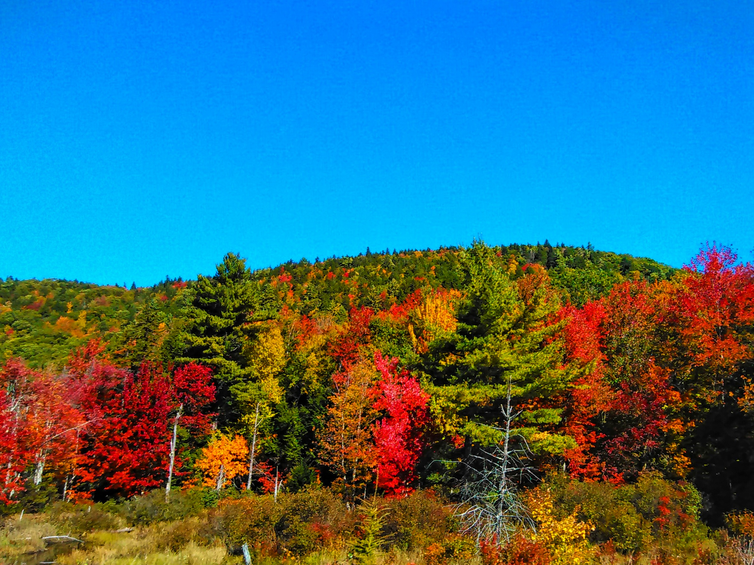
Initially, it appeared that blazing vibrant colors might be missing in this year's annual fall foliage extravaganza due to the hot and dry conditions from mid-August into mid-September. While the scene is still variable with color ranging from muted to vibrant, the leaves have definitely been popping recently due to the decrease in daylight/sunlight and the increase in nippy nights. This has triggered a stoppage in the food-making process in the leaves and the chemical changes in the trees resulting in the break down of chlorophyll which gives the leaf its green color. Consequently, the other pigments that were masked during the summer are released.
By the way, thank you for the many stunning foliage pictures that you shared with me over the long weekend and please keep them coming as the color wave progresses across the region.
We'll enjoy one more balmy day before the cooler air takes control. As an impulse skirts by the region this morning, a clump of showers will strike mainly southeastern MA with a few stragglers perhaps up into the Boston area before some sunshine takes over this afternoon. The cold front approaching from the wet may spike a few spotty showers this evening but, in between, there should be some areas of sunshine to boost the temperatures at least into the lower 70s. The next cold front will drive another round of clouds and possibly a few spotty brief showers on Wednesday. After a showery, windy Friday, the coldest air arrives this weekend with highs only in the upper 40s on Sunday with strong, gusty winds for the great Head Of The Charles Regatta.
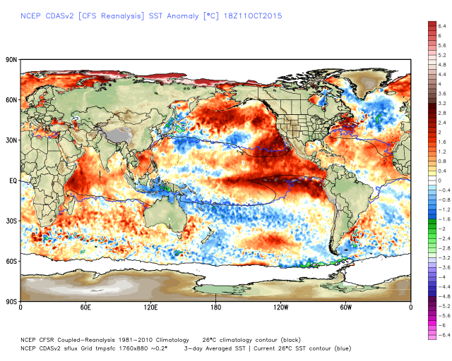
The above graphic depicts the latest sea-surface temperature anomaly. We are studying this map and a myriad of other global factors to determine the forecast for the upcoming winter season. The expanse of warmer than average(red) water in the eastern Pacific and the colder than average(blue) water in the North Atlantic are important clues. Additionally, the strong El Nino reflected in the strip of very warm water in the eastern equatorial region if the Pacific Ocean is a complicating factor for the upcoming winter. For now, I can tell you that a much different winter is on tap than last year. A stretch of record powder snowfall in 30 days is highly unlikely but that doesn't mean that the winter will not be rough. February will not feature the record brutal cold but it is likely to still be below average. We are assembling the puzzle and will deliver our full winter forecast on our "Eye On Weather: Winter Special" on November 14. It should be a very interesting half hour program scheduled for 7:30pm.
In the meantime, make it a great week.