Past, Present & Future Musings
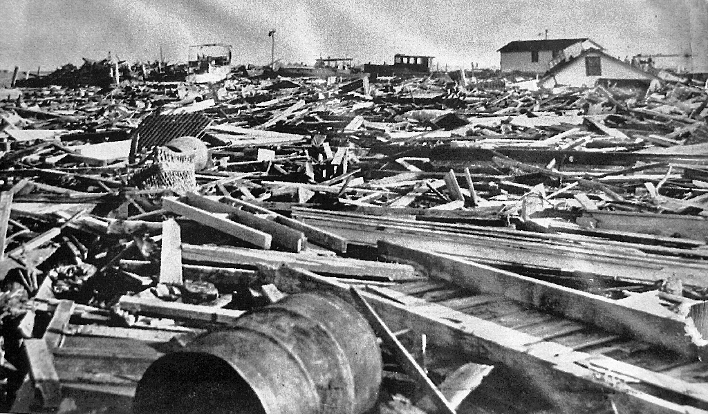
Today is the anniversary of the Great New England Hurricane Of 1938. On this date 77 years ago, one of the most devastating and powerful storms produced a catastrophe in this region. Having occurred before hurricanes were named, this one made landfall near New Haven, CT moving north at near 60 mph! A massive storm surge submerged much of the New England South Coast especially in the Narragansett Bay area. Providence was flooded in a storm tide of about 20 feet! Antecedent heavy rainfall from a frontal system a few days earlier plus the rainfall from the hurricane amounted to 10-17" in the CT River Valley producing horrendous record flooding. Building, tree and boat damage across New England was widespread. There were 564 deaths and more than 1700 injuries. For more details, check out this story from the National Weather Service Forecast Office.
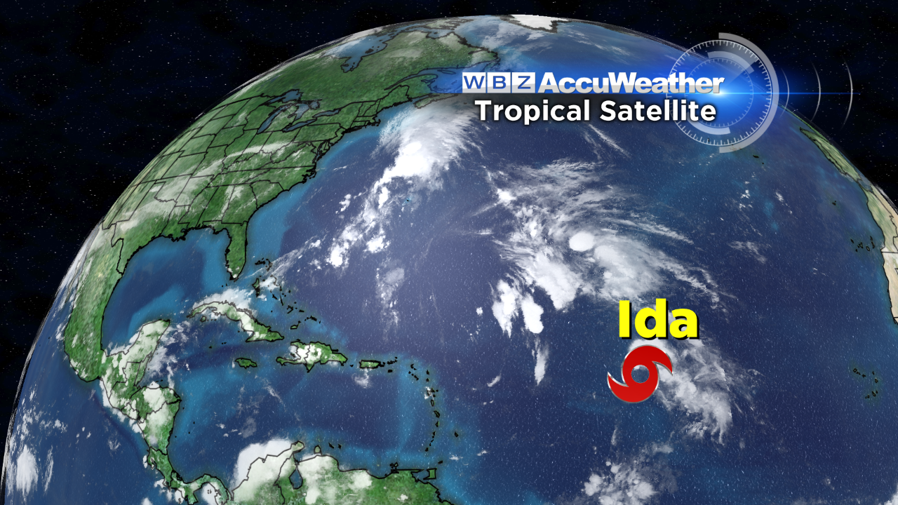 Thankfully, today, we only have a rather weak tropical storm named Ida way out in the Atlantic about 1000 miles east of the northern Leeward Islands. Over the next few days, Ida's strength will fluctuate but probably never gain hurricane status and the storm will stay far out in the Atlantic. While the peak of the hurricane season has passed, conditions may be favorable for additional tropical development in the next few weeks in the Gulf of Mexico and tucked in closer to the southeastern U.S. as dominant high pressure systems build across the Great Lakes into the Northeast and southeastern Canada.
 Peaceful, delightful weather will exist here for many days and that is just the way I like it. With that said, it would be wonderful to have a solid soaker lasting 1-2 days to quench the thirst of the parched land but that is not in the cards. Many crispy cool nights are ahead especially away from the ocean where an onshore wind will modify the air. Expect choppy to somewhat rough seas especially on the Cape and points south into midweek.
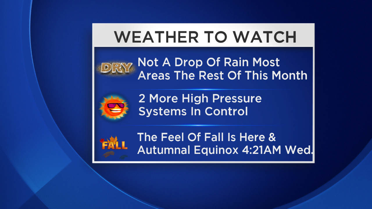
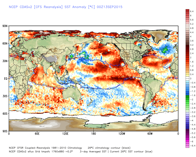 The autumnal equinox happens at 4:21AM on Wednesday. That is the official beginning of astronomical fall. Looking at the current sea surface temperature anomaly map to the left, we see the pools of warmer and colder than average water in the Atlantic and Pacific in almost the same locations as last winter. These pools were the main drivers in the winter that we experienced. However, the El Nino which is reflected in the strip of warm water in the central and eastern equatorial waters of the Pacific is stronger now and will likely be a contributor to the events of the upcoming winter. The southward expanding pool of cold water in the North Atlantic will be monitored closely in the so-called cold AMO. If the pool of warm water persists in the eastern Pacific in tandem with the pool of cold water in the North Atlantic, it appears that another winter of somewhat below average temperatures are probable but it should in no way match the magnitude of last winter's extreme cold. The presence of an El Nino, albeit weakening this winter, will likely contribute an active subtropical jet stream across southern California to Texas and the Gulf Coast States. Some storms will be steered up the eastern seaboard to yield a variety of storms- not just a series of powder snows squeezed into a short period of 4 weeks. This winter will be different in many ways. We will continue to examine the myriad of other global factors and attempt to determine the importance of each factor in defining the specifics of this winter. The WBZ AccuWeather Team will deliver the winter outlook on our "Eye On Weather: Winter Special" on November 14 at 7:30pm. Until then, lets enjoy some terrific early fall weather in the next 10 days.
Now that summer is almost over, I would like to know how you would rate it on a scale of 1 to 10. I put this request out on Twitter last evening and received many many responses which was really great. Most rated the summer between 8 and 10. I rate it a 9/9+ because I think most of the summer was fabulous. I didn't give it a full 10 due to the prolonged spell of hot and muggy weather late August into the first week of September. Thanks in advance for your rating!
Make it a great week.