Memorial Day Weekend

It's the Memorial Day Weekend marking the unofficial beginning of summer. Meteorological summer begins on June 1 and the official beginning of astronomical summer, the summer solstice, occurs on June 21 at 12:38 pm. While we celebrate the kickoff of the vacation season this weekend, we must pause to think about what this weekend really means. Memorial Day Weekend is a time to remember all of the people who died while serving in our nation's armed forces. Memorial events including parades, concerts and other remembrances such as visiting cemeteries will take place all across the nation. Seeing a sea of flags or just one flag always takes always my breath away when I think of the sacrifices and service that each and every person gave to our country. Check out the 37,000 flags on the Boston Common that honor all of the Massachusetts' fallen heroes!
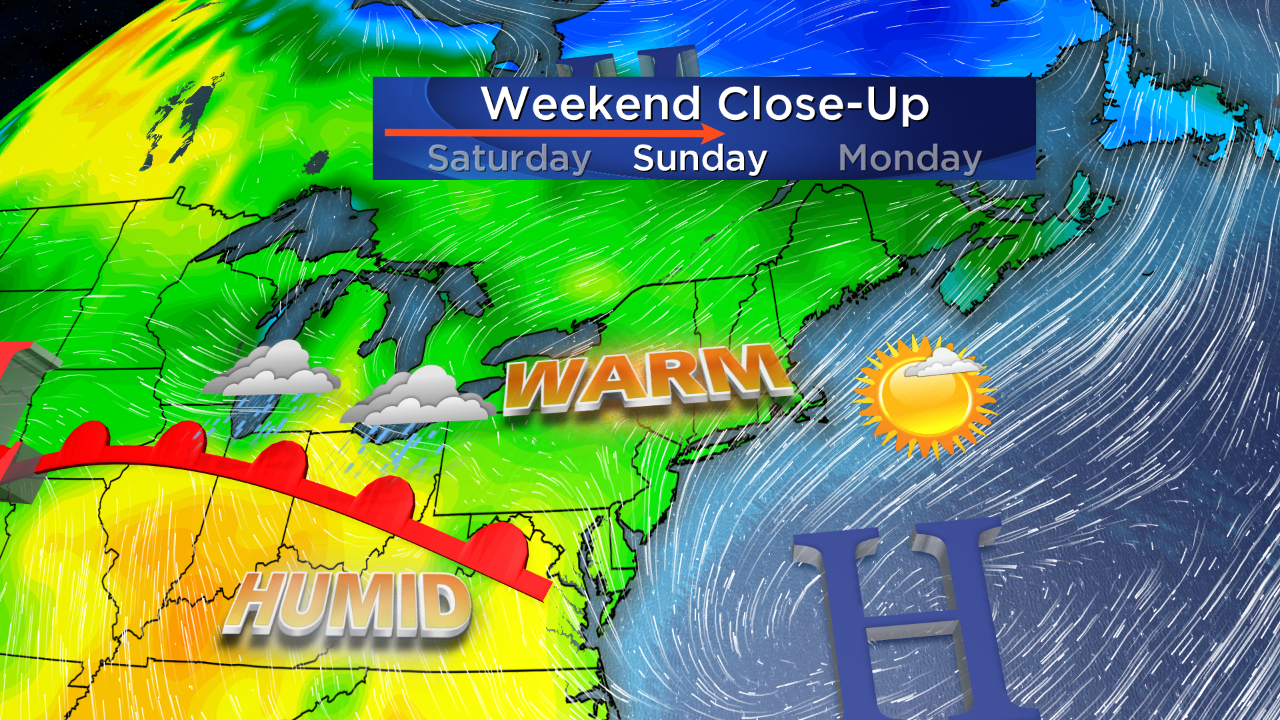 Following that record-breaking harsh winter of snow and cold, everyone has been looking forward to this premature start of the summer season. Are we going to be satisfied with the weather this holiday weekend? I think most people will be very pleased with it. After the chunk of chill passes by early in the weekend, high pressure will build south of New England resulting in a southwesterly flow which will warm the area quickly on Sunday as temperatures reach 80 except over Cape Cod where 60s will be common.
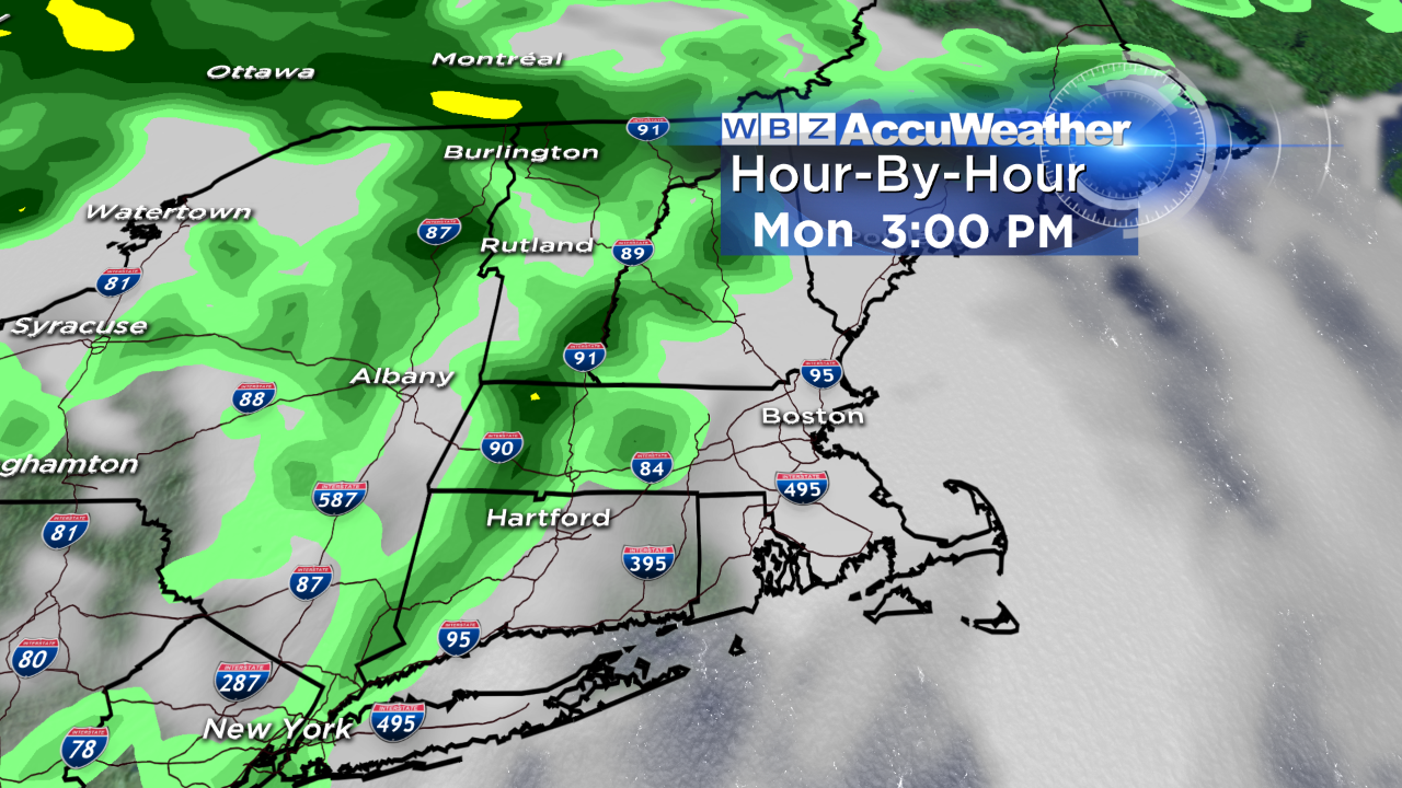 Memorial Day contains some forecast uncertainty regarding coverage of rain showers. Most signs favor scattered activity with the highest probability farther northwest of Boston. Because of more limited sunshine, temperatures may be reduced a bit from Sunday's levels. This action is associated with an approaching front of warmer and more humid air.
High tides will occur from the late afternoon to early evening through Monday with ocean temperatures in the upper 40s to middle 50s from north to south. Brisk westerly winds up to 25+ knots are likely Saturday followed by more southwesterly winds at 12-25 knots on Sunday . Visibility will be good at over 5 miles. Hiking and camping out west or up north will be decent with chilly to cool nights and pleasant days but be ready for a few showers on Monday.
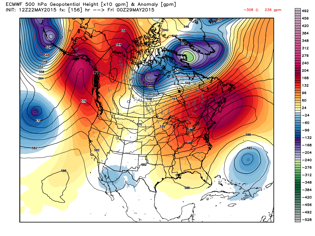 A remarkable change in the weather pattern is in the works. A ridge of high pressure surface and aloft will strengthen along and just off the eastern seaboard next week. Consequently, the stage is set for a potential heat wave! Amazingly, Boston did not experience a single heat wave last summer. The first day at 90 degrees or higher did not even happen until July 2. A heat wave is defined as three consecutive days of 90 degrees or higher. At this time, it is possible that much of the Boston area could swelter in 4 or more consecutive days at 90 or higher. WOW! Get the fans and A/C ready or head for natural cooling on Cape Cod as most of that region has highs in the 60s to lower 70s. The humidity will ramp up and become high to bordering on oppressive everywhere the second half of next week! The risk of thunderstorms will occur mainly farther north and west of Boston into western and northern New England.
May will end up in the record books with a mean temperature much above the current level of a +3.3 degree anomaly and that is significantly higher than I had been expecting. Does that suggest that the whole summer is going to be a steamer? With the global factors in play despite a strengthening El Nino, I am still anticipating meteorological summer to be a bit more than a degree above average.
Have a happy and safe holiday weekend.


