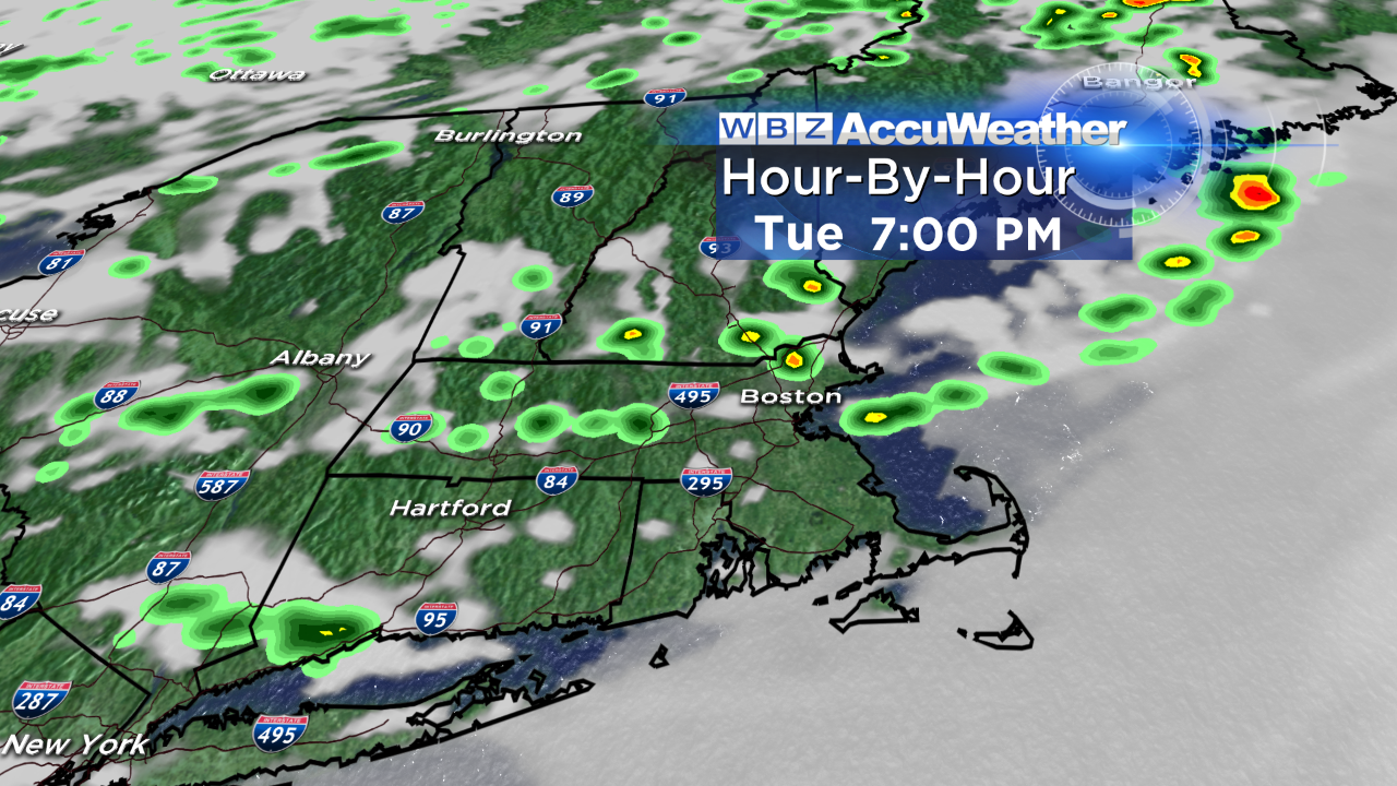
Chance Of Thunderstorms Tuesday Afternoon
It's a murky start out there. Low clouds, patchy fog and cool temperatures make it hard to believe we'll be well into the 70s and even some 80s by later on today! The backdoor front that came through yesterday has stalled in western New England. It will gradually lift northward, shifting our wind to blow out of the southwest this afternoon; this will result in emerging sunshine and rising temperatures. Admittedly, our highs will depend on how much sunshine actually comes out. More sun equals warmer temps which in turn, creates instability in the atmosphere. Which brings me to our threat for thunderstorms…
A cold front will approach late in the day triggering afternoon and evening storms. Not everyone will see a thunderstorm, and not every thunderstorm will be strong – but there is a risk of isolated strong cells. Don't be surprised to encounter torrential downpours, brief gusty wind and lightning in any storms that do pop-up (mainly 2-8PM). We'll be monitoring this threat closely this afternoon and will have live updates on WBZ as warranted. Just keep in mind, we're getting to that time of year when you need to remember our trusty old weather rhyme: "When Thunder Roars, Go Indoors!".
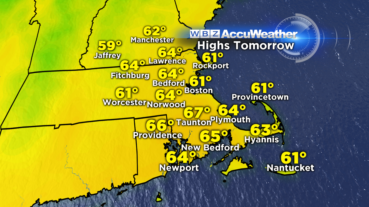
Behind this front, crisp dry air takes over and will be with us for the remainder of the week. Highs top out in the low to mid 60s tomorrow with northwest wind gusts to 30 mph. Our next chance of any wet weather doesn't arrive until Saturday…poor timing for the weekend, but we could certainly use some rain. More updates on that later this week.
-Danielle
Find Danielle on Facebook and Twitter. To Donate to her Pan-Mass Challenge ride, CLICK HERE.


